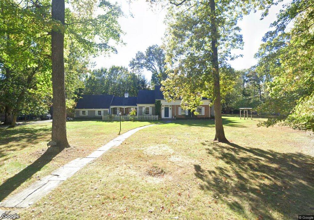
112 Watchung Fork Westfield, NJ 07090
Estimated Value: $1,824,654 - $2,162,000
--
Bed
--
Bath
2,791
Sq Ft
$706/Sq Ft
Est. Value
About This Home
This home is located at 112 Watchung Fork, Westfield, NJ 07090 and is currently estimated at $1,969,664, approximately $705 per square foot. 112 Watchung Fork is a home located in Union County with nearby schools including Franklin Elementary School, Roosevelt Intermediate School, and Westfield Senior High School.
Ownership History
Date
Name
Owned For
Owner Type
Purchase Details
Closed on
Dec 8, 2003
Sold by
O'Connell John
Bought by
Zimmerman Jean Marc and Zimmerman Bethany
Current Estimated Value
Home Financials for this Owner
Home Financials are based on the most recent Mortgage that was taken out on this home.
Original Mortgage
$945,000
Outstanding Balance
$440,952
Interest Rate
5.98%
Estimated Equity
$1,528,712
Create a Home Valuation Report for This Property
The Home Valuation Report is an in-depth analysis detailing your home's value as well as a comparison with similar homes in the area
Home Values in the Area
Average Home Value in this Area
Purchase History
| Date | Buyer | Sale Price | Title Company |
|---|---|---|---|
| Zimmerman Jean Marc | $1,350,000 | -- |
Source: Public Records
Mortgage History
| Date | Status | Borrower | Loan Amount |
|---|---|---|---|
| Open | Zimmerman Jean Marc | $945,000 |
Source: Public Records
Tax History Compared to Growth
Tax History
| Year | Tax Paid | Tax Assessment Tax Assessment Total Assessment is a certain percentage of the fair market value that is determined by local assessors to be the total taxable value of land and additions on the property. | Land | Improvement |
|---|---|---|---|---|
| 2025 | $25,427 | $1,029,100 | $922,800 | $106,300 |
| 2024 | $24,908 | $1,129,100 | $922,800 | $206,300 |
| 2023 | $24,908 | $1,129,100 | $922,800 | $206,300 |
| 2022 | $24,389 | $1,129,100 | $922,800 | $206,300 |
| 2021 | $24,422 | $1,129,100 | $922,800 | $206,300 |
| 2020 | $24,366 | $1,129,100 | $922,800 | $206,300 |
| 2019 | $24,276 | $1,129,100 | $922,800 | $206,300 |
| 2018 | $26,608 | $286,200 | $202,600 | $83,600 |
| 2017 | $26,462 | $286,200 | $202,600 | $83,600 |
| 2016 | $25,841 | $286,200 | $202,600 | $83,600 |
| 2015 | $25,326 | $286,200 | $202,600 | $83,600 |
| 2014 | $24,490 | $286,200 | $202,600 | $83,600 |
Source: Public Records
Map
Nearby Homes
- 740 Lawrence Ave
- 559 Lawrence Ave
- 143 Stanmore Place
- 304 E Dudley Ave
- 819 Standish Ave
- 415 Highland Ave
- 303 Prospect St
- 11 Mountainview Dr
- 113 Barchester Way
- 1163 Lawrence Ave
- 869 Standish Ave
- 260 Prospect St Unit C15
- 508 N Chestnut St
- 1463 Dunn Pkwy
- 350 W Dudley Ave
- 2588 Liberty Ave
- 2406 Park Place
- 766 Oak Ave
- 724 South Ave W Unit 724A
- 2398 Hamlette Place
- 104 Watchung Fork
- 225 Watchung Fork
- 207 Watchung Fork
- 804 Ramapo Way
- 240 Watchung Fork
- 268 Watchung Fork
- 232 Watchung Fork
- 761 Lenape Trail
- 731 Lenape Trail
- 745 Lenape Trail
- 224 Watchung Fork
- 805 Ramapo Way
- 279 Watchung Fork
- 719 Lenape Trail
- 763 Lawrence Ave
- 288 Watchung Fork
- 751 Lawrence Ave
- 820 Ramapo Way
- 206 Watchung Fork
- 216 Watchung Fork