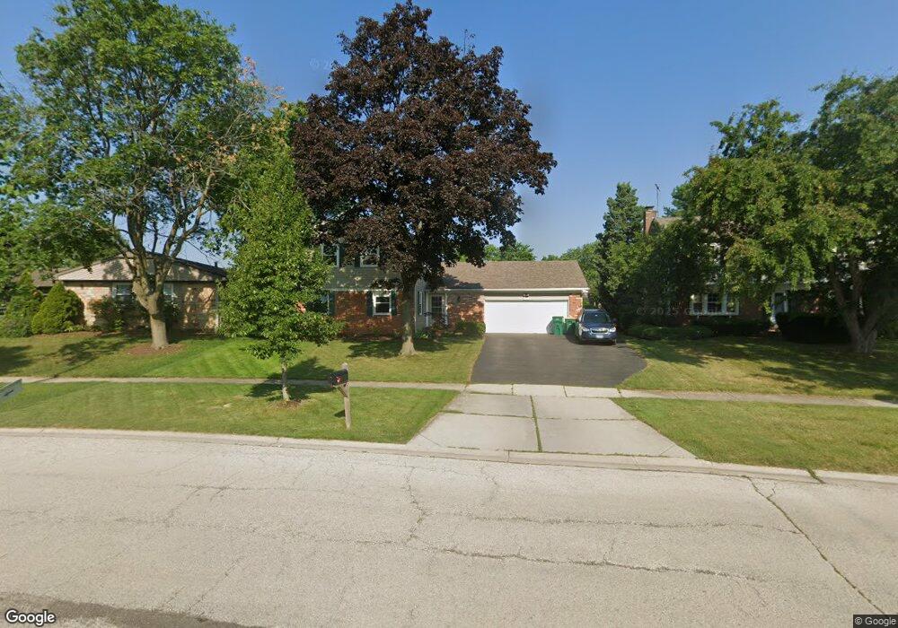
112 Weidner Rd Buffalo Grove, IL 60089
South Buffalo Grove NeighborhoodEstimated Value: $477,295 - $524,000
4
Beds
3
Baths
2,086
Sq Ft
$242/Sq Ft
Est. Value
About This Home
This home is located at 112 Weidner Rd, Buffalo Grove, IL 60089 and is currently estimated at $505,324, approximately $242 per square foot. 112 Weidner Rd is a home located in Cook County with nearby schools including Henry W Longfellow Elementary School, Cooper Middle School, and Buffalo Grove High School.
Ownership History
Date
Name
Owned For
Owner Type
Purchase Details
Closed on
Aug 7, 2017
Sold by
Knepp Craig and Knepp Margaret A
Bought by
Silgalis Mark and Silgalis Jessica
Current Estimated Value
Home Financials for this Owner
Home Financials are based on the most recent Mortgage that was taken out on this home.
Original Mortgage
$273,600
Outstanding Balance
$226,905
Interest Rate
4%
Mortgage Type
New Conventional
Estimated Equity
$278,419
Create a Home Valuation Report for This Property
The Home Valuation Report is an in-depth analysis detailing your home's value as well as a comparison with similar homes in the area
Home Values in the Area
Average Home Value in this Area
Purchase History
| Date | Buyer | Sale Price | Title Company |
|---|---|---|---|
| Silgalis Mark | $342,000 | Citywide Title Corporation |
Source: Public Records
Mortgage History
| Date | Status | Borrower | Loan Amount |
|---|---|---|---|
| Open | Silgalis Mark | $273,600 |
Source: Public Records
Tax History
| Year | Tax Paid | Tax Assessment Tax Assessment Total Assessment is a certain percentage of the fair market value that is determined by local assessors to be the total taxable value of land and additions on the property. | Land | Improvement |
|---|---|---|---|---|
| 2025 | $10,461 | $43,000 | $9,046 | $33,954 |
| 2024 | $10,461 | $36,001 | $7,754 | $28,247 |
| 2023 | $10,032 | $36,001 | $7,754 | $28,247 |
| 2022 | $10,032 | $36,001 | $7,754 | $28,247 |
| 2021 | $9,545 | $30,347 | $4,953 | $25,394 |
| 2020 | $9,367 | $30,347 | $4,953 | $25,394 |
| 2019 | $9,355 | $33,645 | $4,953 | $28,692 |
| 2018 | $9,654 | $31,467 | $4,307 | $27,160 |
| 2017 | $9,496 | $31,467 | $4,307 | $27,160 |
| 2016 | $9,099 | $31,467 | $4,307 | $27,160 |
| 2015 | $8,148 | $26,607 | $3,661 | $22,946 |
| 2014 | $8,031 | $26,607 | $3,661 | $22,946 |
| 2013 | $7,406 | $26,607 | $3,661 | $22,946 |
Source: Public Records
Map
Nearby Homes
- 170 Cherrywood Rd
- 915 Plum Grove Cir
- 267 Timber Hill Rd
- 610 Maple Dr
- 462 Longwood Dr
- 252 Appletree Ct
- 858 Old Checker Rd Unit C4
- 225 Thornapple Ct Unit 225
- 571 Estate Dr
- 612 White Pine Rd
- 1096 Beechwood Rd
- 632 Weidner Rd
- 876 Stradford Cir Unit A1
- 170 Manchester Dr Unit 306
- 4210 N Walnut Ave
- 232 Manor Dr Unit 12C
- 440 Burnt Ember Ln
- 800 Weidner Rd Unit 208
- 760 Weidner Rd Unit 107
- 820 Weidner Rd Unit 4013
- 122 Weidner Rd
- 100 Weidner Rd
- 105 Timber Hill Rd
- 95 Timber Hill Rd
- 117 Timber Hill Rd
- 136 Weidner Rd
- 85 Timber Hill Rd
- 135 Timber Hill Rd
- 784 Saint Marys Pkwy
- 141 Weidner Rd
- 768 Saint Marys Pkwy
- 77 Timber Hill Rd
- 160 Weidner Rd
- 856 Country Ln
- 159 Timber Hill Rd
- 155 Weidner Rd
- 760 Saint Marys Pkwy
- 69 Timber Hill Rd
- 99 Stonegate Rd
- 146 Belaire Dr
Your Personal Tour Guide
Ask me questions while you tour the home.