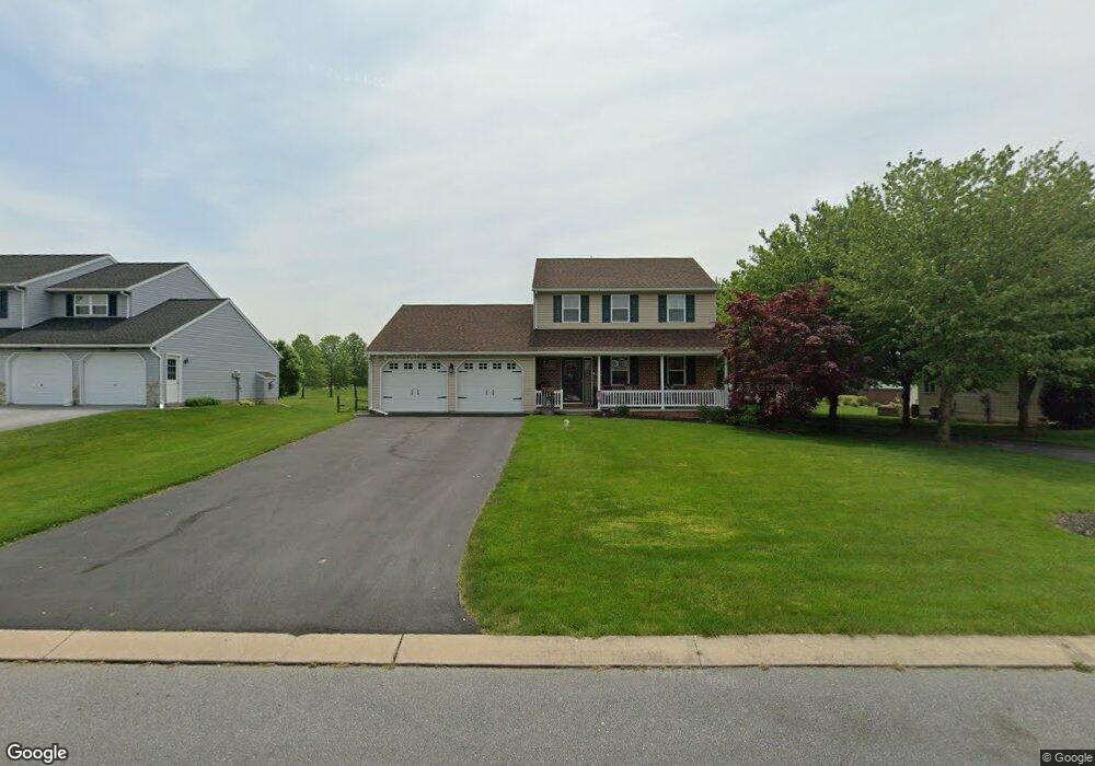
112 Windsock Way New Holland, PA 17557
Estimated Value: $435,344 - $490,000
3
Beds
3
Baths
2,040
Sq Ft
$224/Sq Ft
Est. Value
About This Home
This home is located at 112 Windsock Way, New Holland, PA 17557 and is currently estimated at $456,836, approximately $223 per square foot. 112 Windsock Way is a home located in Lancaster County with nearby schools including Garden Spot Middle School, Garden Spot Senior High School, and Mill Creek Valley Parochial School.
Ownership History
Date
Name
Owned For
Owner Type
Purchase Details
Closed on
Jun 9, 2023
Sold by
Friel Barry J and Friel Annette M
Bought by
Friel Annette M
Current Estimated Value
Purchase Details
Closed on
Sep 11, 1998
Sold by
Zimmerman Luke and Zimmerman Luke R
Bought by
Friel Barry J and Friel Annette M
Home Financials for this Owner
Home Financials are based on the most recent Mortgage that was taken out on this home.
Original Mortgage
$123,600
Interest Rate
6.92%
Create a Home Valuation Report for This Property
The Home Valuation Report is an in-depth analysis detailing your home's value as well as a comparison with similar homes in the area
Home Values in the Area
Average Home Value in this Area
Purchase History
| Date | Buyer | Sale Price | Title Company |
|---|---|---|---|
| Friel Annette M | -- | None Listed On Document | |
| Friel Barry J | $133,600 | Lawyers Title Insurance Corp |
Source: Public Records
Mortgage History
| Date | Status | Borrower | Loan Amount |
|---|---|---|---|
| Previous Owner | Friel Barry J | $123,600 |
Source: Public Records
Tax History Compared to Growth
Tax History
| Year | Tax Paid | Tax Assessment Tax Assessment Total Assessment is a certain percentage of the fair market value that is determined by local assessors to be the total taxable value of land and additions on the property. | Land | Improvement |
|---|---|---|---|---|
| 2025 | $4,120 | $239,700 | $53,400 | $186,300 |
| 2024 | $4,120 | $239,700 | $53,400 | $186,300 |
| 2023 | $4,058 | $239,700 | $53,400 | $186,300 |
| 2022 | $4,012 | $239,700 | $53,400 | $186,300 |
| 2021 | $3,945 | $239,700 | $53,400 | $186,300 |
| 2020 | $3,945 | $239,700 | $53,400 | $186,300 |
| 2019 | $3,901 | $239,700 | $53,400 | $186,300 |
| 2018 | $5,809 | $239,700 | $53,400 | $186,300 |
| 2017 | $3,729 | $186,200 | $42,900 | $143,300 |
| 2016 | $3,729 | $186,200 | $42,900 | $143,300 |
| 2015 | $928 | $186,200 | $42,900 | $143,300 |
| 2014 | $2,619 | $186,200 | $42,900 | $143,300 |
Source: Public Records
Map
Nearby Homes
- 529 Ranck Rd Unit 1
- 529 Ranck Rd Unit 2
- 529 Ranck Rd Unit 3
- 529 Ranck Rd Unit 4
- 529 Ranck Rd Unit 5
- 529 Ranck Rd Unit 9
- 529 Ranck Rd Unit 6
- 529 Ranck Rd Unit 8
- 529 Ranck Rd Unit 10
- 13 Amber Cir
- 385 Valley View Dr
- 391 E Jackson St
- 406 Brimmer Ave
- 20 N Kinzer Ave
- 148 E Broad St
- 227 Locust St
- 144 W Conestoga St
- 210 Musser Rd
- 259 Hill Rd
- 80 Diller Ave Unit 9
- 114 Windsock Way
- 108 Windsock Way
- 116 Windsock Way
- 106 Windsock Way
- 110 Windsock Way
- 117 Windsock Way
- 118 Windsock Way
- 119 Windsock Way
- 115 Windsock Way
- 121 Windsock Way
- 104 Windsock Way
- 120 Windsock Way
- 123 Windsock Way
- 125 Windsock Way
- 547 Airport Rd
- 541 Airport Rd
- 111 Windsock Way
- 102 Windsock Way
- 122 Windsock Way
- 551 Airport Rd