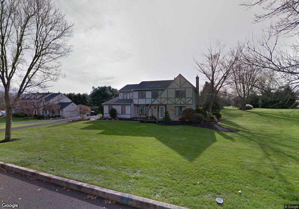
112 Windsong Dr Doylestown, PA 18901
Estimated Value: $904,912 - $984,000
4
Beds
3
Baths
3,198
Sq Ft
$298/Sq Ft
Est. Value
About This Home
This home is located at 112 Windsong Dr, Doylestown, PA 18901 and is currently estimated at $951,478, approximately $297 per square foot. 112 Windsong Dr is a home located in Bucks County with nearby schools including Groveland Elementary School, Tohickon Middle School, and Central Bucks High School-West.
Ownership History
Date
Name
Owned For
Owner Type
Purchase Details
Closed on
Sep 29, 2006
Sold by
Cartus Financial Corp
Bought by
Martindale Gregory and Maignan Nancy
Current Estimated Value
Home Financials for this Owner
Home Financials are based on the most recent Mortgage that was taken out on this home.
Original Mortgage
$85,500
Interest Rate
6.36%
Mortgage Type
Purchase Money Mortgage
Purchase Details
Closed on
Jul 3, 2006
Sold by
Skonicki Michael J and Skonicki Mary H
Bought by
Cartus Financial Corp
Create a Home Valuation Report for This Property
The Home Valuation Report is an in-depth analysis detailing your home's value as well as a comparison with similar homes in the area
Home Values in the Area
Average Home Value in this Area
Purchase History
| Date | Buyer | Sale Price | Title Company |
|---|---|---|---|
| Martindale Gregory | $585,000 | None Available | |
| Cartus Financial Corp | $585,000 | None Available |
Source: Public Records
Mortgage History
| Date | Status | Borrower | Loan Amount |
|---|---|---|---|
| Previous Owner | Martindale Gregory | $85,500 |
Source: Public Records
Tax History Compared to Growth
Tax History
| Year | Tax Paid | Tax Assessment Tax Assessment Total Assessment is a certain percentage of the fair market value that is determined by local assessors to be the total taxable value of land and additions on the property. | Land | Improvement |
|---|---|---|---|---|
| 2025 | $9,910 | $56,000 | $11,720 | $44,280 |
| 2024 | $9,910 | $56,000 | $11,720 | $44,280 |
| 2023 | $9,449 | $56,000 | $11,720 | $44,280 |
| 2022 | $9,344 | $56,000 | $11,720 | $44,280 |
| 2021 | $9,152 | $56,000 | $11,720 | $44,280 |
| 2020 | $9,110 | $56,000 | $11,720 | $44,280 |
| 2019 | $9,012 | $56,000 | $11,720 | $44,280 |
| 2018 | $8,984 | $56,000 | $11,720 | $44,280 |
| 2017 | $8,914 | $56,000 | $11,720 | $44,280 |
| 2016 | $8,858 | $56,000 | $11,720 | $44,280 |
| 2015 | -- | $56,000 | $11,720 | $44,280 |
| 2014 | -- | $56,000 | $11,720 | $44,280 |
Source: Public Records
Map
Nearby Homes
- 301 Windy Run Rd
- 100 Bishops Gate Ln Unit 67
- 194 Victoria Ct Unit 143
- 114 Blackfriars Cir
- 3711 Jacob Stout Rd Unit 5
- 3723 William Daves Rd
- 3765 William Daves Rd
- 5437 Rinker Cir Unit 283
- 4748 Bishop Cir
- 3838 Jacob Stout Rd
- 3923 Ferry Rd
- 62 Constitution Ave
- 1 Gatehouse Ln
- 157 Pine Run Rd
- 4 Old Colonial Dr Unit 254
- 90 Chapman Ave
- 418 North St
- 333 Dorset Ct Unit 333
- 215 N Franklin St
- 4263 Kleinot Dr
- 110 Windsong Dr
- 114 Windsong Dr
- 108 Windsong Dr
- 300 Windy Run Rd
- 113 Windsong Dr
- 116 Windsong Dr
- 106 Windsong Dr
- 118 Windsong Dr
- 302 Windy Run Rd
- 104 Windsong Dr
- 119 Windsong Dr
- 111 Windsong Dr
- 200 Southwind Dr
- 109 Windsong Dr
- 35 S Chapman Rd Unit POND
- 35 S Chapman Rd
- 117 Windsong Dr
- 306 Windy Run Rd
- 107 Windsong Dr
- 202 Southwind Dr