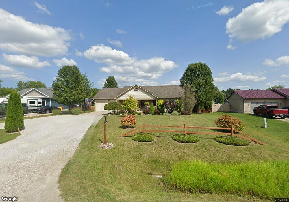
1120 Allen Rd Kimball, MI 48074
Estimated Value: $275,118 - $323,000
3
Beds
2
Baths
1,314
Sq Ft
$225/Sq Ft
Est. Value
About This Home
This home is located at 1120 Allen Rd, Kimball, MI 48074 and is currently estimated at $296,280, approximately $225 per square foot. 1120 Allen Rd is a home located in St. Clair County with nearby schools including Kimball Elementary School, Central Middle School, and Port Huron High School.
Ownership History
Date
Name
Owned For
Owner Type
Purchase Details
Closed on
Sep 12, 2006
Sold by
Wolverine Custom Builders Llc
Bought by
Wilbur Ian
Current Estimated Value
Home Financials for this Owner
Home Financials are based on the most recent Mortgage that was taken out on this home.
Original Mortgage
$179,000
Outstanding Balance
$107,672
Interest Rate
6.7%
Mortgage Type
VA
Estimated Equity
$188,608
Create a Home Valuation Report for This Property
The Home Valuation Report is an in-depth analysis detailing your home's value as well as a comparison with similar homes in the area
Home Values in the Area
Average Home Value in this Area
Purchase History
| Date | Buyer | Sale Price | Title Company |
|---|---|---|---|
| Wilbur Ian | $179,000 | None Available | |
| Wolverine Custom Builders Llc | -- | None Available | |
| Chesterfield Homes Llc | $36,000 | None Available |
Source: Public Records
Mortgage History
| Date | Status | Borrower | Loan Amount |
|---|---|---|---|
| Open | Wilbur Ian | $179,000 |
Source: Public Records
Tax History Compared to Growth
Tax History
| Year | Tax Paid | Tax Assessment Tax Assessment Total Assessment is a certain percentage of the fair market value that is determined by local assessors to be the total taxable value of land and additions on the property. | Land | Improvement |
|---|---|---|---|---|
| 2025 | $2,217 | $130,100 | $0 | $0 |
| 2024 | $1,165 | $123,400 | $0 | $0 |
| 2023 | $1,067 | $116,800 | $0 | $0 |
| 2022 | $2,489 | $101,400 | $0 | $0 |
| 2021 | $2,532 | $96,200 | $0 | $0 |
| 2020 | $2,532 | $85,300 | $85,300 | $0 |
| 2019 | $1,789 | $87,600 | $0 | $0 |
| 2018 | $2,210 | $79,300 | $0 | $0 |
| 2016 | $869 | $76,300 | $0 | $0 |
| 2015 | -- | $74,700 | $74,700 | $0 |
| 2014 | -- | $61,700 | $61,700 | $0 |
| 2013 | -- | $60,100 | $0 | $0 |
Source: Public Records
Map
Nearby Homes
- 1091 Allen Rd
- 5117 Ravenswood Rd
- 0 Ravenswood Rd Unit 20251017048
- 0000 Ravenswood Rd
- 1604 Allen Rd
- 1701 Allen Rd
- V/L Allen
- 183 Nevada Ave
- 00 Range Rd
- 4745 Smiths Creek Rd
- 250 Oregon Ave
- 1405 Range Rd
- 4632 Cloverdale Ln
- 000 Montana Ave
- 174 Meadow Ln
- 42 Liberty Ave
- 0000 Wisconsin Ave
- 153 Meadow Ln
- 104 Oldbrook Ln
- 277 Liberty Ave
- 1116 Allen Rd
- 1130 Allen Rd
- 1106 Allen Rd
- 1140 Allen Rd
- 1096 Allen Rd
- 1117 Allen Rd
- 1093 Broad ax Ln
- 1143 Allen Rd
- 1100 Broad ax Ln
- 1089 Broad ax Ln
- 0 Broad Ax - Unit 56 4218057
- 0 Broad Ax - Unit 60 4218055
- 0 Broad Ax - Unit 54 4218058
- 0 Broad Ax - Unit 43 4218056
- 0 Broad Ax - Unit 60 4396780
- 0 Broad Ax - Unit 56 4396782
- 0 Broad Ax - Unit 54 4396783
- 0 Broad Ax - Unit 43 4396781
- 0 Broad Ax - Unit 43 4433519
- 0 Broad Ax - Unit 54 4433517