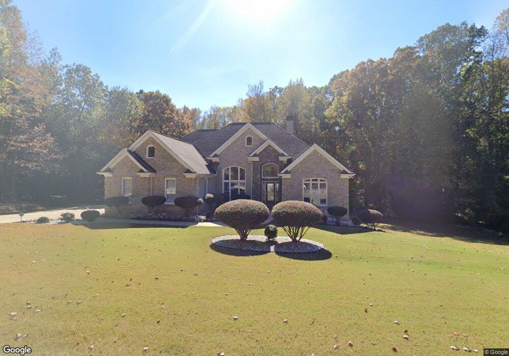
1120 Brookfield Dr SE Unit 2 Conyers, GA 30013
Estimated Value: $466,000 - $479,242
3
Beds
3
Baths
3,070
Sq Ft
$154/Sq Ft
Est. Value
About This Home
This home is located at 1120 Brookfield Dr SE Unit 2, Conyers, GA 30013 and is currently estimated at $473,811, approximately $154 per square foot. 1120 Brookfield Dr SE Unit 2 is a home located in Rockdale County with nearby schools including Barksdale Elementary School, Memorial Middle School, and Salem High School.
Ownership History
Date
Name
Owned For
Owner Type
Purchase Details
Closed on
Apr 1, 2025
Sold by
Fortune Oswald
Bought by
Fortune Oswald and Jones Zenobia L
Current Estimated Value
Purchase Details
Closed on
Mar 7, 2005
Sold by
Boswell Luke B
Bought by
Fortune Oswald and Fortune Mary
Purchase Details
Closed on
Mar 2, 2004
Sold by
Kitchens Robert L
Bought by
Boswell Luke B
Home Financials for this Owner
Home Financials are based on the most recent Mortgage that was taken out on this home.
Original Mortgage
$181,272
Interest Rate
6.75%
Mortgage Type
New Conventional
Create a Home Valuation Report for This Property
The Home Valuation Report is an in-depth analysis detailing your home's value as well as a comparison with similar homes in the area
Home Values in the Area
Average Home Value in this Area
Purchase History
| Date | Buyer | Sale Price | Title Company |
|---|---|---|---|
| Fortune Oswald | -- | -- | |
| Fortune Oswald | $350,000 | -- | |
| Boswell Luke B | $232,400 | -- |
Source: Public Records
Mortgage History
| Date | Status | Borrower | Loan Amount |
|---|---|---|---|
| Previous Owner | Boswell Luke B | $181,272 |
Source: Public Records
Tax History Compared to Growth
Tax History
| Year | Tax Paid | Tax Assessment Tax Assessment Total Assessment is a certain percentage of the fair market value that is determined by local assessors to be the total taxable value of land and additions on the property. | Land | Improvement |
|---|---|---|---|---|
| 2024 | $5,138 | $229,720 | $36,160 | $193,560 |
| 2023 | $4,350 | $207,960 | $31,480 | $176,480 |
| 2022 | $3,725 | $171,360 | $27,800 | $143,560 |
| 2021 | $3,604 | $157,080 | $22,160 | $134,920 |
| 2020 | $3,239 | $138,760 | $20,000 | $118,760 |
| 2019 | $2,783 | $121,000 | $9,800 | $111,200 |
| 2018 | $2,797 | $120,880 | $9,800 | $111,080 |
| 2017 | $2,484 | $109,760 | $9,800 | $99,960 |
| 2016 | $2,255 | $109,760 | $9,800 | $99,960 |
| 2015 | $2,031 | $102,040 | $9,800 | $92,240 |
| 2014 | $2,298 | $103,160 | $10,920 | $92,240 |
| 2013 | -- | $125,720 | $20,000 | $105,720 |
Source: Public Records
Map
Nearby Homes
- 1107 Brookfield Dr SE
- 1104 Brookfield Dr SE
- 1296 Carman Ct SE
- 4260 Brandy Ln SE
- 65 King James Ct SE
- 330 Christian Woods Dr SE
- 4210 Stephanie Cir SE
- 4195 Stephanie Cir SE
- 4217 SE Lindsey Way
- 1789 Brandy Dr SE
- 926 Bell Rd SE
- 1120 Kinnett Rd
- 1790 Brandy Woods Trail SE
- 1828 Brandy Woods Dr SE
- 4824 Georgia 20
- 1580 Christian Cir SE
- 1388 Caritas Ct SE
- 1122 Brookfield Dr SE
- 1118 Brookfield Dr SE Unit 2
- 1117 Brookfield Dr SE
- 1119 Brookfield Dr SE
- 1124 Brookfield Dr SE Unit 2
- 1116 Brookfield Dr SE
- 1121 Brookfield Dr SE
- 1115 Brookfield Dr SE
- 1115 Brookfield Dr SE
- 1115 Brookfield Dr SE
- 1979 Christian Cir SE
- 1227 Dover Place SE
- 1123 Brookfield Dr SE
- 1114 Brookfield Dr SE
- 1225 Dover Place SE Unit 2
- 1221 Dover Place SE
- 1223 Dover Place SE
- 1126 Brookfield Dr SE Unit 2
- 1219 Dover Place SE Unit 2
- 1229 Dover Place SE Unit 2