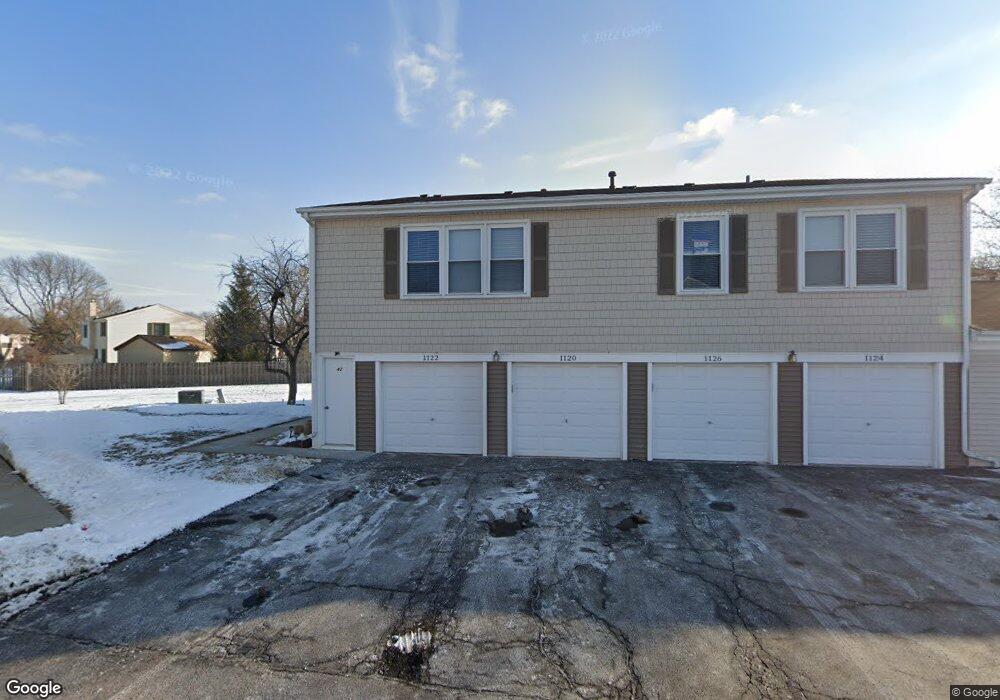
1120 Brunswick Harbor Unit 42 Schaumburg, IL 60193
South Schaumburg NeighborhoodEstimated Value: $236,734 - $263,000
2
Beds
--
Bath
1,000
Sq Ft
$254/Sq Ft
Est. Value
About This Home
This home is located at 1120 Brunswick Harbor Unit 42, Schaumburg, IL 60193 and is currently estimated at $254,434, approximately $254 per square foot. 1120 Brunswick Harbor Unit 42 is a home located in Cook County with nearby schools including Michael Collins Elementary School, Robert Frost Junior High School, and J B Conant High School.
Ownership History
Date
Name
Owned For
Owner Type
Purchase Details
Closed on
Sep 11, 2003
Sold by
Fuchs Ralph
Bought by
Fuchs Lori
Current Estimated Value
Home Financials for this Owner
Home Financials are based on the most recent Mortgage that was taken out on this home.
Original Mortgage
$139,500
Interest Rate
6.02%
Mortgage Type
Unknown
Create a Home Valuation Report for This Property
The Home Valuation Report is an in-depth analysis detailing your home's value as well as a comparison with similar homes in the area
Home Values in the Area
Average Home Value in this Area
Purchase History
| Date | Buyer | Sale Price | Title Company |
|---|---|---|---|
| Fuchs Lori | -- | Chicago Title Insurance Comp |
Source: Public Records
Mortgage History
| Date | Status | Borrower | Loan Amount |
|---|---|---|---|
| Closed | Fuchs Lori | $139,500 |
Source: Public Records
Tax History Compared to Growth
Tax History
| Year | Tax Paid | Tax Assessment Tax Assessment Total Assessment is a certain percentage of the fair market value that is determined by local assessors to be the total taxable value of land and additions on the property. | Land | Improvement |
|---|---|---|---|---|
| 2024 | $4,367 | $15,590 | $646 | $14,944 |
| 2023 | $4,235 | $15,590 | $646 | $14,944 |
| 2022 | $4,235 | $15,590 | $646 | $14,944 |
| 2021 | $4,205 | $13,874 | $352 | $13,522 |
| 2020 | $4,133 | $13,874 | $352 | $13,522 |
| 2019 | $4,132 | $15,416 | $352 | $15,064 |
| 2018 | $3,284 | $10,944 | $293 | $10,651 |
| 2017 | $3,233 | $10,944 | $293 | $10,651 |
| 2016 | $3,023 | $10,944 | $293 | $10,651 |
| 2015 | $2,794 | $9,341 | $264 | $9,077 |
| 2014 | $2,764 | $9,341 | $264 | $9,077 |
| 2013 | $2,693 | $9,341 | $264 | $9,077 |
Source: Public Records
Map
Nearby Homes
- 286 Nantucket Harbor Unit 601
- 1078 Newport Harbor Unit 6101
- 1100 Boston Harbor Unit 7004
- 1205 Laurel Ln
- 421 E Wise Rd
- 1323 S Roselle Rd
- 620 S Point Dr
- 731 Highpoint Ct
- 1420 Indian Hill Dr
- 13 W Monterey Ave
- 717 Tipperary Ct Unit 1C
- 733 Limerick Ln Unit 7333D
- 211 Steeple Bush Ln Unit 10343
- 205 Steeple Bush Ln Unit 10444
- 712 Tipperary Ct Unit 1C
- 711 Tipperary Ct Unit 2D
- 727 Killarney Ct Unit 2D
- 134 Lunt Ave
- 826 Thornton Ct Unit 2AL
- 1531 Marion St
- 1124 Brunswick Harbor Unit 42
- 1124 Brunswick Harbor Unit 1124
- 1122 Brunswick Harbor Unit 42
- 1126 Brunswick Harbor Unit 42
- 1118 Brunswick Harbor Unit 43
- 1114 Brunswick Harbor Unit 43
- 1116 Brunswick Harbor Unit 43
- 1116 Brunswick Harbor
- 1112 Brunswick Harbor Unit 43
- 290 Nantucket Harbor Unit 603
- 1108 Brunswick Harbor Unit 41
- 276 Nantucket Harbor Unit 704
- 280 Nantucket Harbor Unit 702
- 282 Nantucket Harbor Unit 701
- 1104 Brunswick Harbor Unit 41
- 284 Nantucket Harbor Unit 604
- 1106 Brunswick Harbor Unit 41
- 1110 Brunswick Harbor Unit 41
- 1110 Brunswick Harbor Unit 1110
- 1110 Brunswick Harbor Unit 4101