Estimated Value: $734,000 - $877,000
Studio
--
Bath
--
Sq Ft
353,272
Sq Ft
About This Home
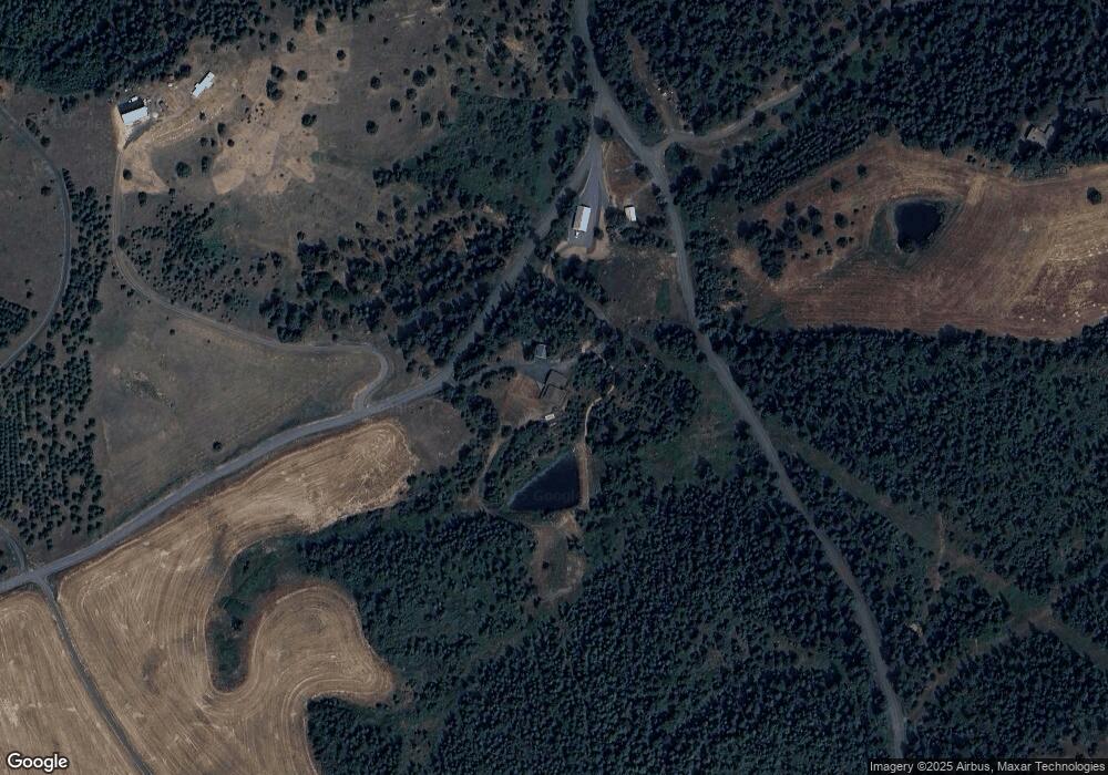
This home is located at 1120 Clay Pit Rd, Troy, ID 83871 and is currently estimated at $825,960. 1120 Clay Pit Rd is a home located in Latah County with nearby schools including Troy Elementary School and Troy Junior/Senior High School.
Ownership History
Date
Name
Owned For
Owner Type
Purchase Details
Closed on
Nov 26, 2012
Sold by
Cummings Barry J and Cummings Larissa L
Bought by
Cummings Barry J and Cummings Larissa
Current Estimated Value
Home Financials for this Owner
Home Financials are based on the most recent Mortgage that was taken out on this home.
Original Mortgage
$264,200
Outstanding Balance
$180,733
Interest Rate
3.33%
Mortgage Type
New Conventional
Estimated Equity
$645,227
Create a Home Valuation Report for This Property
The Home Valuation Report is an in-depth analysis detailing your home's value as well as a comparison with similar homes in the area
Purchase History
| Date | Buyer | Sale Price | Title Company |
|---|---|---|---|
| Cummings Barry J | -- | Latah County Title Co |
Source: Public Records
Mortgage History
| Date | Status | Borrower | Loan Amount |
|---|---|---|---|
| Open | Cummings Barry J | $264,200 |
Source: Public Records
Tax History
| Year | Tax Paid | Tax Assessment Tax Assessment Total Assessment is a certain percentage of the fair market value that is determined by local assessors to be the total taxable value of land and additions on the property. | Land | Improvement |
|---|---|---|---|---|
| 2025 | $3,390 | $678,465 | $175,500 | $502,965 |
| 2024 | $3,390 | $678,463 | $175,500 | $502,963 |
| 2023 | $3,966 | $730,568 | $175,500 | $555,068 |
| 2022 | $1,516 | $481,609 | $75,469 | $406,140 |
| 2021 | $3,343 | $330,534 | $41,304 | $289,230 |
| 2020 | $3,803 | $404,468 | $41,632 | $362,836 |
| 2019 | $3,510 | $358,633 | $41,451 | $317,182 |
| 2018 | $3,312 | $328,023 | $41,276 | $286,747 |
| 2017 | $3,128 | $306,116 | $41,109 | $265,007 |
| 2016 | $3,227 | $0 | $0 | $0 |
| 2014 | $2,834 | $282,109 | $40,948 | $241,161 |
Source: Public Records
Map
Nearby Homes
- 4370 Idaho 8
- 705 Rachel St
- TBD Burnt Ridge Rd Parcel 1
- 300 Big Meadow Rd
- TBD Burnt Ridge Rd Parcel 2
- 1703 Little Bear Ridge Rd
- 111 E A St
- 411 S Pine St
- 813 S Bentz St
- TBD Hwy 3
- 1005 Williams Ln
- 300 Main St
- 1050 Tukta Way Ln
- 1017 Laura Ln
- NKA O'Reilly Rd
- 1101 Ruby Creek Rd
- 1031 E Rock Creek Rd
- 1089 Wallen Rd
- 3336 Highway 8 Unit 2
- TBD Foothill Rd
- 1120 Claypit Rd
- 1115 Claypit Rd
- 1172 Nora Creek Rd
- 1102 Clay Pit Rd
- TBD Nora Creek Rd
- 1087 Clay Pit Rd
- 1066 Clay Pit Rd
- 1160 Nora Creek Rd
- 1061 Clay Pit Rd
- 1180 Nora Creek Rd
- 1184 Nora Creek Rd
- 1062 Clay Pit Rd
- 1100 Claypit Rd
- 1100 Clay Pit Rd
- 1090 Clay Pit Rd
- 1090 Claypit Rd
- 1164 Nora Creek Rd
- 1060 Claypit Rd
- 1131 Nora Creek Rd
- 1207 Nora Creek Rd
Your Personal Tour Guide
Ask me questions while you tour the home.
