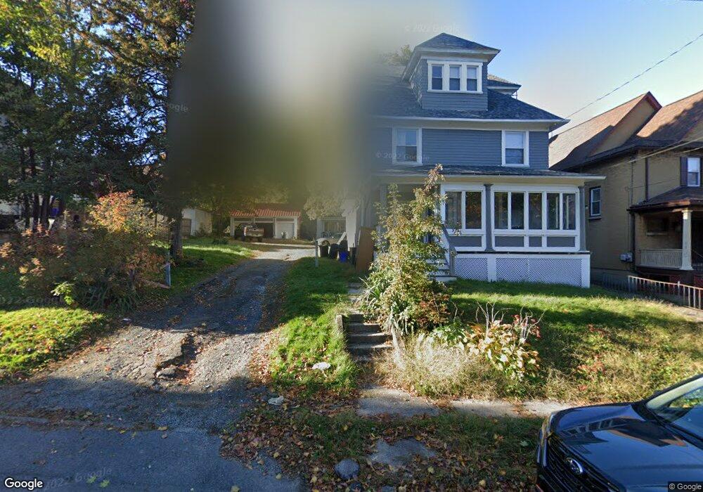
1120 Fisk St Scranton, PA 18509
Greenridge NeighborhoodEstimated Value: $112,580 - $265,000
--
Bed
--
Bath
--
Sq Ft
9,627
Sq Ft Lot
About This Home
This home is located at 1120 Fisk St, Scranton, PA 18509 and is currently estimated at $221,895. 1120 Fisk St is a home located in Lackawanna County with nearby schools including Maybeury Elementary School, Pinchbeck Elementary School, and Robert Morris #27.
Ownership History
Date
Name
Owned For
Owner Type
Purchase Details
Closed on
Jun 30, 2017
Sold by
Reza Salim
Bought by
Axtell Keith Robert
Current Estimated Value
Home Financials for this Owner
Home Financials are based on the most recent Mortgage that was taken out on this home.
Original Mortgage
$95,351
Outstanding Balance
$79,177
Interest Rate
3.87%
Mortgage Type
FHA
Estimated Equity
$142,718
Purchase Details
Closed on
Dec 5, 2012
Sold by
Mcwilliams Floyd W and Mcwilliams Judith A
Bought by
Reza Salim
Create a Home Valuation Report for This Property
The Home Valuation Report is an in-depth analysis detailing your home's value as well as a comparison with similar homes in the area
Home Values in the Area
Average Home Value in this Area
Purchase History
| Date | Buyer | Sale Price | Title Company |
|---|---|---|---|
| Axtell Keith Robert | $65,000 | None Available | |
| Reza Salim | -- | None Available |
Source: Public Records
Mortgage History
| Date | Status | Borrower | Loan Amount |
|---|---|---|---|
| Open | Axtell Keith Robert | $95,351 |
Source: Public Records
Tax History Compared to Growth
Tax History
| Year | Tax Paid | Tax Assessment Tax Assessment Total Assessment is a certain percentage of the fair market value that is determined by local assessors to be the total taxable value of land and additions on the property. | Land | Improvement |
|---|---|---|---|---|
| 2025 | $5,369 | $15,000 | $5,150 | $9,850 |
| 2024 | $4,943 | $15,000 | $5,150 | $9,850 |
| 2023 | $4,943 | $15,000 | $5,150 | $9,850 |
| 2022 | $4,835 | $15,000 | $5,150 | $9,850 |
| 2021 | $4,835 | $15,000 | $5,150 | $9,850 |
| 2020 | $4,755 | $15,000 | $5,150 | $9,850 |
| 2019 | $4,484 | $15,000 | $5,150 | $9,850 |
| 2018 | $4,484 | $15,000 | $5,150 | $9,850 |
| 2017 | $4,413 | $15,000 | $5,150 | $9,850 |
| 2016 | $1,696 | $15,000 | $5,150 | $9,850 |
| 2015 | $3,410 | $15,000 | $5,150 | $9,850 |
| 2014 | -- | $15,000 | $5,150 | $9,850 |
Source: Public Records
Map
Nearby Homes
- 1008 Fisk St
- 2349 Adams Ave
- 831 Raines St
- 2707 Olyphant Ave
- 2237 Boulevard Ave
- 1420 College Ave
- 601 Dean St
- 1021 Richmont St
- 2106 Boulevard Ave
- 2129 Comegys Ave Unit L11
- 1118 Columbia St
- 35 Dean St
- 2706 N Main Ave
- 121 Throop St
- 1012 Sunset St
- 1008 Sunset St
- 1599 Electric St
- 2724 N Main Ave
- 802 Sunset St
- 1732 Capouse Ave
- 1120 Fisk St
- 1120 Fisk St
- 1112 Fisk St
- 1108 Fisk St
- 2327 N Washington Ave
- 2329 N Washington Ave
- 1124 Fisk St
- 2331 N Washington Ave
- 1106 Fisk St
- 2323 N Washington Ave Unit 2325
- 2333 N Washington Ave
- 1100 Fisk St
- 1125 Fisk St
- 1040 Fisk St
- 2400 N Washington Ave
- 2321 N Washington Ave
- 1107 1109 Fisk St Unit first floor middle C
- 1107 1109 Fisk St Unit Upper right C
- 1107 1109 Fisk St Unit upper left B
- 1107 1109 Fisk St