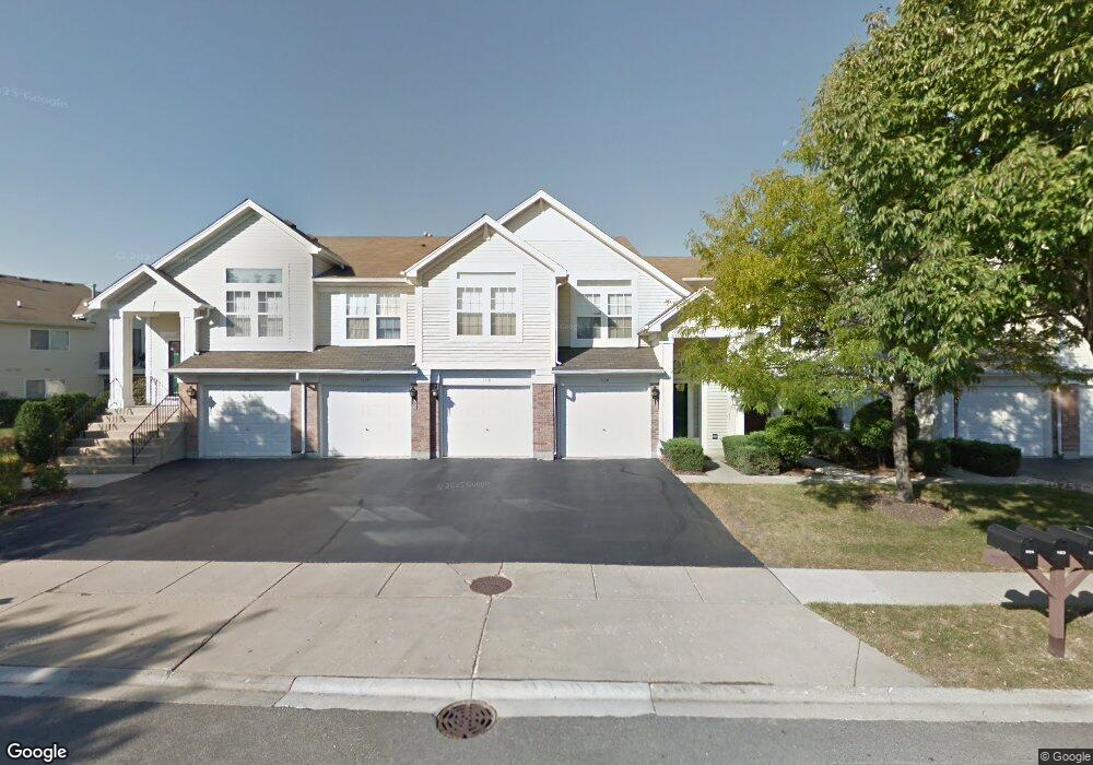
1120 Hawthorne Ln Unit 90420 Elk Grove Village, IL 60007
Elk Grove Village West NeighborhoodEstimated Value: $342,000 - $358,000
2
Beds
--
Bath
15,500
Sq Ft
$23/Sq Ft
Est. Value
About This Home
This home is located at 1120 Hawthorne Ln Unit 90420, Elk Grove Village, IL 60007 and is currently estimated at $349,627, approximately $22 per square foot. 1120 Hawthorne Ln Unit 90420 is a home located in Cook County with nearby schools including Adolph Link Elementary School, Margaret Mead Junior High School, and J B Conant High School.
Ownership History
Date
Name
Owned For
Owner Type
Purchase Details
Closed on
Sep 4, 1996
Sold by
The Northern Trust Company
Bought by
Pizza Steven and Pizza Annette
Current Estimated Value
Home Financials for this Owner
Home Financials are based on the most recent Mortgage that was taken out on this home.
Original Mortgage
$158,800
Interest Rate
8.32%
Create a Home Valuation Report for This Property
The Home Valuation Report is an in-depth analysis detailing your home's value as well as a comparison with similar homes in the area
Home Values in the Area
Average Home Value in this Area
Purchase History
| Date | Buyer | Sale Price | Title Company |
|---|---|---|---|
| Pizza Steven | $167,500 | -- |
Source: Public Records
Mortgage History
| Date | Status | Borrower | Loan Amount |
|---|---|---|---|
| Previous Owner | Pizza Steven | $158,800 |
Source: Public Records
Tax History Compared to Growth
Tax History
| Year | Tax Paid | Tax Assessment Tax Assessment Total Assessment is a certain percentage of the fair market value that is determined by local assessors to be the total taxable value of land and additions on the property. | Land | Improvement |
|---|---|---|---|---|
| 2024 | $4,627 | $27,673 | $3,482 | $24,191 |
| 2023 | $4,650 | $27,673 | $3,482 | $24,191 |
| 2022 | $4,650 | $27,673 | $3,482 | $24,191 |
| 2021 | $4,900 | $22,200 | $2,708 | $19,492 |
| 2020 | $5,110 | $22,200 | $2,708 | $19,492 |
| 2019 | $4,955 | $23,991 | $2,708 | $21,283 |
| 2018 | $4,337 | $20,165 | $2,321 | $17,844 |
| 2017 | $5,156 | $20,165 | $2,321 | $17,844 |
| 2016 | $5,058 | $20,165 | $2,321 | $17,844 |
| 2015 | $4,766 | $18,150 | $2,063 | $16,087 |
| 2014 | $4,722 | $18,150 | $2,063 | $16,087 |
| 2013 | $4,587 | $18,150 | $2,063 | $16,087 |
Source: Public Records
Map
Nearby Homes
- 1057 Talbots Ln Unit A
- 1057 Savoy Ct Unit 221713
- 716 Clover Hill Ct
- 936 Debra Ln
- 1297 Old Mill Ln Unit 534
- 1189 Grissom Trail
- 579 Bristol Ln
- 870 Debra Ln
- 1124 Lovell Ct
- 1517 White Trail
- 258 Bay Dr
- 146 Bay Dr
- 1093 Gloria Dr
- 815 Leicester Rd Unit A211
- 520 Biesterfield Rd Unit D318
- 805 Leicester Rd Unit B118
- 805 Leicester Rd Unit B320
- 805 Leicester Rd Unit B105
- 850 Wellington Ave Unit 304
- 898 Wellington Ave Unit 202
- 1116 Hawthorne Ln Unit 90420
- 1118 Hawthorne Ln Unit 90420
- 1114 Hawthorne Ln Unit 90420
- 1112 Hawthorne Ln Unit 90420
- 1112 Hawthorne Ln Unit 1112
- 1110 Hawthorne Ln Unit 90420
- 1122 Hawthorne Ln Unit 90420
- 1124 Hawthorne Ln Unit 90420
- 1001 Huntington Dr Unit 7043
- 1003 Huntington Dr Unit 7043
- 1003 Huntington Dr Unit 102
- 1005 Huntington Dr Unit 7043
- 1121 Hawthorne Ln Unit 90240
- 1115 Hawthorne Ln Unit 90240
- 1123 Hawthorne Ln Unit 90240
- 1125 Hawthorne Ln Unit 10025
- 1152 Hawthorne Ln Unit 14041
- 1154 Hawthorne Ln Unit 14041
- 1127 Hawthorne Ln Unit 10025
- 1113 Hawthorne Ln Unit 90240