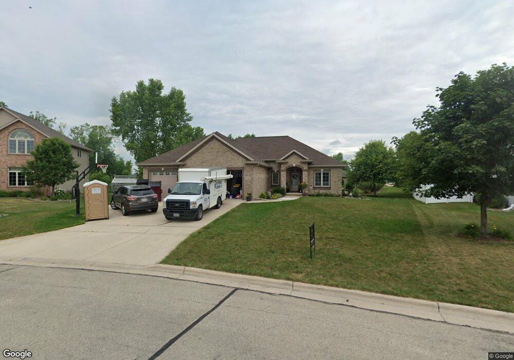
1120 Lansdale Cir de Pere, WI 54115
Estimated Value: $500,000 - $631,913
--
Bed
--
Bath
--
Sq Ft
0.4
Acres
About This Home
This home is located at 1120 Lansdale Cir, de Pere, WI 54115 and is currently estimated at $591,478. 1120 Lansdale Cir is a home located in Brown County with nearby schools including Heritage Elementary School, De Pere Middle School, and Foxview Intermediate School.
Ownership History
Date
Name
Owned For
Owner Type
Purchase Details
Closed on
Oct 11, 2007
Sold by
Cho Timothy T and Cho Helen B
Bought by
Nelson Matthew A and Nelson Krista R
Current Estimated Value
Home Financials for this Owner
Home Financials are based on the most recent Mortgage that was taken out on this home.
Original Mortgage
$304,000
Interest Rate
5.87%
Mortgage Type
Purchase Money Mortgage
Purchase Details
Closed on
Jul 28, 2006
Sold by
Lexington Homes Inc
Bought by
Cho Timothy T and Cho Helen B
Home Financials for this Owner
Home Financials are based on the most recent Mortgage that was taken out on this home.
Original Mortgage
$274,320
Interest Rate
6.82%
Mortgage Type
Purchase Money Mortgage
Create a Home Valuation Report for This Property
The Home Valuation Report is an in-depth analysis detailing your home's value as well as a comparison with similar homes in the area
Home Values in the Area
Average Home Value in this Area
Purchase History
| Date | Buyer | Sale Price | Title Company |
|---|---|---|---|
| Nelson Matthew A | $320,000 | None Available | |
| Cho Timothy T | $342,900 | Evans Title |
Source: Public Records
Mortgage History
| Date | Status | Borrower | Loan Amount |
|---|---|---|---|
| Previous Owner | Nelson Matthew A | $304,000 | |
| Previous Owner | Cho Timothy T | $274,320 |
Source: Public Records
Tax History Compared to Growth
Tax History
| Year | Tax Paid | Tax Assessment Tax Assessment Total Assessment is a certain percentage of the fair market value that is determined by local assessors to be the total taxable value of land and additions on the property. | Land | Improvement |
|---|---|---|---|---|
| 2024 | $7,513 | $514,600 | $68,900 | $445,700 |
| 2023 | $6,084 | $468,000 | $68,900 | $399,100 |
| 2022 | $5,718 | $468,000 | $68,900 | $399,100 |
| 2021 | $5,351 | $340,500 | $54,700 | $285,800 |
| 2020 | $5,262 | $340,500 | $54,700 | $285,800 |
| 2019 | $5,733 | $340,500 | $54,700 | $285,800 |
| 2018 | $5,873 | $340,500 | $54,700 | $285,800 |
| 2017 | $5,766 | $340,500 | $54,700 | $285,800 |
| 2016 | $6,008 | $299,600 | $47,700 | $251,900 |
| 2015 | $6,049 | $299,600 | $47,700 | $251,900 |
| 2014 | $6,098 | $299,600 | $47,700 | $251,900 |
| 2013 | $6,098 | $299,600 | $47,700 | $251,900 |
Source: Public Records
Map
Nearby Homes
- 3980 N Parker Way
- 3910 Monroe Rd
- 2200 Dickinson Rd
- 4011 Garrett St
- 7759 Sunstone Ct
- 1482 Brayden Ln
- 2087 Swanstone Cir
- 4649 Royal Vista Trail
- 1679 Arnie's Ct
- 1655 Arnie's Ct
- 3832 Bower Creek Rd
- 1986 Tyler Ln
- 1535 Brayden Ln
- 3924 Hawk Ledge Cir
- 3808 Bower Creek Rd
- 1526 Red Hawk Landing Trail
- 1568 Brayden Ln
- 737 Desplaine Rd
- 3749 Rustic Ledge Way
- 1769 Bobby Jones Dr
- 1116 Lansdale Cir
- 1124 Lansdale Cir
- 2326 Berkley Rd
- 2332 Berkley Rd
- 1112 Lansdale Cir
- 1121 Lansdale Cir
- 1128 Lansdale Cir
- 2336 Berkley Rd
- 1111 Lansdale Cir
- 1108 Lansdale Cir
- 1135 Lansdale Cir
- 2340 Berkley Rd
- 1132 Lansdale Cir
- 1960 Prescott Place
- 2329 Berkley Rd
- 1964 Prescott Place
- 2333 Berkley Rd
- 1948 Prescott Place
- 1968 Prescott Place
- 2344 Berkley Rd