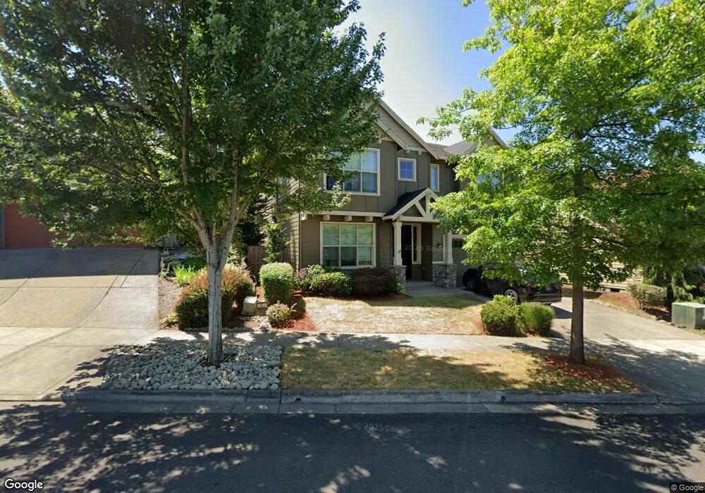
1120 Lilac St Forest Grove, OR 97116
Estimated Value: $662,000 - $745,000
4
Beds
3
Baths
3,440
Sq Ft
$202/Sq Ft
Est. Value
About This Home
This home is located at 1120 Lilac St, Forest Grove, OR 97116 and is currently estimated at $694,608, approximately $201 per square foot. 1120 Lilac St is a home located in Washington County with nearby schools including Dilley Elementary School, Tom McCall Upper Elementary School, and Neil Armstrong Middle School.
Ownership History
Date
Name
Owned For
Owner Type
Purchase Details
Closed on
Jan 20, 2017
Sold by
Moews Matthew J and Moews Karen
Bought by
Hp Oregon I Llc
Current Estimated Value
Purchase Details
Closed on
Jul 14, 2014
Sold by
Stone Bridge Homes Nw Llc
Bought by
Moews Matthew J and Moews Karen
Home Financials for this Owner
Home Financials are based on the most recent Mortgage that was taken out on this home.
Original Mortgage
$368,589
Interest Rate
4.75%
Mortgage Type
FHA
Create a Home Valuation Report for This Property
The Home Valuation Report is an in-depth analysis detailing your home's value as well as a comparison with similar homes in the area
Home Values in the Area
Average Home Value in this Area
Purchase History
| Date | Buyer | Sale Price | Title Company |
|---|---|---|---|
| Hp Oregon I Llc | $452,000 | Stewart Title | |
| Moews Matthew J | $395,000 | First American |
Source: Public Records
Mortgage History
| Date | Status | Borrower | Loan Amount |
|---|---|---|---|
| Previous Owner | Moews Matthew J | $368,589 |
Source: Public Records
Tax History Compared to Growth
Tax History
| Year | Tax Paid | Tax Assessment Tax Assessment Total Assessment is a certain percentage of the fair market value that is determined by local assessors to be the total taxable value of land and additions on the property. | Land | Improvement |
|---|---|---|---|---|
| 2026 | $8,511 | $477,930 | -- | -- |
| 2025 | $8,511 | $464,010 | -- | -- |
| 2024 | $8,210 | $450,500 | -- | -- |
| 2023 | $8,210 | $437,380 | $0 | $0 |
| 2022 | $7,179 | $437,380 | $0 | $0 |
| 2021 | $7,086 | $412,290 | $0 | $0 |
| 2020 | $7,048 | $400,290 | $0 | $0 |
| 2019 | $6,891 | $388,640 | $0 | $0 |
| 2018 | $6,680 | $377,330 | $0 | $0 |
| 2017 | $6,473 | $366,340 | $0 | $0 |
| 2016 | $6,291 | $355,670 | $0 | $0 |
| 2015 | $6,049 | $345,320 | $0 | $0 |
| 2014 | $6,020 | $335,270 | $0 | $0 |
Source: Public Records
Map
Nearby Homes
- 2517 Sweetwood Ct
- 1104 Magnolia Way
- 1315 Begonia Ave
- 1222 Brookside Ave
- 2440 Heather Way
- 1078 Vista Oaks Dr
- 1609 Camino Dr
- 1425 Willamina Ave
- 1611 Camino Dr
- 1224 Alyssum Ave
- 918 Rosebud Ct
- 922 Rosebud Ct
- 2819 Buxton St
- 911 Rosebud Ct
- 920 Rosebud Ct
- 924 Rosebud Ct
- 507-FH Plan at Parkview Terrace
- 504-STD Plan at Parkview Terrace
- Poppy - Plan 308C at Parkview Terrace
- 430A Plan at Parkview Terrace
- 1112 Lilac St
- 1128 Lilac St
- 1113 Parkside Ave
- 1104 Lilac St
- 1117 Parkside Ave
- 1091 Parkside Ave
- 1123 Parkside Ave
- 2621 Jasmine Ln
- 1056 Lilac St
- 1085 Parkside Ave
- 0 Jasmine Ln Unit 14367692
- 1129 Lilac St
- 1137 Lilac St
- 2625 Jasmine Ln
- 1079 Parkside Ave
- 1050 Lilac St
- 1135 Parkside Ave
- 1065 Lilac St
- 2654 Windstream St
- 1073 Parkside Ave