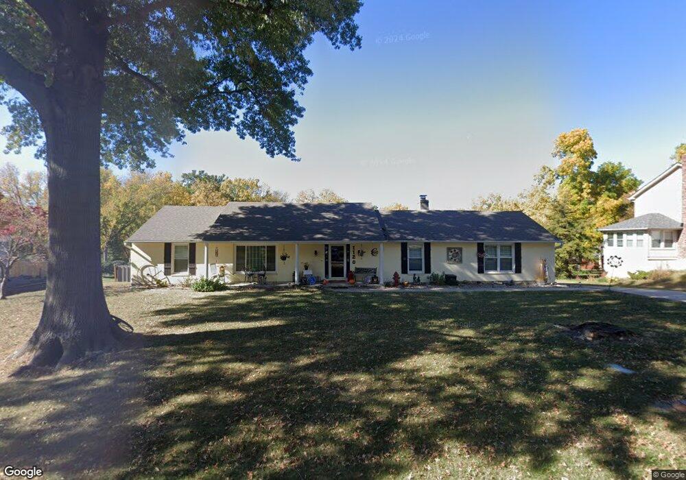
1120 Manchester Rd Liberty, MO 64068
Estimated Value: $389,617 - $467,000
4
Beds
4
Baths
2,176
Sq Ft
$198/Sq Ft
Est. Value
About This Home
This home is located at 1120 Manchester Rd, Liberty, MO 64068 and is currently estimated at $430,654, approximately $197 per square foot. 1120 Manchester Rd is a home located in Clay County with nearby schools including Alexander Doniphan Elementary School, Discovery Middle School, and Liberty High School.
Ownership History
Date
Name
Owned For
Owner Type
Purchase Details
Closed on
Jan 18, 2024
Sold by
Coffman Jon C and Coffman Glenda R
Bought by
Jon C Coffman And Glenda R Coffman Revocable and Coffman
Current Estimated Value
Purchase Details
Closed on
Jul 26, 2010
Sold by
Matteson Billy G and Matteson Beverly D
Bought by
Coffman Jon C and Coffman Glenda R
Home Financials for this Owner
Home Financials are based on the most recent Mortgage that was taken out on this home.
Original Mortgage
$145,600
Interest Rate
4.76%
Mortgage Type
New Conventional
Purchase Details
Closed on
Jul 5, 1999
Sold by
Matteson Billy and Matteson Beverly
Bought by
Matteson Billy G and Matteson Beverly D
Create a Home Valuation Report for This Property
The Home Valuation Report is an in-depth analysis detailing your home's value as well as a comparison with similar homes in the area
Home Values in the Area
Average Home Value in this Area
Purchase History
| Date | Buyer | Sale Price | Title Company |
|---|---|---|---|
| Jon C Coffman And Glenda R Coffman Revocable | -- | None Listed On Document | |
| Coffman Jon C | -- | Mst | |
| Matteson Billy G | -- | -- |
Source: Public Records
Mortgage History
| Date | Status | Borrower | Loan Amount |
|---|---|---|---|
| Previous Owner | Coffman Jon C | $145,600 |
Source: Public Records
Tax History Compared to Growth
Tax History
| Year | Tax Paid | Tax Assessment Tax Assessment Total Assessment is a certain percentage of the fair market value that is determined by local assessors to be the total taxable value of land and additions on the property. | Land | Improvement |
|---|---|---|---|---|
| 2025 | $4,202 | $60,570 | -- | -- |
| 2024 | $4,202 | $54,640 | -- | -- |
| 2023 | $4,274 | $54,640 | $0 | $0 |
| 2022 | $4,049 | $51,110 | $0 | $0 |
| 2021 | $4,017 | $51,110 | $11,400 | $39,710 |
| 2020 | $3,235 | $38,650 | $0 | $0 |
| 2019 | $3,234 | $38,646 | $5,700 | $32,946 |
| 2018 | $3,050 | $35,780 | $0 | $0 |
| 2017 | $3,021 | $35,780 | $5,320 | $30,460 |
| 2016 | $3,021 | $35,780 | $5,320 | $30,460 |
| 2015 | $3,022 | $35,780 | $5,320 | $30,460 |
| 2014 | $2,881 | $33,840 | $5,320 | $28,520 |
Source: Public Records
Map
Nearby Homes
- 1124 Amesbury Ave
- 415 Monterey Ave
- 918 Amesbury Ave
- 862 Amesbury Ave
- 509 Belmont St
- 420 Belmont St
- 1323 Amesbury Ave
- 1218 Canterbury Ln
- 716 Bristol Ct
- 1507 Amesbury Ave
- 1733 Welleslay Ln
- 1331 Park Ln
- 1317 Park Ln
- 1537 Canterbury Ln
- 253 S Stewart Rd
- 1304 Wellington Way
- 1209 Liberty Drive Terrace
- 1327 Easton Ct
- 7908 N Ditzler Ave
- 9102 NE 79th Terrace
- 1106 Manchester Rd
- 1140 Manchester Rd
- 1934 Barford Rd
- 1107 Manchester Rd
- 1121 Manchester Rd
- 1036 Manchester Rd
- 1930 Barford Rd
- 1933 Barford Rd
- 1037 Manchester Rd
- 1020 Manchester Rd
- 1926 Barford Rd
- 1021 Manchester Rd
- 409 Wilshire Blvd
- 405 Wilshire Blvd
- 1925 Barford Rd
- 401 Wilshire Blvd
- 1929 Barford Rd
- 317 Wilshire Blvd
- 313 Wilshire Blvd
- 413 Wilshire Blvd