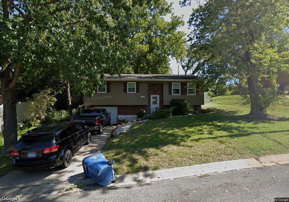
1120 Olive St Collinsville, IL 62234
Estimated Value: $186,516 - $205,000
3
Beds
3
Baths
1,037
Sq Ft
$188/Sq Ft
Est. Value
About This Home
This home is located at 1120 Olive St, Collinsville, IL 62234 and is currently estimated at $194,629, approximately $187 per square foot. 1120 Olive St is a home located in Madison County with nearby schools including John A Renfro Elementary School, Dorris Intermediate School, and Collinsville Middle School.
Ownership History
Date
Name
Owned For
Owner Type
Purchase Details
Closed on
Oct 31, 2008
Sold by
Harris Wesley N and Harris Mary E
Bought by
Border William T
Current Estimated Value
Home Financials for this Owner
Home Financials are based on the most recent Mortgage that was taken out on this home.
Original Mortgage
$118,795
Outstanding Balance
$78,018
Interest Rate
6.09%
Mortgage Type
VA
Estimated Equity
$116,611
Create a Home Valuation Report for This Property
The Home Valuation Report is an in-depth analysis detailing your home's value as well as a comparison with similar homes in the area
Home Values in the Area
Average Home Value in this Area
Purchase History
| Date | Buyer | Sale Price | Title Company |
|---|---|---|---|
| Border William T | $115,000 | Community Title Shiloh Llc |
Source: Public Records
Mortgage History
| Date | Status | Borrower | Loan Amount |
|---|---|---|---|
| Open | Border William T | $118,795 |
Source: Public Records
Tax History Compared to Growth
Tax History
| Year | Tax Paid | Tax Assessment Tax Assessment Total Assessment is a certain percentage of the fair market value that is determined by local assessors to be the total taxable value of land and additions on the property. | Land | Improvement |
|---|---|---|---|---|
| 2024 | $2,948 | $52,110 | $4,780 | $47,330 |
| 2023 | $2,948 | $48,230 | $4,420 | $43,810 |
| 2022 | $2,779 | $43,010 | $3,960 | $39,050 |
| 2021 | $2,377 | $40,410 | $3,720 | $36,690 |
| 2020 | $2,273 | $38,560 | $3,550 | $35,010 |
| 2019 | $2,198 | $37,240 | $3,430 | $33,810 |
| 2018 | $2,627 | $42,050 | $3,570 | $38,480 |
| 2017 | $2,622 | $41,210 | $3,500 | $37,710 |
| 2016 | $2,752 | $41,210 | $3,500 | $37,710 |
| 2015 | $2,555 | $40,140 | $3,410 | $36,730 |
| 2014 | $2,555 | $40,140 | $3,410 | $36,730 |
| 2013 | $2,555 | $40,140 | $3,410 | $36,730 |
Source: Public Records
Map
Nearby Homes
- 892 Lester Ave
- 1227 Ridge Ave
- 706 Illinois Ave
- 501 Spring
- 919 Vine St
- 1002 California Ave
- 921 Prospect St
- 1210 Constance St
- 1120 Williams St
- 1322 Leland St
- 6430 Lebanon Rd
- 308 Brown Ave
- 238 Mill St
- 203 Greenfield Dr
- 300 Pine Lake Rd Unit 6
- 300 Pine Lake Rd Unit 7
- 102 Toni Ct
- 617 N Morrison Ave
- 404 E Church St
- 1224 Cedar Ridge Ct