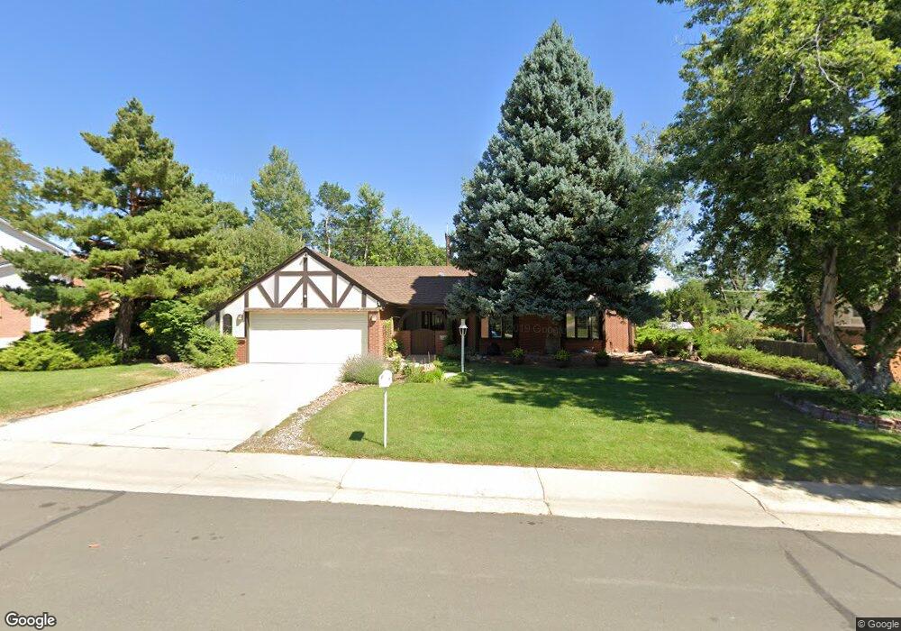
1120 Par Rd Broomfield, CO 80020
Broomfield Country Club NeighborhoodEstimated Value: $680,239 - $746,000
4
Beds
3
Baths
4,071
Sq Ft
$174/Sq Ft
Est. Value
About This Home
This home is located at 1120 Par Rd, Broomfield, CO 80020 and is currently estimated at $709,060, approximately $174 per square foot. 1120 Par Rd is a home located in Broomfield County with nearby schools including Birch Elementary School, Aspen Creek K-8 School, and Broomfield High School.
Ownership History
Date
Name
Owned For
Owner Type
Purchase Details
Closed on
Jan 20, 2016
Sold by
Smith Dale M and Smith Sandra L
Bought by
Smith Sandra L
Current Estimated Value
Home Financials for this Owner
Home Financials are based on the most recent Mortgage that was taken out on this home.
Original Mortgage
$652,500
Outstanding Balance
$513,444
Interest Rate
3.64%
Mortgage Type
Reverse Mortgage Home Equity Conversion Mortgage
Estimated Equity
$195,616
Purchase Details
Closed on
Mar 22, 2013
Sold by
Hill Dee Ann
Bought by
Smith Dale M and Smith Sandra L
Home Financials for this Owner
Home Financials are based on the most recent Mortgage that was taken out on this home.
Original Mortgage
$190,000
Interest Rate
3.59%
Mortgage Type
New Conventional
Purchase Details
Closed on
Apr 27, 2000
Purchase Details
Closed on
Mar 20, 1981
Create a Home Valuation Report for This Property
The Home Valuation Report is an in-depth analysis detailing your home's value as well as a comparison with similar homes in the area
Home Values in the Area
Average Home Value in this Area
Purchase History
| Date | Buyer | Sale Price | Title Company |
|---|---|---|---|
| Smith Sandra L | -- | Avalanche Title & Escrow Llc | |
| Smith Dale M | $320,000 | Heritage Title | |
| -- | $270,000 | -- | |
| -- | $118,000 | -- |
Source: Public Records
Mortgage History
| Date | Status | Borrower | Loan Amount |
|---|---|---|---|
| Open | Smith Sandra L | $652,500 | |
| Closed | Smith Dale M | $190,000 |
Source: Public Records
Tax History
| Year | Tax Paid | Tax Assessment Tax Assessment Total Assessment is a certain percentage of the fair market value that is determined by local assessors to be the total taxable value of land and additions on the property. | Land | Improvement |
|---|---|---|---|---|
| 2025 | $3,466 | $42,510 | $10,720 | $31,790 |
| 2024 | $3,466 | $43,690 | $9,890 | $33,800 |
| 2023 | $4,086 | $49,140 | $11,120 | $38,020 |
| 2022 | $3,288 | $34,010 | $7,820 | $26,190 |
| 2021 | $3,270 | $34,980 | $8,040 | $26,940 |
| 2020 | $2,997 | $31,860 | $7,510 | $24,350 |
| 2019 | $2,992 | $32,080 | $7,560 | $24,520 |
| 2018 | $2,770 | $29,350 | $7,450 | $21,900 |
| 2017 | $2,728 | $32,460 | $8,240 | $24,220 |
| 2016 | $2,647 | $28,070 | $8,240 | $19,830 |
| 2015 | $2,556 | $28,230 | $8,240 | $19,990 |
| 2014 | $2,627 | $28,230 | $8,240 | $19,990 |
Source: Public Records
Map
Nearby Homes
- 286 E 12th Ave
- 951 E 10th Ave
- 1118 Oakhurst Dr
- 1123 Oakhurst Dr
- 1296 Aspen St
- 1221 Dexter St
- 1110 E 9th Ave
- 1 Amesbury St
- 1150 E 9th Ave
- 37 E 14th Place
- 1598 Aspen St
- 114 E 14th Ct
- 12565 Sheridan Blvd Unit 116
- 12565 Sheridan Blvd Unit 115
- 12565 Sheridan Blvd Unit 308
- 1356 Dexter St
- 1500 Abilene Dr
- 1370 Daphne St
- 1732 Peregrine Ln
- 1736 Cottonwood St
Your Personal Tour Guide
Ask me questions while you tour the home.