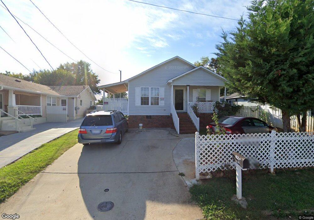
1120 Richland St High Point, NC 27260
Greater High Point NeighborhoodEstimated Value: $141,000 - $177,000
3
Beds
2
Baths
1,185
Sq Ft
$138/Sq Ft
Est. Value
About This Home
This home is located at 1120 Richland St, High Point, NC 27260 and is currently estimated at $163,000, approximately $137 per square foot. 1120 Richland St is a home located in Guilford County with nearby schools including Fairview Elementary School, Ferndale Middle School, and High Point Central High School.
Ownership History
Date
Name
Owned For
Owner Type
Purchase Details
Closed on
Nov 6, 2003
Sold by
Glover Richard R
Bought by
Farooq Mohammad and Akhtar Shaheen
Current Estimated Value
Home Financials for this Owner
Home Financials are based on the most recent Mortgage that was taken out on this home.
Original Mortgage
$62,026
Outstanding Balance
$28,255
Interest Rate
5.75%
Mortgage Type
FHA
Estimated Equity
$134,745
Create a Home Valuation Report for This Property
The Home Valuation Report is an in-depth analysis detailing your home's value as well as a comparison with similar homes in the area
Home Values in the Area
Average Home Value in this Area
Purchase History
| Date | Buyer | Sale Price | Title Company |
|---|---|---|---|
| Farooq Mohammad | $63,000 | -- |
Source: Public Records
Mortgage History
| Date | Status | Borrower | Loan Amount |
|---|---|---|---|
| Open | Farooq Mohammad | $62,026 |
Source: Public Records
Tax History
| Year | Tax Paid | Tax Assessment Tax Assessment Total Assessment is a certain percentage of the fair market value that is determined by local assessors to be the total taxable value of land and additions on the property. | Land | Improvement |
|---|---|---|---|---|
| 2025 | $1,084 | $78,700 | $10,000 | $68,700 |
| 2024 | $1,084 | $78,700 | $10,000 | $68,700 |
| 2023 | $1,084 | $78,700 | $10,000 | $68,700 |
| 2022 | $1,061 | $78,700 | $10,000 | $68,700 |
| 2021 | $991 | $71,900 | $6,000 | $65,900 |
| 2020 | $991 | $71,900 | $6,000 | $65,900 |
| 2019 | $991 | $71,900 | $0 | $0 |
| 2018 | $986 | $71,900 | $0 | $0 |
| 2017 | $991 | $71,900 | $0 | $0 |
| 2016 | $1,094 | $78,000 | $0 | $0 |
| 2015 | $1,100 | $78,000 | $0 | $0 |
| 2014 | $1,119 | $78,000 | $0 | $0 |
Source: Public Records
Map
Nearby Homes
- 1010 Grace St
- 1103 Jefferson St
- 1021 Asheboro St
- 1012 Jefferson St
- 925 Randolph St
- 909 Randolph St
- 1015 Sharon St
- 705 Wise Ave
- 335 Nathan Hunt Dr
- 702 Park St
- 507 E Grimes Ave
- 650 Wesley Dr
- 812 E Russell Ave
- 1309 Pershing St
- 640 Wesley Dr
- 1504 Cloverdale St
- 1217 Cloverdale St
- 809 E Green Dr
- 4304 Griffins Gate Ln
- 526 White Oak St
- 1122 Richland St
- 1118 Richland St
- 1116 Richland St
- 1124 Richland St
- 1126 Richland St
- 1119 Richland St
- 1112 Richland St
- 1117 Richland St
- 807 E Kearns Ave
- 1115 Richland St
- 1113 Richland St
- 1111 Richland St
- 1116 Grace St
- 1118 Grace St
- 1114 Grace St
- 1120 Grace St
- 1109 Richland St
- 1106 Richland St
- 810 E Kearns Ave
- 1122 Grace St
Your Personal Tour Guide
Ask me questions while you tour the home.