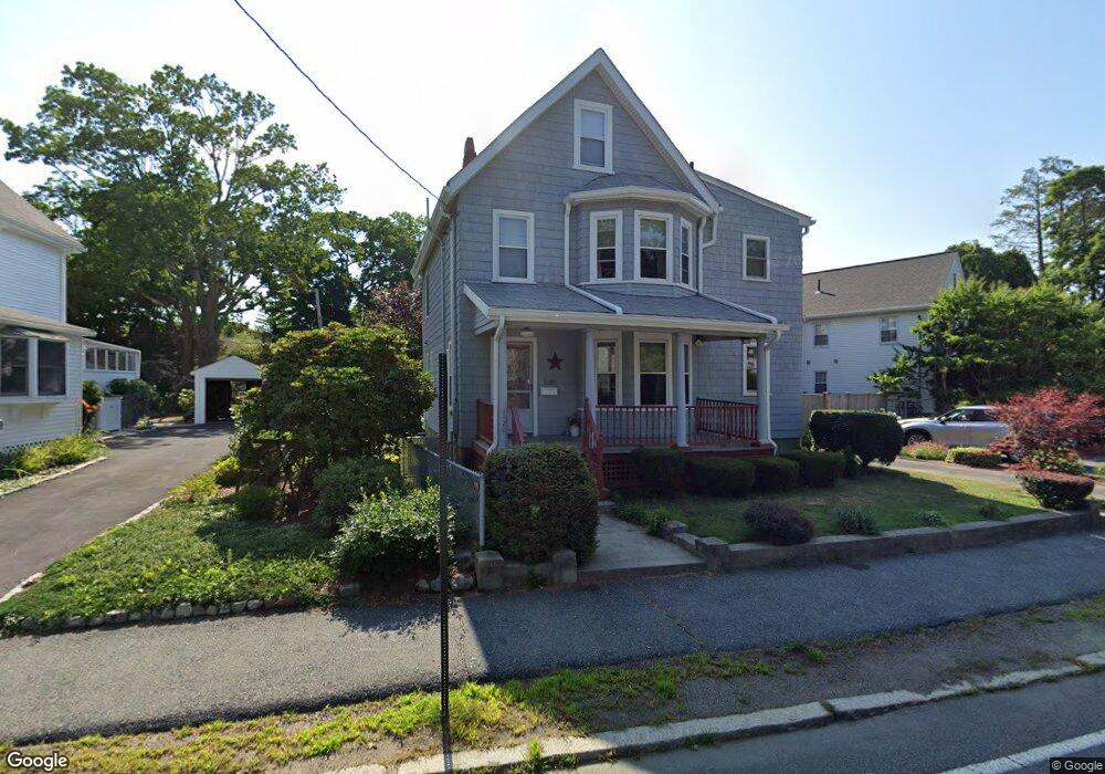
1120 Walnut St Newton Highlands, MA 02461
Newton Highlands NeighborhoodEstimated Value: $1,476,000 - $1,759,000
3
Beds
3
Baths
2,134
Sq Ft
$754/Sq Ft
Est. Value
About This Home
This home is located at 1120 Walnut St, Newton Highlands, MA 02461 and is currently estimated at $1,608,503, approximately $753 per square foot. 1120 Walnut St is a home located in Middlesex County with nearby schools including Mason Rice Elementary School, Charles E Brown Middle School, and Newton South High School.
Ownership History
Date
Name
Owned For
Owner Type
Purchase Details
Closed on
Apr 1, 2009
Sold by
1120 Walnut Street Ret and Tuson Elaine M
Bought by
Tuson Tr Joseph C and Tuson Elaine M
Current Estimated Value
Purchase Details
Closed on
Jul 26, 2004
Sold by
Tuson Elaine M and Tuson Joseph C
Bought by
1120 Walnut St Ret and Tuson Elaine M
Purchase Details
Closed on
Sep 2, 2003
Sold by
Zeolla Josephine C
Bought by
Tuson Elaine M and Tuson Joseph C
Create a Home Valuation Report for This Property
The Home Valuation Report is an in-depth analysis detailing your home's value as well as a comparison with similar homes in the area
Home Values in the Area
Average Home Value in this Area
Purchase History
| Date | Buyer | Sale Price | Title Company |
|---|---|---|---|
| Tuson Tr Joseph C | -- | -- | |
| 1120 Walnut St Ret | -- | -- | |
| Tuson Elaine M | -- | -- |
Source: Public Records
Tax History Compared to Growth
Tax History
| Year | Tax Paid | Tax Assessment Tax Assessment Total Assessment is a certain percentage of the fair market value that is determined by local assessors to be the total taxable value of land and additions on the property. | Land | Improvement |
|---|---|---|---|---|
| 2025 | $10,222 | $1,043,100 | $827,100 | $216,000 |
| 2024 | $9,833 | $1,007,500 | $803,000 | $204,500 |
| 2023 | $9,245 | $908,200 | $605,900 | $302,300 |
| 2022 | $8,846 | $840,900 | $561,000 | $279,900 |
| 2021 | $8,536 | $793,300 | $529,200 | $264,100 |
| 2020 | $8,282 | $793,300 | $529,200 | $264,100 |
| 2019 | $8,049 | $770,200 | $513,800 | $256,400 |
| 2018 | $7,646 | $706,700 | $464,300 | $242,400 |
| 2017 | $7,414 | $666,700 | $438,000 | $228,700 |
| 2016 | $7,004 | $615,500 | $409,300 | $206,200 |
| 2015 | $6,678 | $575,200 | $382,500 | $192,700 |
Source: Public Records
Map
Nearby Homes
- 1151 Walnut St Unit 205
- 1151 Walnut St Unit 405
- 1151 Walnut St Unit 207
- 2 Raeburn Terrace
- 1623-1625 Centre St
- 1629 Centre St
- 1597 Centre St Unit 1597
- 1597 Centre St
- 3 Glenmore Terrace Unit 2
- 956 Walnut St Unit 4
- 956 Walnut St Unit 7
- 956 Walnut St Unit 6
- 35 Kingston Rd
- 1292 Walnut St
- 200 Lincoln St
- 56 Cloverdale Rd
- 28 Wilson Cir Unit 28
- 32 Wilson Cir Unit 32
- 1308 Walnut St
- 26 Wilson Cir Unit 26
- 1130 Walnut St Unit 2
- 1130 Walnut St Unit 1
- 1130 Walnut St Unit 1130
- 1130 Walnut St
- 1116 Walnut St
- 341 Lake Ave Unit 343
- 341 Lake Ave Unit 1
- 335 Lake Ave
- 1136 Walnut St Unit 1138
- 1136 Walnut St Unit 1
- 1136-1138 Walnut St
- 1110 Walnut St
- 1129 Walnut St
- 331 Lake Ave Unit 333
- 5 Forest St
- 5 Forest St
- 5 Forest St Unit 2
- 5 Forest St Unit 1
- 5 Forest St Unit 5
- 3 Forest St Unit 3