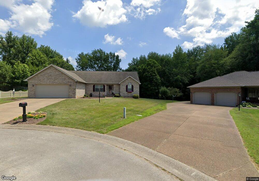
11201 Farm Way Rd Evansville, IN 47712
Estimated Value: $279,000 - $351,000
3
Beds
2
Baths
1,834
Sq Ft
$174/Sq Ft
Est. Value
About This Home
This home is located at 11201 Farm Way Rd, Evansville, IN 47712 and is currently estimated at $318,638, approximately $173 per square foot. 11201 Farm Way Rd is a home located in Posey County with nearby schools including Mount Vernon Junior High School and Mount Vernon High School.
Ownership History
Date
Name
Owned For
Owner Type
Purchase Details
Closed on
Nov 5, 2019
Sold by
Peerman Kenneth and Peerman Doris J
Bought by
Peerman Doris J
Current Estimated Value
Create a Home Valuation Report for This Property
The Home Valuation Report is an in-depth analysis detailing your home's value as well as a comparison with similar homes in the area
Home Values in the Area
Average Home Value in this Area
Purchase History
| Date | Buyer | Sale Price | Title Company |
|---|---|---|---|
| Peerman Doris J | -- | None Available |
Source: Public Records
Tax History Compared to Growth
Tax History
| Year | Tax Paid | Tax Assessment Tax Assessment Total Assessment is a certain percentage of the fair market value that is determined by local assessors to be the total taxable value of land and additions on the property. | Land | Improvement |
|---|---|---|---|---|
| 2024 | $2,189 | $263,400 | $39,900 | $223,500 |
| 2023 | $1,664 | $214,800 | $37,000 | $177,800 |
| 2022 | $2,077 | $252,500 | $33,700 | $218,800 |
| 2021 | $1,684 | $209,500 | $33,700 | $175,800 |
| 2020 | $1,647 | $203,100 | $33,100 | $170,000 |
| 2019 | $1,634 | $203,300 | $38,800 | $164,500 |
| 2018 | $1,525 | $196,400 | $38,800 | $157,600 |
| 2017 | $1,408 | $193,200 | $38,800 | $154,400 |
| 2016 | $1,303 | $188,200 | $38,800 | $149,400 |
| 2014 | $1,249 | $188,100 | $40,800 | $147,300 |
| 2013 | $1,249 | $191,300 | $40,800 | $150,500 |
Source: Public Records
Map
Nearby Homes
- 6855 Lakeside Ln
- 0 Fox Ridge Rd
- 11314 Vixen Dr
- 10311 Eastgate Dr S
- 10900 Woodside Dr S
- 5225 Star Dr
- 2734 Marycrest Dr
- 2646 Marycrest Dr
- Little Rock Craftsman Plan at Westridge Commons
- Revolution Craftsman Plan at Westridge Commons
- Revolution Farmhouse Plan at Westridge Commons
- Walnut Craftsman Plan at Westridge Commons
- Patriot Modern Plan at Westridge Commons
- National Farmhouse Plan at Westridge Commons
- Cumberland Farmhouse 3-Car Plan at Westridge Commons
- National Modern Plan at Westridge Commons
- National Craftsman Plan at Westridge Commons
- Cumberland Modern 3-Car Plan at Westridge Commons
- Patriot Farmhouse Plan at Westridge Commons
- Cumberland Craftsman 3-Car Plan at Westridge Commons
- 11161 Farm Way Rd
- 6560 Highfield Rd
- 11141 Farm Way Rd
- 11140 Farm Way Rd
- 6541 Highfield Rd
- 11121 Farm Way Rd
- 6540 Highfield Rd
- 6520 Highfield Rd
- 6521 Highfield Rd
- 11101 Farm Way Rd
- 11200 Forest Edge Rd
- 11160 Forest Edge Rd
- 6500 Highfield Rd
- 11140 Forest Edge Rd
- 6501 Highfield Rd
- 11100 Farm Way Rd
- 6550 Orchard Way Rd
- 11061 Farm Way Rd
- 11120 Forest Edge Rd
- 6550 Orchard Way