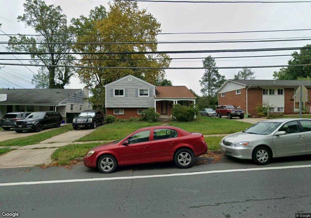
11204 Newport Mill Rd Kensington, MD 20895
North Kensington NeighborhoodEstimated Value: $611,767 - $647,000
--
Bed
3
Baths
1,673
Sq Ft
$376/Sq Ft
Est. Value
About This Home
This home is located at 11204 Newport Mill Rd, Kensington, MD 20895 and is currently estimated at $629,442, approximately $376 per square foot. 11204 Newport Mill Rd is a home located in Montgomery County with nearby schools including Rock View Elementary School, Newport Mill Middle School, and Albert Einstein High School.
Ownership History
Date
Name
Owned For
Owner Type
Purchase Details
Closed on
Sep 27, 2021
Sold by
Huynh Dia V
Bought by
Huynh Dia V and Nguyen Oanh Thuy
Current Estimated Value
Home Financials for this Owner
Home Financials are based on the most recent Mortgage that was taken out on this home.
Original Mortgage
$318,000
Outstanding Balance
$289,986
Interest Rate
2.8%
Mortgage Type
New Conventional
Estimated Equity
$339,456
Purchase Details
Closed on
Apr 27, 1999
Sold by
Aleksandar N N and Aleksandar Ivanovich C
Bought by
Dia V Huynh
Create a Home Valuation Report for This Property
The Home Valuation Report is an in-depth analysis detailing your home's value as well as a comparison with similar homes in the area
Home Values in the Area
Average Home Value in this Area
Purchase History
| Date | Buyer | Sale Price | Title Company |
|---|---|---|---|
| Huynh Dia V | -- | Accommodation | |
| Dia V Huynh | $165,000 | -- |
Source: Public Records
Mortgage History
| Date | Status | Borrower | Loan Amount |
|---|---|---|---|
| Open | Huynh Dia V | $318,000 |
Source: Public Records
Tax History Compared to Growth
Tax History
| Year | Tax Paid | Tax Assessment Tax Assessment Total Assessment is a certain percentage of the fair market value that is determined by local assessors to be the total taxable value of land and additions on the property. | Land | Improvement |
|---|---|---|---|---|
| 2025 | $5,827 | $454,200 | -- | -- |
| 2024 | $5,827 | $442,700 | $218,800 | $223,900 |
| 2023 | $6,215 | $418,367 | $0 | $0 |
| 2022 | $4,310 | $394,033 | $0 | $0 |
| 2021 | $3,884 | $369,700 | $217,400 | $152,300 |
| 2020 | $3,884 | $364,567 | $0 | $0 |
| 2019 | $3,792 | $359,433 | $0 | $0 |
| 2018 | $3,711 | $354,300 | $217,400 | $136,900 |
| 2017 | $3,771 | $354,300 | $0 | $0 |
| 2016 | -- | $354,300 | $0 | $0 |
| 2015 | $3,480 | $357,500 | $0 | $0 |
| 2014 | $3,480 | $354,400 | $0 | $0 |
Source: Public Records
Map
Nearby Homes
- 3607 Sandy Ct
- 11403 Mapleview Dr
- 11409 Mapleview Dr
- 11006 Madison St
- 3708 Woodridge Ave
- 11310 Norris Dr
- 3419 University Blvd W Unit 102
- 3355 University Blvd W Unit 206
- 3333 University Blvd W Unit 606
- 3333 University Blvd W Unit 1101
- 3225 University Blvd W Unit 22
- 11515 Lund Place
- 3611 Lowell Place
- 3511 Decatur Ave
- 11410 Cam Ct
- 11411 Cam Ct
- 11211 Valley View Ave
- 11605 Gail St
- 3914 Kincaid Terrace
- 2849 Schoolhouse Cir
- 11202 Newport Mill Rd
- 11206 Newport Mill Rd
- 0 Newport Mill Rd
- 3500 Sandy Ct
- 11208 Newport Mill Rd
- 3503 Astoria Rd
- 3501 Sandy Ct
- 3501 Astoria Rd
- 3505 Astoria Rd
- 3502 Sandy Ct
- 11210 Newport Mill Rd
- 3509 Astoria Rd
- 3503 Sandy Ct
- 3504 Sandy Ct
- 11212 Newport Mill Rd
- 3601 Astoria Rd
- 11223 Newport Mill Rd
- 3505 Sandy Ct
- 3506 Sandy Ct
- 3500 Astoria Rd