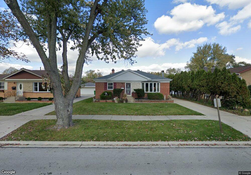
11208 Charles St Westchester, IL 60154
Estimated Value: $351,000 - $401,000
3
Beds
2
Baths
1,416
Sq Ft
$266/Sq Ft
Est. Value
About This Home
This home is located at 11208 Charles St, Westchester, IL 60154 and is currently estimated at $376,798, approximately $266 per square foot. 11208 Charles St is a home located in Cook County with nearby schools including Westchester Primary School, Westchester Intermediate School, and Westchester Middle School.
Ownership History
Date
Name
Owned For
Owner Type
Purchase Details
Closed on
Apr 5, 2000
Sold by
Lasalle Bank National Assn
Bought by
Reynolds Hubert and Reynolds Sandra
Current Estimated Value
Home Financials for this Owner
Home Financials are based on the most recent Mortgage that was taken out on this home.
Original Mortgage
$203,000
Outstanding Balance
$69,847
Interest Rate
8.29%
Mortgage Type
VA
Estimated Equity
$306,951
Create a Home Valuation Report for This Property
The Home Valuation Report is an in-depth analysis detailing your home's value as well as a comparison with similar homes in the area
Home Values in the Area
Average Home Value in this Area
Purchase History
| Date | Buyer | Sale Price | Title Company |
|---|---|---|---|
| Reynolds Hubert | -- | -- |
Source: Public Records
Mortgage History
| Date | Status | Borrower | Loan Amount |
|---|---|---|---|
| Open | Reynolds Hubert | $203,000 |
Source: Public Records
Tax History Compared to Growth
Tax History
| Year | Tax Paid | Tax Assessment Tax Assessment Total Assessment is a certain percentage of the fair market value that is determined by local assessors to be the total taxable value of land and additions on the property. | Land | Improvement |
|---|---|---|---|---|
| 2024 | $6,045 | $29,000 | $4,480 | $24,520 |
| 2023 | $5,636 | $29,000 | $4,480 | $24,520 |
| 2022 | $5,636 | $24,630 | $3,840 | $20,790 |
| 2021 | $5,503 | $24,630 | $3,840 | $20,790 |
| 2020 | $5,495 | $24,630 | $3,840 | $20,790 |
| 2019 | $5,540 | $25,785 | $3,520 | $22,265 |
| 2018 | $5,465 | $25,785 | $3,520 | $22,265 |
| 2017 | $5,390 | $25,785 | $3,520 | $22,265 |
| 2016 | $5,017 | $21,483 | $3,200 | $18,283 |
| 2015 | $4,890 | $21,483 | $3,200 | $18,283 |
| 2014 | $4,804 | $21,483 | $3,200 | $18,283 |
| 2013 | $4,512 | $22,455 | $3,200 | $19,255 |
Source: Public Records
Map
Nearby Homes
- 1905 S Wolf Rd Unit 302
- 1847 Boeger Ave
- 11157 Shaw St
- 1948 Boeger Ave
- 2130 Mandel Ave
- 1413 Highridge Pkwy
- 1327 S Wolf Rd
- 1326 Heidorn Ave
- 2300 Boeger Ave
- 1811 Downing Ave
- 1242 Heidorn Ave
- 2205 Mayfair Ave
- 1860 Buckingham Ave
- 11140 Windsor Dr
- 10630 W Cermak Rd Unit 2E
- 10567 Waterford Dr
- 2337 Kensington Ave
- 2401 Mayfair Ave
- 11449 Prescott Ln
- 10531 Camelot St
- 11212 Charles St
- 11204 Charles St
- 1648 Boeger Ave
- 1653 Heidorn Ave
- 1657 Heidorn Ave
- 1644 Boeger Ave
- 1649 Heidorn Ave
- 11209 Charles St
- 1640 Boeger Ave
- 11213 Charles St
- 11205 Charles St
- 1645 Heidorn Ave
- 11134 Highridge Ave
- 1806 Boeger Ave
- 11217 Charles St
- 1645 Boeger Ave
- 1641 Heidorn Ave
- 11221 Charles St
- 1636 Boeger Ave
- 1805 Boeger Ave