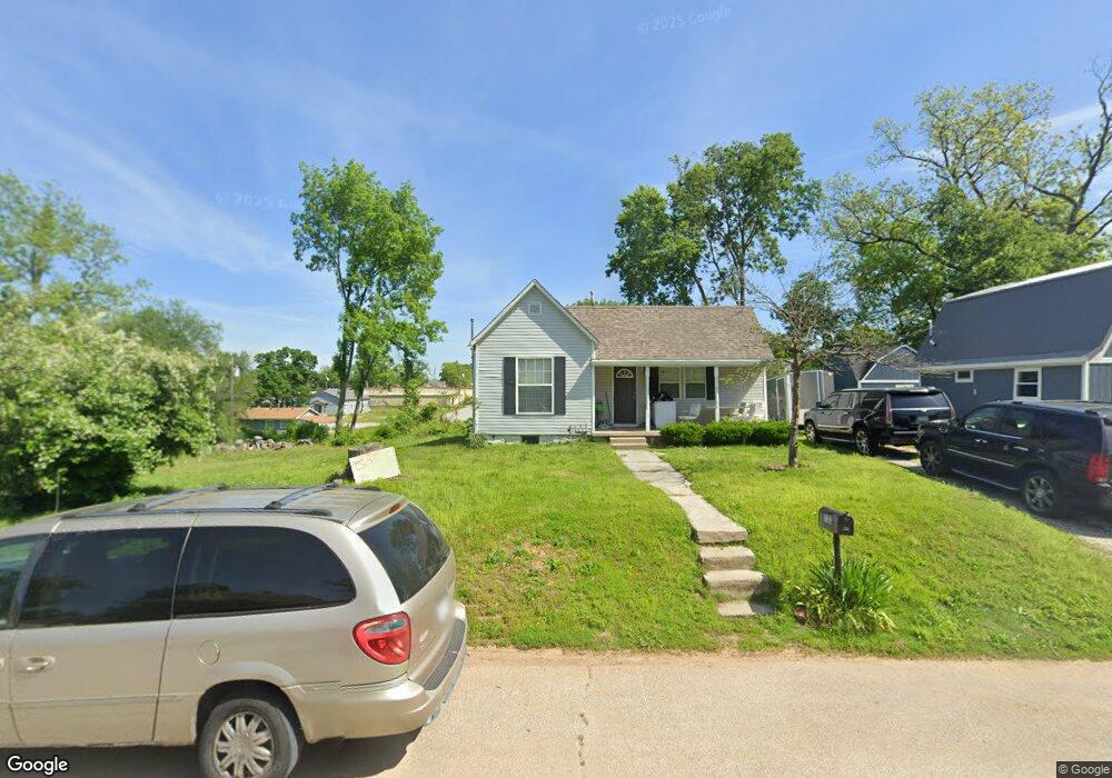
1121 Grove St Carthage, MO 64836
Estimated Value: $105,000 - $121,000
2
Beds
1
Bath
732
Sq Ft
$153/Sq Ft
Est. Value
About This Home
This home is located at 1121 Grove St, Carthage, MO 64836 and is currently estimated at $112,272, approximately $153 per square foot. 1121 Grove St is a home located in Jasper County with nearby schools including Carthage High School, Victory Academy, and St. Ann's Catholic School.
Ownership History
Date
Name
Owned For
Owner Type
Purchase Details
Closed on
Apr 19, 2018
Bought by
Felix Enrique A
Current Estimated Value
Home Financials for this Owner
Home Financials are based on the most recent Mortgage that was taken out on this home.
Original Mortgage
$53,856
Outstanding Balance
$46,248
Interest Rate
4.47%
Estimated Equity
$66,024
Purchase Details
Closed on
Apr 20, 2007
Sold by
White Angela C and White Dorian Keith
Bought by
Kennedy Rick J
Home Financials for this Owner
Home Financials are based on the most recent Mortgage that was taken out on this home.
Original Mortgage
$40,400
Interest Rate
6.15%
Mortgage Type
Purchase Money Mortgage
Create a Home Valuation Report for This Property
The Home Valuation Report is an in-depth analysis detailing your home's value as well as a comparison with similar homes in the area
Home Values in the Area
Average Home Value in this Area
Purchase History
| Date | Buyer | Sale Price | Title Company |
|---|---|---|---|
| Felix Enrique A | -- | -- | |
| Kennedy Rick J | -- | Abbey |
Source: Public Records
Mortgage History
| Date | Status | Borrower | Loan Amount |
|---|---|---|---|
| Open | Felix Enrique A | $53,856 | |
| Closed | Felix Enrique A | -- | |
| Previous Owner | Kennedy Rick J | $40,400 |
Source: Public Records
Tax History
| Year | Tax Paid | Tax Assessment Tax Assessment Total Assessment is a certain percentage of the fair market value that is determined by local assessors to be the total taxable value of land and additions on the property. | Land | Improvement |
|---|---|---|---|---|
| 2025 | $536 | $11,620 | $2,200 | $9,420 |
| 2024 | $536 | $10,410 | $2,200 | $8,210 |
| 2023 | $536 | $10,410 | $2,200 | $8,210 |
| 2022 | $524 | $10,210 | $2,200 | $8,010 |
| 2021 | $518 | $10,210 | $2,200 | $8,010 |
| 2020 | $503 | $9,500 | $2,200 | $7,300 |
| 2019 | $504 | $9,500 | $2,200 | $7,300 |
| 2018 | $460 | $8,690 | $0 | $0 |
| 2017 | $461 | $8,690 | $0 | $0 |
| 2016 | $459 | $8,690 | $0 | $0 |
Source: Public Records
Map
Nearby Homes
- 1101 Oak St
- 1018 Olive St
- 1324 W Central Ave
- 827 W Chestnut St
- 802 Oak St
- 431 S Orner St
- 703 W Central Tract 2
- 514 Poplar St
- 1107 Ash St
- 1143 S Case St
- 1206 Douglas Ct
- 516 Wooster St
- 510 Miller St
- 714 Pine St
- 1135 S Maple St
- 1112 S Garrison Ave
- 903 S Main St
- 1500 Robertson Ave
- 831 Rombauer Ave
- 1131 Lyon St
Your Personal Tour Guide
Ask me questions while you tour the home.