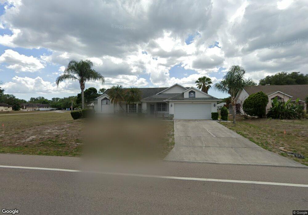
1121 Sheehan Blvd Port Charlotte, FL 33952
Estimated Value: $291,000 - $397,000
3
Beds
2
Baths
1,694
Sq Ft
$201/Sq Ft
Est. Value
About This Home
This home is located at 1121 Sheehan Blvd, Port Charlotte, FL 33952 and is currently estimated at $340,658, approximately $201 per square foot. 1121 Sheehan Blvd is a home located in Charlotte County with nearby schools including Neil Armstrong Elementary School, Port Charlotte Middle School, and Port Charlotte High School.
Ownership History
Date
Name
Owned For
Owner Type
Purchase Details
Closed on
Apr 25, 2008
Sold by
Sesterhenn Irene E
Bought by
Bell Stephen C and Bell Susan E
Current Estimated Value
Purchase Details
Closed on
Apr 11, 1995
Sold by
Patrick Theodore A and Patrick Deborah A
Bought by
Marslender Daniel and Marslender Janice
Home Financials for this Owner
Home Financials are based on the most recent Mortgage that was taken out on this home.
Original Mortgage
$80,000
Interest Rate
8.35%
Create a Home Valuation Report for This Property
The Home Valuation Report is an in-depth analysis detailing your home's value as well as a comparison with similar homes in the area
Home Values in the Area
Average Home Value in this Area
Purchase History
| Date | Buyer | Sale Price | Title Company |
|---|---|---|---|
| Bell Stephen C | $218,000 | Attorney | |
| Marslender Daniel | $86,500 | -- |
Source: Public Records
Mortgage History
| Date | Status | Borrower | Loan Amount |
|---|---|---|---|
| Previous Owner | Marslender Daniel | $80,000 |
Source: Public Records
Tax History Compared to Growth
Tax History
| Year | Tax Paid | Tax Assessment Tax Assessment Total Assessment is a certain percentage of the fair market value that is determined by local assessors to be the total taxable value of land and additions on the property. | Land | Improvement |
|---|---|---|---|---|
| 2023 | $5,252 | $223,237 | $0 | $0 |
| 2022 | $4,680 | $277,962 | $28,050 | $249,912 |
| 2021 | $3,639 | $189,428 | $5,950 | $183,478 |
| 2020 | $3,391 | $177,111 | $5,100 | $172,011 |
| 2019 | $3,194 | $172,634 | $4,675 | $167,959 |
| 2018 | $2,841 | $166,035 | $4,250 | $161,785 |
| 2017 | $2,625 | $144,992 | $3,903 | $141,089 |
| 2016 | $2,482 | $106,640 | $0 | $0 |
| 2015 | $2,241 | $96,945 | $0 | $0 |
| 2014 | $2,017 | $88,132 | $0 | $0 |
Source: Public Records
Map
Nearby Homes
- 1130 Strasburg Dr
- 1049 Marcus St
- 1065 Marcus St
- 1209 Alton Rd
- 1091 Cazenovia St
- 1041 Strasburg Dr
- 1224 Alton Rd
- 1057 Presque Isle Dr
- 1117 Marcus St
- 522 Bounds St
- 22484 Bradford Ave
- 22342 Bradford Ave
- 1041 Bounds St
- 1141 Cazenovia St
- 22190 Esplanade Ave
- 1026 Presque Isle Dr
- 530 Bounds St
- 1234 Tift St
- 563 Presque Isle Dr
- 22270 Esplanade Ave
- 1113 Sheehan Blvd
- 1134 Alton Rd
- 22210 Hallstead Ave
- 1106 Alton Rd
- 1114 Sheehan Blvd
- 1097 Sheehan Blvd
- 1098 Alton Rd
- 22193 Hallstead Ave
- 1100 Sheehan Blvd
- 1150 Alton Rd
- 1150 Sheehan Blvd
- 1129 Alton Rd
- 1121 Alton Rd
- 1137 Alton Rd
- 1113 Alton Rd
- 1105 Marcus St
- 1089 Sheehan Blvd
- 1105 Alton Rd
- 22217 Hallstead Ave
- 1160 Alton Rd