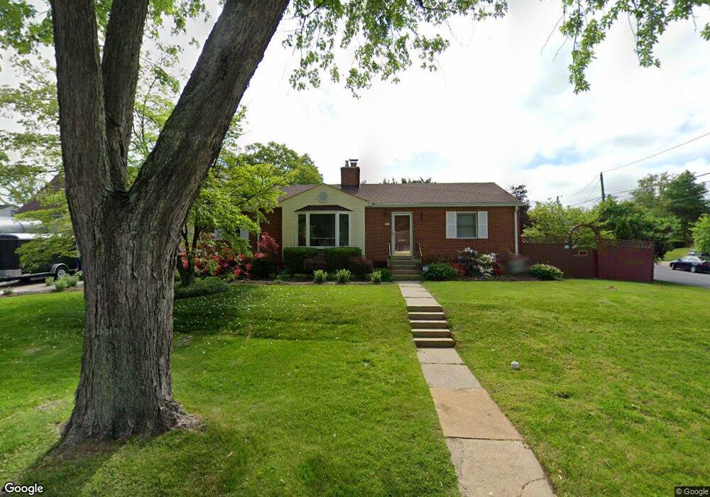
1121 W Nolcrest Dr Silver Spring, MD 20903
Estimated Value: $564,000 - $606,160
Studio
3
Baths
1,297
Sq Ft
$454/Sq Ft
Est. Value
About This Home
This home is located at 1121 W Nolcrest Dr, Silver Spring, MD 20903 and is currently estimated at $588,790, approximately $453 per square foot. 1121 W Nolcrest Dr is a home located in Montgomery County with nearby schools including Roscoe R. Nix Elementary School, Cresthaven Elementary School, and Francis Scott Key Middle School.
Ownership History
Date
Name
Owned For
Owner Type
Purchase Details
Closed on
May 15, 2023
Sold by
Laigle Pascal
Bought by
Pascal Laigle Revocable Trust and Sheri Laigle Revocable Trust
Current Estimated Value
Purchase Details
Closed on
Jun 1, 2005
Sold by
Laigle Pascal
Bought by
Laigle Pascal and Laigle Sheri
Purchase Details
Closed on
Jul 15, 2002
Sold by
Kramer Leslie B and Kramer K M
Bought by
Laigle Pascal
Create a Home Valuation Report for This Property
The Home Valuation Report is an in-depth analysis detailing your home's value as well as a comparison with similar homes in the area
Home Values in the Area
Average Home Value in this Area
Purchase History
| Date | Buyer | Sale Price | Title Company |
|---|---|---|---|
| Pascal Laigle Revocable Trust | -- | None Listed On Document | |
| Laigle Pascal | -- | -- | |
| Laigle Pascal | -- | -- | |
| Laigle Pascal | $252,500 | -- |
Source: Public Records
Tax History
| Year | Tax Paid | Tax Assessment Tax Assessment Total Assessment is a certain percentage of the fair market value that is determined by local assessors to be the total taxable value of land and additions on the property. | Land | Improvement |
|---|---|---|---|---|
| 2025 | $5,934 | $461,333 | -- | -- |
| 2024 | $5,934 | $451,967 | $0 | $0 |
| 2023 | $6,495 | $442,600 | $219,400 | $223,200 |
| 2022 | $4,567 | $417,400 | $0 | $0 |
| 2021 | $3,911 | $392,200 | $0 | $0 |
| 2020 | $3,911 | $367,000 | $219,400 | $147,600 |
| 2019 | $3,858 | $365,400 | $0 | $0 |
| 2018 | $3,816 | $363,800 | $0 | $0 |
| 2017 | $3,860 | $362,200 | $0 | $0 |
| 2016 | $3,721 | $334,767 | $0 | $0 |
| 2015 | $3,721 | $307,333 | $0 | $0 |
| 2014 | $3,721 | $279,900 | $0 | $0 |
Source: Public Records
Map
Nearby Homes
- 10708 Woodsdale Dr
- 11158 Oak Leaf Dr
- 10611 Meadowhill Rd
- 1600 Oaklawn Ct
- 11323 Baritone Ct
- 413 Southwest Dr
- 405 Southwest Dr
- 11348 Baroque Rd
- 1605 Regent Manor Ct
- 1912 Kimberly Rd
- 413 Williamsburg Dr
- 314 Crescendo Way
- 644 Symphony Woods Dr
- 10832 Margate Rd
- 1018 Heartfields Dr
- 10018 Brookmoor Dr
- 1641 Carriage House Terrace Unit F
- 9801 Arbor Hill Dr
- 1216 Kathryn Rd
- 10304 Ridgemoor Dr
- 10811 Blossom Ln
- 1123 W Nolcrest Dr
- 10809 Blossom Ln
- 10810 Blossom Ln
- 1124 W Nolcrest Dr
- 1126 W Nolcrest Dr
- 1122 W Nolcrest Dr
- 10810 E Nolcrest Dr
- 10812 E Nolcrest Dr
- 10808 Blossom Ln
- 1128 W Nolcrest Dr
- 10808 E Nolcrest Dr
- 10807 Blossom Ln
- 1120 W Nolcrest Dr
- 1115 W Nolcrest Dr
- 10806 E Nolcrest Dr
- 1118 W Nolcrest Dr
- 1130 W Nolcrest Dr
- 10806 Blossom Ln
- 10805 Blossom Ln
Your Personal Tour Guide
Ask me questions while you tour the home.