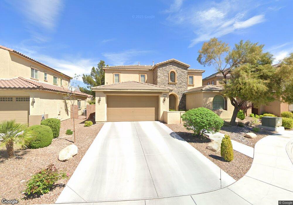
11210 Applevale Ct Las Vegas, NV 89138
Estimated Value: $747,000 - $881,000
4
Beds
3
Baths
2,739
Sq Ft
$288/Sq Ft
Est. Value
About This Home
This home is located at 11210 Applevale Ct, Las Vegas, NV 89138 and is currently estimated at $788,564, approximately $287 per square foot. 11210 Applevale Ct is a home located in Clark County with nearby schools including Linda Rankin Givens Elementary School, Sig Rogich Middle School, and Palo Verde High School.
Ownership History
Date
Name
Owned For
Owner Type
Purchase Details
Closed on
Dec 30, 2008
Sold by
William Lyon Homes Inc
Bought by
Adams Wayne C and Adams Jocelyn B
Current Estimated Value
Home Financials for this Owner
Home Financials are based on the most recent Mortgage that was taken out on this home.
Original Mortgage
$402,800
Outstanding Balance
$265,932
Interest Rate
6.03%
Mortgage Type
Unknown
Estimated Equity
$522,632
Create a Home Valuation Report for This Property
The Home Valuation Report is an in-depth analysis detailing your home's value as well as a comparison with similar homes in the area
Home Values in the Area
Average Home Value in this Area
Purchase History
| Date | Buyer | Sale Price | Title Company |
|---|---|---|---|
| Adams Wayne C | $42,400 | Fidelity National Title Las |
Source: Public Records
Mortgage History
| Date | Status | Borrower | Loan Amount |
|---|---|---|---|
| Open | Adams Wayne C | $402,800 |
Source: Public Records
Tax History Compared to Growth
Tax History
| Year | Tax Paid | Tax Assessment Tax Assessment Total Assessment is a certain percentage of the fair market value that is determined by local assessors to be the total taxable value of land and additions on the property. | Land | Improvement |
|---|---|---|---|---|
| 2025 | $4,352 | $204,362 | $68,250 | $136,112 |
| 2024 | $4,226 | $204,362 | $68,250 | $136,112 |
| 2023 | $3,404 | $176,957 | $49,000 | $127,957 |
| 2022 | $4,103 | $157,402 | $40,950 | $116,452 |
| 2021 | $3,982 | $149,236 | $38,850 | $110,386 |
| 2020 | $3,863 | $146,338 | $37,100 | $109,238 |
| 2019 | $3,815 | $141,354 | $33,950 | $107,404 |
| 2018 | $3,638 | $130,458 | $28,000 | $102,458 |
| 2017 | $4,309 | $131,245 | $28,000 | $103,245 |
| 2016 | $3,404 | $122,019 | $19,600 | $102,419 |
| 2015 | $3,398 | $101,850 | $18,200 | $83,650 |
| 2014 | $3,299 | $97,424 | $14,000 | $83,424 |
Source: Public Records
Map
Nearby Homes
- 11304 Asilo Bianco Ave
- 11226 Kenyan Sunshine Ct
- 956 Baronet Dr
- 957 Baronet Dr
- 929 Viscanio Place
- 713 Jacobs Ladder Place
- 653 Del Giorno St
- 11221 Stanwick Ave
- 776 Tillis Place
- 11425 Via Spiga Dr
- 11001 Edina Ct
- 11329 Hedgemont Ave
- 858 La Sconsa Dr
- Fitzroy Plan at The Loughton
- Liten Plan at The Loughton
- Rafferty Plan at The Loughton
- 10116 Gabby Glen St
- 10122 Gabby Glen St
- 10104 Gabby Glen St
- 10110 Gabby Glen St
- 11218 Applevale Ct
- 11168 Applevale Ct
- 11209 Robin Park Ave
- 11226 Applevale Ct
- 11164 Applevale Ct
- 11169 Robin Park Ave
- 11213 Robin Park Ave
- 11217 Robin Park Ave
- 11219 Applevale Ct
- 11211 Applevale Ct
- 11169 Applevale Ct
- 11227 Applevale Ct
- 917 Hickory Park St
- 921 Hickory Park St
- 11165 Applevale Ct
- 925 Hickory Park St
- 913 Ambrosia Dr
- 909 Ambrosia Dr
- 917 Ambrosia Dr
- 921 Ambrosia Dr