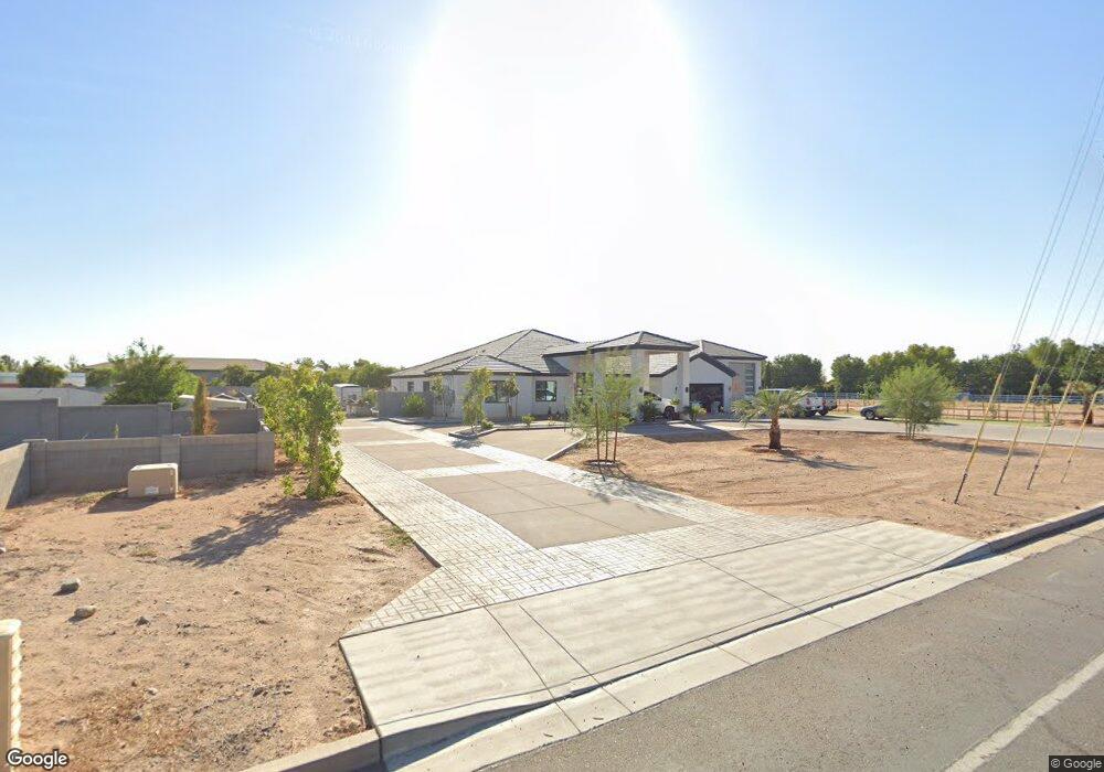
11213 N Dysart Rd El Mirage, AZ 85335
Estimated Value: $846,000 - $942,000
--
Bed
--
Bath
3,820
Sq Ft
$235/Sq Ft
Est. Value
About This Home
This home is located at 11213 N Dysart Rd, El Mirage, AZ 85335 and is currently estimated at $899,000, approximately $235 per square foot. 11213 N Dysart Rd is a home located in Maricopa County with nearby schools including El Mirage Elementary School, Dysart Middle School, and Dysart High School.
Ownership History
Date
Name
Owned For
Owner Type
Purchase Details
Closed on
Aug 31, 2020
Sold by
Powerhouse Investments Group Llc
Bought by
Nunez Alejandro Florez
Current Estimated Value
Purchase Details
Closed on
Feb 6, 2017
Sold by
Wbb Investments Llc
Bought by
Powerhouse Investment Group Llc
Home Financials for this Owner
Home Financials are based on the most recent Mortgage that was taken out on this home.
Original Mortgage
$17,892
Interest Rate
4.19%
Mortgage Type
Unknown
Purchase Details
Closed on
Apr 7, 1997
Sold by
Wolfley Vern A
Bought by
Wbb Investments Llc
Create a Home Valuation Report for This Property
The Home Valuation Report is an in-depth analysis detailing your home's value as well as a comparison with similar homes in the area
Home Values in the Area
Average Home Value in this Area
Purchase History
| Date | Buyer | Sale Price | Title Company |
|---|---|---|---|
| Nunez Alejandro Florez | $165,000 | Wfg National Title Ins Co | |
| Powerhouse Investment Group Llc | $150,000 | Great American Title Agency | |
| Wbb Investments Llc | -- | Equity Title Agency |
Source: Public Records
Mortgage History
| Date | Status | Borrower | Loan Amount |
|---|---|---|---|
| Previous Owner | Powerhouse Investment Group Llc | $17,892 | |
| Previous Owner | Powerhouse Investment Group Llc | $300,000 |
Source: Public Records
Tax History Compared to Growth
Tax History
| Year | Tax Paid | Tax Assessment Tax Assessment Total Assessment is a certain percentage of the fair market value that is determined by local assessors to be the total taxable value of land and additions on the property. | Land | Improvement |
|---|---|---|---|---|
| 2025 | $4,721 | $43,633 | -- | -- |
| 2024 | $574 | $41,555 | -- | -- |
| 2023 | $574 | $20,415 | $20,415 | $0 |
| 2022 | $574 | $13,800 | $13,800 | $0 |
| 2021 | $596 | $13,515 | $13,515 | $0 |
| 2020 | $597 | $12,600 | $12,600 | $0 |
| 2019 | $580 | $9,840 | $9,840 | $0 |
| 2018 | $573 | $9,465 | $9,465 | $0 |
| 2017 | $539 | $6,765 | $6,765 | $0 |
| 2016 | $524 | $6,015 | $6,015 | $0 |
| 2015 | $517 | $7,280 | $7,280 | $0 |
Source: Public Records
Map
Nearby Homes
- 13037 W Laurel Ln
- 12622 W Cameron Dr
- 12717 W Laurel Ln Unit 2
- 11406 N 126th Dr
- 12813 W Paradise Dr Unit 2
- 12106 N 128th Ave
- 12749 W Bloomfield Rd
- 12726 W Charter Oak Rd
- 13030 W Columbine Dr
- 12626 W Paradise Dr
- 13021 W Scotts Dr
- 12736 W Rosewood Dr
- 12818 W Rosewood Dr
- 12732 W Columbine Dr
- 12744 W Columbine Dr
- 10800 N El Mirage Rd Unit 1
- 13021 W Windrose Dr
- 12841 W Aster Dr
- 12909 W Aster Dr
- 12901 N 130th Dr
- 11213 N Dysart Rd
- 11213 N Dysart Rd
- 11225 N Dysart Rd
- 11225 N Dysart Rd
- 11225 N Dysart Rd
- 13012 W Wolfley Dr Unit 1
- 13012 W Wolfley Dr
- 11291 N Dysart Rd
- 13027 W Wolfley Dr
- 13000 W Wolfley Dr Unit 2
- 13017 W Wolfley Dr
- 00000 W Varney Rd Unit 6
- 11304 N Dysart Rd Unit 100
- 13007 W Varney Rd
- 13005 W Wolfley Dr
- 11029 N Dysart Rd
- 11017 N Dysart Rd
- 12945 W Varney Rd
- 12945 W Wolfley Dr
- 13018 W Desert Cove Rd