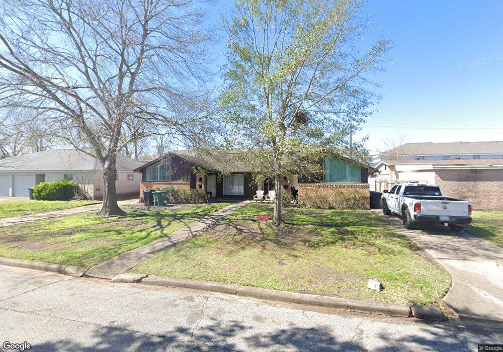
11218 Waxwing St Unit B Houston, TX 77035
Willow Meadows-Willowbend NeighborhoodEstimated Value: $337,000 - $439,000
2
Beds
2
Baths
1,095
Sq Ft
$354/Sq Ft
Est. Value
About This Home
This home is located at 11218 Waxwing St Unit B, Houston, TX 77035 and is currently estimated at $387,678, approximately $354 per square foot. 11218 Waxwing St Unit B is a home located in Harris County with nearby schools including Red Elementary School, Meyerland Middle, and Westbury High School.
Ownership History
Date
Name
Owned For
Owner Type
Purchase Details
Closed on
Sep 29, 2014
Sold by
Williford Mary M and Williford Mary Margaret
Bought by
Schaaf Stacy
Current Estimated Value
Purchase Details
Closed on
Oct 31, 1994
Sold by
Baccaro Paul M and Baccaro Geneuffa A
Bought by
Williford George R and Williford Mary M
Home Financials for this Owner
Home Financials are based on the most recent Mortgage that was taken out on this home.
Original Mortgage
$57,600
Interest Rate
8.73%
Mortgage Type
Seller Take Back
Create a Home Valuation Report for This Property
The Home Valuation Report is an in-depth analysis detailing your home's value as well as a comparison with similar homes in the area
Home Values in the Area
Average Home Value in this Area
Purchase History
| Date | Buyer | Sale Price | Title Company |
|---|---|---|---|
| Schaaf Stacy | -- | Multiple | |
| Williford George R | -- | -- |
Source: Public Records
Mortgage History
| Date | Status | Borrower | Loan Amount |
|---|---|---|---|
| Previous Owner | Williford George R | $57,600 |
Source: Public Records
Tax History Compared to Growth
Tax History
| Year | Tax Paid | Tax Assessment Tax Assessment Total Assessment is a certain percentage of the fair market value that is determined by local assessors to be the total taxable value of land and additions on the property. | Land | Improvement |
|---|---|---|---|---|
| 2025 | $5,361 | $295,635 | $196,938 | $98,697 |
| 2024 | $5,361 | $256,230 | $196,938 | $59,292 |
| 2023 | $5,361 | $262,480 | $196,938 | $65,542 |
| 2022 | $5,588 | $253,700 | $196,938 | $56,762 |
| 2021 | $5,844 | $250,741 | $196,938 | $53,803 |
| 2020 | $6,021 | $248,658 | $196,938 | $51,720 |
| 2019 | $6,225 | $246,000 | $196,938 | $49,062 |
| 2018 | $6,230 | $246,200 | $196,938 | $49,262 |
| 2017 | $6,296 | $248,980 | $196,938 | $52,042 |
| 2016 | $6,235 | $246,566 | $196,938 | $49,628 |
| 2015 | -- | $246,566 | $196,938 | $49,628 |
| 2014 | -- | $213,345 | $149,673 | $63,672 |
Source: Public Records
Map
Nearby Homes
- 4834 Sanford Rd
- 4813 Hummingbird St
- 4734 Sanford Rd
- 4842 Hummingbird St
- 4709 Sanford Rd
- 4705 Sanford Rd
- 4753 Redstart St
- 4845 Briarbend Dr
- 4702 Kingfisher Dr
- 11106 Huggins Dr
- 4862 Creekbend Dr
- 4811 Stillbrooke Dr
- 4721 Briarbend Dr
- 4543 Warm Springs Rd
- 5103 Briarbend Dr
- 5114 Kinglet St
- 4526 Benning Dr
- 4518 Warm Springs Rd
- 4525 Kingfisher Dr
- 10715 Willowgrove Dr
- 11218 Waxwing St
- 11218 Waxwing St Unit A
- 11220 Waxwing St
- 11214 Waxwing St
- 11222 Waxwing St
- 4839 Spellman Rd
- 11210 Waxwing St
- 11211 S Post Oak Rd
- 11226 Waxwing St
- 4834 Warm Springs Rd
- 4835 Spellman Rd
- 11206 Waxwing St
- 4838 Spellman Rd
- 11208 Waxwing St
- 4853 Benning Dr
- 4839 Warm Springs Rd
- 4857 Benning Dr
- 4834 Spellman Rd
- 4851 Benning Dr
- 4831 Spellman Rd