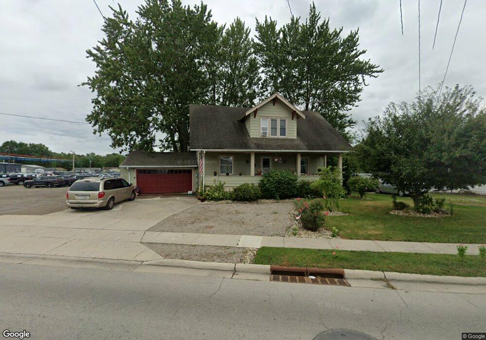
1122 W Main St van Wert, OH 45891
Estimated Value: $179,942 - $296,000
3
Beds
1
Bath
2,544
Sq Ft
$85/Sq Ft
Est. Value
About This Home
This home is located at 1122 W Main St, van Wert, OH 45891 and is currently estimated at $215,236, approximately $84 per square foot. 1122 W Main St is a home located in Van Wert County with nearby schools including Van Wert Early Childhood Center, Van Wert High School, and Lifelinks Community School.
Ownership History
Date
Name
Owned For
Owner Type
Purchase Details
Closed on
Sep 11, 2017
Sold by
Hill Krista M and Hill Michael
Bought by
Sbg Realty Llc
Current Estimated Value
Purchase Details
Closed on
May 2, 2013
Sold by
Farmer Charmel and Winifred R Ruhlin Living Trust
Bought by
Hill Krista M
Purchase Details
Closed on
Mar 4, 2013
Sold by
Estate Of Winifred R Rurlin
Bought by
Farmer Charmel and Winifred R Ruhlin Living Trust
Purchase Details
Closed on
Nov 6, 2012
Sold by
Farmer Charmel and Robert D Ruhlin Living Trust
Bought by
Ruhlin Winifred R
Create a Home Valuation Report for This Property
The Home Valuation Report is an in-depth analysis detailing your home's value as well as a comparison with similar homes in the area
Home Values in the Area
Average Home Value in this Area
Purchase History
| Date | Buyer | Sale Price | Title Company |
|---|---|---|---|
| Sbg Realty Llc | $1,000 | Attorney | |
| Hill Krista M | $18,500 | Attorney | |
| Farmer Charmel | -- | None Available | |
| Ruhlin Winifred R | -- | None Available |
Source: Public Records
Tax History
| Year | Tax Paid | Tax Assessment Tax Assessment Total Assessment is a certain percentage of the fair market value that is determined by local assessors to be the total taxable value of land and additions on the property. | Land | Improvement |
|---|---|---|---|---|
| 2024 | $1,047 | $41,060 | $7,040 | $34,020 |
| 2023 | $1,380 | $41,060 | $7,040 | $34,020 |
| 2022 | $1,121 | $28,930 | $5,450 | $23,480 |
| 2021 | $1,092 | $28,930 | $5,450 | $23,480 |
| 2020 | $1,089 | $28,930 | $5,450 | $23,480 |
| 2019 | $942 | $24,510 | $5,450 | $19,060 |
| 2018 | $915 | $24,300 | $5,240 | $19,060 |
| 2017 | $912 | $24,300 | $5,240 | $19,060 |
| 2016 | $766 | $21,470 | $5,240 | $16,230 |
| 2015 | $766 | $21,470 | $5,240 | $16,230 |
| 2014 | $698 | $19,780 | $5,240 | $14,540 |
| 2013 | $824 | $21,680 | $5,240 | $16,440 |
Source: Public Records
Map
Nearby Homes
- 224 Woodstock Dr
- 222 Shaffer St
- 302 Shaffer St
- 255 Parkview Dr
- 1328 Kathy St
- 1421 Krendl Dr
- 129 S Lynn St
- 9188 John Brown Rd Unit 25
- 9188 John Brown Rd Unit LOT 50
- 9365 John Brown Rd
- 836 State St
- 114 S Wall St
- 610 State St
- 522 South Ave
- 515 N Jefferson St
- 000 Lincoln Hwy
- 14934 Lincoln Hwy
- 00 Lincoln Hwy
- 931 Kiger St
- 949 Southway St
- 1124 W Main St
- 1118 W Main St
- 1126 W Main St
- 1111 W Main St
- 154 Kenwick Dr
- 1136 W Main St
- 160 Kenwick Dr
- 1138 W Main St
- 166 Kenwick Dr
- 153 Kenwick Dr
- 172 Kenwick Dr
- 159 Kenwick Dr
- 1140 W Main St
- 183 Woodstock Dr
- 165 Kenwick Dr
- 178 Kenwick Dr
- 190 Woodstock Dr
- 189 Woodstock Dr
- 171 Kenwick Dr
- 1049 Westchester Ct
Your Personal Tour Guide
Ask me questions while you tour the home.