Estimated Value: $439,000 - $475,000
5
Beds
5
Baths
3,131
Sq Ft
$146/Sq Ft
Est. Value
About This Home
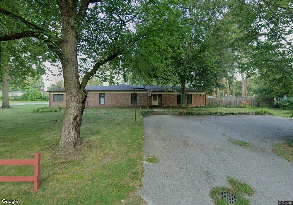
This home is located at 1122 Wesaw Rd, Niles, MI 49120 and is currently estimated at $456,658, approximately $145 per square foot. 1122 Wesaw Rd is a home located in Berrien County with nearby schools including Ballard Elementary School, Oak Manor Sixth Grade Center, and Ring Lardner Middle School.
Ownership History
Date
Name
Owned For
Owner Type
Purchase Details
Closed on
Sep 21, 2010
Sold by
Campbell Kate D and Fozkos Patricia H
Bought by
Larson Lawrence L and Larson Jeanine M
Current Estimated Value
Home Financials for this Owner
Home Financials are based on the most recent Mortgage that was taken out on this home.
Original Mortgage
$148,993
Outstanding Balance
$99,280
Interest Rate
4.62%
Mortgage Type
FHA
Estimated Equity
$357,378
Purchase Details
Closed on
Nov 16, 2009
Sold by
Campbell John M
Bought by
Campbell Kate D and Hanson Mary F
Purchase Details
Closed on
Nov 9, 2007
Sold by
Sarah Plym Campbell Revocable Living Tru
Bought by
Campbell Kate D and Hanson Mary F
Purchase Details
Closed on
Feb 5, 2001
Purchase Details
Closed on
Oct 25, 1982
Create a Home Valuation Report for This Property
The Home Valuation Report is an in-depth analysis detailing your home's value as well as a comparison with similar homes in the area
Home Values in the Area
Average Home Value in this Area
Purchase History
| Date | Buyer | Sale Price | Title Company |
|---|---|---|---|
| Larson Lawrence L | $151,000 | Cti | |
| Campbell Kate D | -- | None Available | |
| Campbell Kate D | -- | None Available | |
| -- | $100 | -- | |
| -- | $100 | -- |
Source: Public Records
Mortgage History
| Date | Status | Borrower | Loan Amount |
|---|---|---|---|
| Open | Larson Lawrence L | $148,993 |
Source: Public Records
Tax History Compared to Growth
Tax History
| Year | Tax Paid | Tax Assessment Tax Assessment Total Assessment is a certain percentage of the fair market value that is determined by local assessors to be the total taxable value of land and additions on the property. | Land | Improvement |
|---|---|---|---|---|
| 2025 | $4,361 | $256,200 | $0 | $0 |
| 2024 | $3,461 | $239,400 | $0 | $0 |
| 2023 | $3,318 | $217,700 | $0 | $0 |
| 2022 | $3,160 | $164,100 | $0 | $0 |
| 2021 | $3,872 | $152,700 | $13,600 | $139,100 |
| 2020 | $3,831 | $147,400 | $0 | $0 |
| 2019 | $3,768 | $129,700 | $6,200 | $123,500 |
| 2018 | $3,644 | $129,700 | $0 | $0 |
| 2017 | $3,584 | $111,600 | $0 | $0 |
| 2016 | $3,509 | $111,300 | $0 | $0 |
| 2015 | $3,482 | $118,400 | $0 | $0 |
| 2014 | $2,743 | $123,300 | $0 | $0 |
Source: Public Records
Map
Nearby Homes
- V/L Wesaw Rd
- 1010 Tomahawk Ln
- 413 S Street Joseph Ave
- 124 S State St
- 211 S Street Joseph Ave
- 1639 Sioux Trail
- 1695 Signal Point Dr
- 537 Grant St
- 300 Carefree Ct
- Integrity 1610 Plan at Carefree Villas
- Integrity 1605 Plan at Carefree Villas
- Integrity 1250 Plan at Carefree Villas
- Integrity 1530 Plan at Carefree Villas
- 117 N Fairview Ave
- 340 Carefree Ct
- 211 S 4th St
- 319 S 5th St
- VL Huron St
- 1630 S 3rd St
- 712 Maple St
- 1114 Wesaw Rd
- 1030 Plym Rd
- 925 Plym Rd
- 1025 Sassafras Ln
- 920 Plym Rd
- 902 Plym Rd
- 1115 Wesaw Rd
- 1108 Wesaw Rd
- 930 Plym Rd
- 1019 Sassafras Ln
- 894 Plym Rd
- 1129 Sassafras Ln
- 1020 Sassafras Ln
- 1111 Wesaw Rd
- 1123 Sassafras Ln
- 1011 Sassafras Ln
- 1001 Plym Rd
- 1024 Sassafras Ln
- 1106 Sassafras Ln
- 1030 Topinabee Rd