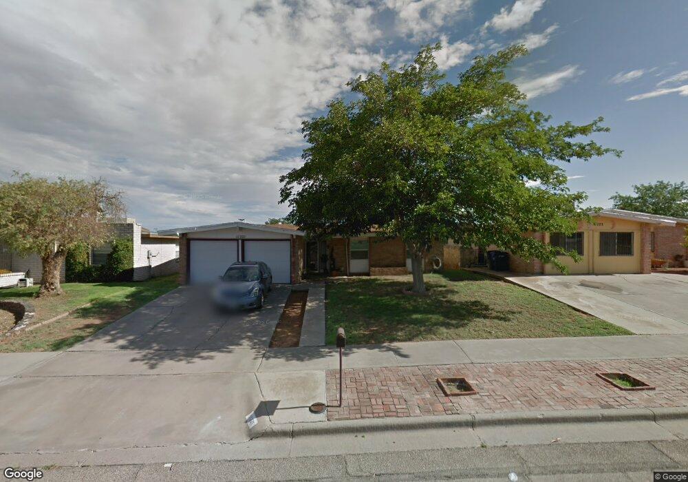
11221 Les Peterson Ln El Paso, TX 79936
Vista Del Sol NeighborhoodEstimated Value: $191,000 - $216,000
3
Beds
2
Baths
1,342
Sq Ft
$149/Sq Ft
Est. Value
About This Home
This home is located at 11221 Les Peterson Ln, El Paso, TX 79936 and is currently estimated at $200,249, approximately $149 per square foot. 11221 Les Peterson Ln is a home located in El Paso County with nearby schools including Tierra Del Sol Elementary School, J M Hanks High School, and EL PASO LEADERSHIP ACADEMY - MIDDLE EAST.
Ownership History
Date
Name
Owned For
Owner Type
Purchase Details
Closed on
Nov 28, 2023
Sold by
Rosales Christine J
Bought by
Rosales Felipe A
Current Estimated Value
Purchase Details
Closed on
Aug 3, 1999
Sold by
Gonzalez Jorge and Gonzalez Guadalupe C
Bought by
Rosales Felipe A and Rosales Christine J
Home Financials for this Owner
Home Financials are based on the most recent Mortgage that was taken out on this home.
Original Mortgage
$66,452
Interest Rate
7.63%
Mortgage Type
FHA
Create a Home Valuation Report for This Property
The Home Valuation Report is an in-depth analysis detailing your home's value as well as a comparison with similar homes in the area
Home Values in the Area
Average Home Value in this Area
Purchase History
| Date | Buyer | Sale Price | Title Company |
|---|---|---|---|
| Rosales Felipe A | -- | None Listed On Document | |
| Rosales Felipe A | -- | -- |
Source: Public Records
Mortgage History
| Date | Status | Borrower | Loan Amount |
|---|---|---|---|
| Previous Owner | Rosales Felipe A | $66,452 |
Source: Public Records
Tax History Compared to Growth
Tax History
| Year | Tax Paid | Tax Assessment Tax Assessment Total Assessment is a certain percentage of the fair market value that is determined by local assessors to be the total taxable value of land and additions on the property. | Land | Improvement |
|---|---|---|---|---|
| 2025 | $2,879 | $185,130 | -- | -- |
| 2024 | $2,879 | $32,584 | $3,392 | $29,192 |
| 2023 | $2,716 | $153,000 | $19,133 | $133,867 |
| 2022 | $4,519 | $145,519 | $0 | $0 |
| 2021 | $4,300 | $132,290 | $19,133 | $113,157 |
| 2020 | $3,929 | $124,404 | $17,367 | $107,037 |
| 2018 | $4,017 | $129,163 | $17,367 | $111,796 |
| 2017 | $3,605 | $117,934 | $17,367 | $100,567 |
| 2016 | $3,605 | $117,934 | $17,367 | $100,567 |
| 2015 | $2,901 | $117,934 | $17,367 | $100,567 |
| 2014 | $2,901 | $122,151 | $17,367 | $104,784 |
Source: Public Records
Map
Nearby Homes
- 1804 Jerry Abbott St
- 1739 Jerry Abbott St
- 2101 E Glen Dr
- 1913 Seagull Dr
- 1868 Tom Bolt Dr
- 1700 Jerry Abbott St
- 1703 Robert Wynn St
- 3655 George Dieter Dr
- 1935 Bay City Place
- 2604 Anise Dr
- 11204 Bob Mitchell Dr
- 2029 Greenlee Dr
- 1817 Hugh Royer Place
- 2348 Sea Side Dr
- 1733 Karl Wyler Dr
- 11276 Skipper Dr
- 1607 Tommy Aaron Dr
- 1617 Tommy Aaron Dr
- 2078 Gus Moran St
- 1901 Bobby Jones Dr
- 11223 Les Peterson Ln
- 11219 Les Peterson Ln
- 11225 Les Peterson Ln
- 11217 Les Peterson Ln
- 1829 Ron Cerrudo St
- 1828 Russ Randall St
- 11215 Les Peterson Ln
- 11227 Les Peterson Ln
- 1827 Ron Cerrudo St
- 1826 Russ Randall St
- 11213 Les Peterson Ln
- 11229 Les Peterson Ln
- 1828 Ron Cerrudo St
- 1829 Russ Randall St
- 1825 Ron Cerrudo St
- 1824 Russ Randall St
- 11211 Les Peterson Ln
- 1826 Ron Cerrudo St
- 1827 Russ Randall St
- 11231 Les Peterson Ln