Estimated Value: $196,480 - $262,000
--
Bed
1
Bath
2,196
Sq Ft
$109/Sq Ft
Est. Value
About This Home
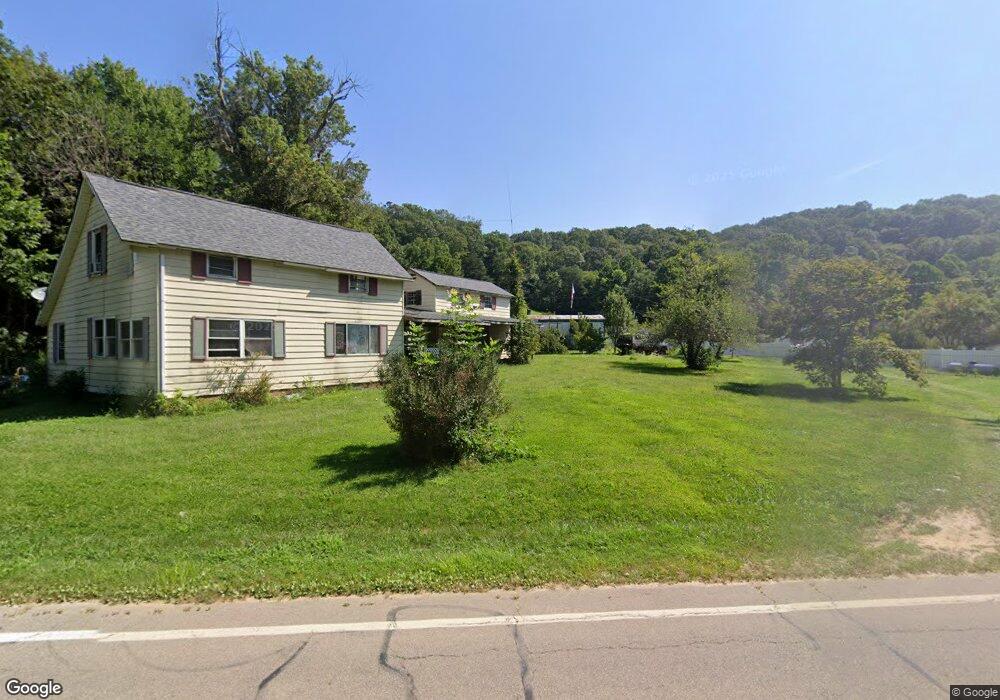
This home is located at 11223 State Route 93 N, Logan, OH 43138 and is currently estimated at $240,370, approximately $109 per square foot. 11223 State Route 93 N is a home located in Hocking County with nearby schools including Green Elementary School.
Ownership History
Date
Name
Owned For
Owner Type
Purchase Details
Closed on
Dec 27, 2006
Sold by
Union Savings Bank
Bought by
Reynolds James and Reynolds Elizabeth A
Current Estimated Value
Home Financials for this Owner
Home Financials are based on the most recent Mortgage that was taken out on this home.
Original Mortgage
$65,467
Outstanding Balance
$39,188
Interest Rate
6.24%
Mortgage Type
FHA
Estimated Equity
$201,182
Purchase Details
Closed on
Jun 30, 2006
Sold by
Travis Robert J
Bought by
Union Savings Bank
Purchase Details
Closed on
May 7, 2001
Bought by
Reynolds James and Elizabeth A.
Create a Home Valuation Report for This Property
The Home Valuation Report is an in-depth analysis detailing your home's value as well as a comparison with similar homes in the area
Home Values in the Area
Average Home Value in this Area
Purchase History
| Date | Buyer | Sale Price | Title Company |
|---|---|---|---|
| Reynolds James | -- | None Available | |
| Union Savings Bank | -- | None Available | |
| Reynolds James | $66,500 | -- |
Source: Public Records
Mortgage History
| Date | Status | Borrower | Loan Amount |
|---|---|---|---|
| Open | Reynolds James | $65,467 |
Source: Public Records
Tax History Compared to Growth
Tax History
| Year | Tax Paid | Tax Assessment Tax Assessment Total Assessment is a certain percentage of the fair market value that is determined by local assessors to be the total taxable value of land and additions on the property. | Land | Improvement |
|---|---|---|---|---|
| 2024 | $1,276 | $33,940 | $13,310 | $20,630 |
| 2023 | $1,276 | $33,940 | $13,310 | $20,630 |
| 2022 | $1,278 | $33,940 | $13,310 | $20,630 |
| 2021 | $1,262 | $31,470 | $9,500 | $21,970 |
| 2020 | $1,256 | $31,470 | $9,500 | $21,970 |
| 2019 | $1,257 | $31,470 | $9,500 | $21,970 |
| 2018 | $1,168 | $29,920 | $7,950 | $21,970 |
| 2017 | $1,146 | $29,920 | $7,950 | $21,970 |
| 2016 | $1,138 | $29,920 | $7,950 | $21,970 |
| 2015 | $892 | $22,630 | $6,310 | $16,320 |
| 2014 | $892 | $22,630 | $6,310 | $16,320 |
| 2013 | $896 | $22,630 | $6,310 | $16,320 |
Source: Public Records
Map
Nearby Homes
- 10706 State Route 93 N
- 0 Swamp Rd
- 35041 Hunter Rd
- 0 Ohio 668
- 9292 Hood Rd
- 0 Tucker Rd Unit 25469222
- 0 Tucker Rd Unit (Tract C at Hocking
- 0 Tucker Rd Unit (Tract B at Hocking
- 0 Tucker Rd Unit (Tract A at Hocking
- 0 Tucker Rd Unit 25025476
- 0 Tucker Rd Unit 25468492
- 0 Tucker Rd Unit (Tract D at Hocking
- 0 Tucker Rd Unit 25025287
- 10081 Ohio 93
- 12151 State Route 93 N
- 38482 Scout Rd
- 12170 State Route 93 N
- 0 Clay Hill Rd
- 0 Little Rd
- 10132 Bremen Rd
- 11249 State Route 93 N
- 11223 Ohio 93
- 11213 State Route 93 N
- 11219 State Route 93 N
- 11183 State Route 93 N
- 11249 Ohio 93
- 9260 Wahl Rd
- 9374 Wahl Rd
- 9037 State Route 668
- 9161 Nutter Boring Rd
- 59 acres State Route 668
- 9353 Nutter Boring Rd
- 11277 State Route 93 N
- 8591 State Route 668
- 8118 Dutch Ridge Rd SE
- 8568 Dutch Ridge Rd SE
- 10974 State Route 93 N
- 10987 State Route 93 N
- 11367 State Route 93 N