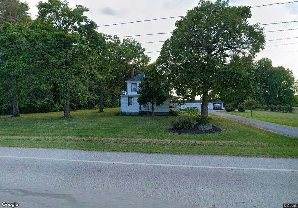
11224 Station Rd Columbia Station, OH 44028
Estimated Value: $387,968 - $559,000
5
Beds
2
Baths
2,564
Sq Ft
$182/Sq Ft
Est. Value
About This Home
This home is located at 11224 Station Rd, Columbia Station, OH 44028 and is currently estimated at $465,742, approximately $181 per square foot. 11224 Station Rd is a home located in Lorain County with nearby schools including Olmsted Falls Intermediate Building, Falls-Lenox Primary Elementary School, and Olmsted Falls Middle School.
Ownership History
Date
Name
Owned For
Owner Type
Purchase Details
Closed on
Jun 16, 1998
Sold by
White Kenneth G and White Eunice L
Bought by
Algotson Eric P and Algotson Danna M
Current Estimated Value
Home Financials for this Owner
Home Financials are based on the most recent Mortgage that was taken out on this home.
Original Mortgage
$127,600
Interest Rate
7.22%
Create a Home Valuation Report for This Property
The Home Valuation Report is an in-depth analysis detailing your home's value as well as a comparison with similar homes in the area
Home Values in the Area
Average Home Value in this Area
Purchase History
| Date | Buyer | Sale Price | Title Company |
|---|---|---|---|
| Algotson Eric P | $159,900 | Choice Title Agency Inc |
Source: Public Records
Mortgage History
| Date | Status | Borrower | Loan Amount |
|---|---|---|---|
| Closed | Algotson Eric P | $127,600 |
Source: Public Records
Tax History Compared to Growth
Tax History
| Year | Tax Paid | Tax Assessment Tax Assessment Total Assessment is a certain percentage of the fair market value that is determined by local assessors to be the total taxable value of land and additions on the property. | Land | Improvement |
|---|---|---|---|---|
| 2024 | $3,764 | $86,009 | $32,617 | $53,393 |
| 2023 | $2,224 | $44,058 | $15,740 | $28,319 |
| 2022 | $2,169 | $44,058 | $15,740 | $28,319 |
| 2021 | $4,342 | $88,116 | $31,483 | $56,634 |
| 2020 | $4,197 | $76,420 | $27,300 | $49,120 |
| 2019 | $4,172 | $76,420 | $27,300 | $49,120 |
| 2018 | $3,850 | $76,420 | $27,300 | $49,120 |
| 2017 | $3,494 | $58,740 | $30,180 | $28,560 |
| 2016 | $3,518 | $58,740 | $30,180 | $28,560 |
| 2015 | $3,519 | $58,740 | $30,180 | $28,560 |
| 2014 | $3,539 | $58,740 | $30,180 | $28,560 |
| 2013 | $3,552 | $58,740 | $30,180 | $28,560 |
Source: Public Records
Map
Nearby Homes
- 23663 Victory Ln
- 26571 Sprague Rd
- 9954 Ethan Dr
- 9628 Kingston Trail
- 27167 Watkin Rd
- 27056 Sprague Rd
- 11834 W River Rd
- 2013 Viewpointe Ct
- 33621 Henwell Rd
- 9130 Devonshire Dr
- 26645 Lake of the Falls Blvd
- 9112 Devonshire Dr
- 23855 W Rim Dr
- 33700 Henwell Rd
- 33743 Henwell Rd
- 26271 Royalton Rd
- 31100 Blooming Ln
- 9159 E Windsor Dr
- 25931 Royalton Rd
- 8860 Sharp Rd
- 11326 Station Rd
- 11225 Station Rd
- 11201 Station Rd
- 26584 Osborne Rd
- 11355 Station Rd
- 11369 Station Rd
- 26602 Osborne Rd
- 26458 Anderson Rd
- 26458 Anderson Rd
- 26630 Osborne Rd
- 26465 Osborne Rd
- 26434 Anderson Rd
- 26654 Osborne Rd
- 26383 Osborne Rd
- 26672 Osborne Rd
- 26593 Osborne Rd
- 26361 Osborne Rd
- 26698 Osborne Rd
- 26641 Osborne Rd
- 11170 Station Rd