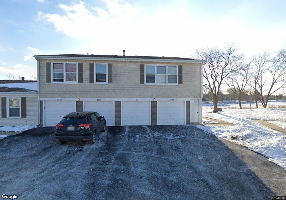
1123 Hampton Harbor Unit 8804 Schaumburg, IL 60193
South Schaumburg NeighborhoodEstimated Value: $240,774 - $277,000
2
Beds
--
Bath
1,000
Sq Ft
$256/Sq Ft
Est. Value
About This Home
This home is located at 1123 Hampton Harbor Unit 8804, Schaumburg, IL 60193 and is currently estimated at $256,194, approximately $256 per square foot. 1123 Hampton Harbor Unit 8804 is a home located in Cook County with nearby schools including Michael Collins Elementary School, Robert Frost Junior High School, and J B Conant High School.
Ownership History
Date
Name
Owned For
Owner Type
Purchase Details
Closed on
Apr 20, 1999
Sold by
Sherpan Jeffrey A
Bought by
Trousil Thomas S
Current Estimated Value
Home Financials for this Owner
Home Financials are based on the most recent Mortgage that was taken out on this home.
Original Mortgage
$76,000
Outstanding Balance
$17,795
Interest Rate
6.87%
Estimated Equity
$238,399
Create a Home Valuation Report for This Property
The Home Valuation Report is an in-depth analysis detailing your home's value as well as a comparison with similar homes in the area
Home Values in the Area
Average Home Value in this Area
Purchase History
| Date | Buyer | Sale Price | Title Company |
|---|---|---|---|
| Trousil Thomas S | $95,000 | -- |
Source: Public Records
Mortgage History
| Date | Status | Borrower | Loan Amount |
|---|---|---|---|
| Open | Trousil Thomas S | $76,000 |
Source: Public Records
Tax History
| Year | Tax Paid | Tax Assessment Tax Assessment Total Assessment is a certain percentage of the fair market value that is determined by local assessors to be the total taxable value of land and additions on the property. | Land | Improvement |
|---|---|---|---|---|
| 2025 | $4,367 | $22,994 | $763 | $22,231 |
| 2024 | $4,367 | $15,590 | $646 | $14,944 |
| 2023 | $4,235 | $15,590 | $646 | $14,944 |
| 2022 | $4,235 | $15,590 | $646 | $14,944 |
| 2021 | $4,205 | $13,874 | $352 | $13,522 |
| 2020 | $4,133 | $13,874 | $352 | $13,522 |
| 2019 | $4,132 | $15,416 | $352 | $15,064 |
| 2018 | $3,284 | $10,944 | $293 | $10,651 |
| 2017 | $3,233 | $10,944 | $293 | $10,651 |
| 2016 | $3,023 | $10,944 | $293 | $10,651 |
| 2015 | $2,794 | $9,341 | $264 | $9,077 |
| 2014 | $2,764 | $9,341 | $264 | $9,077 |
| 2013 | $2,693 | $9,341 | $264 | $9,077 |
Source: Public Records
Map
Nearby Homes
- 1055 Hampton Harbor Unit 1055
- 1064 Hampton Harbor Unit 1064
- 1100 Boston Harbor Unit 7004
- 518 E Niagara Ave
- 411 Drake Cir Unit 401B
- 620 S Point Dr
- 615 Newberry Dr
- 1200 Knottingham Ct Unit 2B
- 826 Thornton Ct Unit 2AL
- 1326 Summit Dr
- 20 Shore Dr
- 602 E Weathersfield Way
- 701 Preston Ln
- 1890 Pebble Beach Cir
- 1821 Pebble Beach Cir Unit 1
- 677 Cumberland Trail Unit 2B
- 98 Wiltshire Ct
- 733 Limerick Ln Unit 7333D
- 717 Killarney Ct Unit 2D
- 531 Cumberland Trail Unit B
- 1127 Hampton Harbor Unit 8802
- 1129 Hampton Harbor Unit 8801
- 1129 Hampton Harbor Unit 1034
- 1125 Hampton Harbor Unit 8803
- 1121 Hampton Harbor Unit 8703
- 1121 Hampton Harbor Unit 87
- 1135 Hampton Harbor Unit 8902
- 1133 Hampton Harbor Unit 8903
- 1131 Hampton Harbor Unit 8904
- 1115 Hampton Harbor Unit 8704
- 1119 Hampton Harbor Unit 8702
- 1115 Hampton Harbor
- 1119 Hampton Harbor Unit 87
- 1111 Hampton Harbor Unit 9002
- 1117 Hampton Harbor Unit 8701
- 1109 Hampton Harbor Unit 9003
- 1107 Hampton Harbor Unit 9004
- 1109 Hampton Harbor Unit 1109
- 1107 Hampton Harbor Unit 9004
- 1113 Hampton Harbor Unit 9001
Your Personal Tour Guide
Ask me questions while you tour the home.