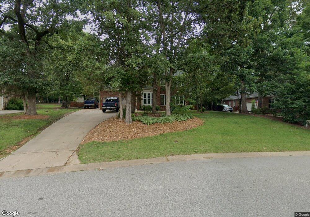
1123 Millwright Ln Matthews, NC 28104
Estimated Value: $480,566 - $528,000
3
Beds
3
Baths
2,088
Sq Ft
$241/Sq Ft
Est. Value
About This Home
This home is located at 1123 Millwright Ln, Matthews, NC 28104 and is currently estimated at $502,392, approximately $240 per square foot. 1123 Millwright Ln is a home located in Union County with nearby schools including Stallings Elementary School, Porter Ridge Middle School, and Porter Ridge High School.
Ownership History
Date
Name
Owned For
Owner Type
Purchase Details
Closed on
Oct 20, 2016
Sold by
Mcdonald Craig and Mcdonald Melissa
Bought by
Mcdonald Craig
Current Estimated Value
Purchase Details
Closed on
Apr 15, 2008
Sold by
Oneill Brian and Oneill Deanna
Bought by
Mcdonald Craig and Mcdonald Melissa
Home Financials for this Owner
Home Financials are based on the most recent Mortgage that was taken out on this home.
Original Mortgage
$237,650
Outstanding Balance
$151,153
Interest Rate
6.22%
Mortgage Type
Unknown
Estimated Equity
$351,239
Create a Home Valuation Report for This Property
The Home Valuation Report is an in-depth analysis detailing your home's value as well as a comparison with similar homes in the area
Purchase History
| Date | Buyer | Sale Price | Title Company |
|---|---|---|---|
| Mcdonald Craig | -- | None Available | |
| Mcdonald Craig | $245,000 | None Available |
Source: Public Records
Mortgage History
| Date | Status | Borrower | Loan Amount |
|---|---|---|---|
| Open | Mcdonald Craig | $237,650 |
Source: Public Records
Tax History Compared to Growth
Tax History
| Year | Tax Paid | Tax Assessment Tax Assessment Total Assessment is a certain percentage of the fair market value that is determined by local assessors to be the total taxable value of land and additions on the property. | Land | Improvement |
|---|---|---|---|---|
| 2025 | $3,024 | $444,100 | $0 | $0 |
| 2024 | $2,598 | $295,900 | $58,000 | $237,900 |
| 2023 | $2,488 | $295,900 | $58,000 | $237,900 |
| 2022 | $2,467 | $295,900 | $58,000 | $237,900 |
| 2021 | $2,467 | $295,900 | $58,000 | $237,900 |
| 2020 | $2,447 | $241,400 | $42,500 | $198,900 |
| 2019 | $2,447 | $241,400 | $42,500 | $198,900 |
| 2018 | $2,447 | $241,400 | $42,500 | $198,900 |
| 2017 | $2,399 | $229,300 | $42,500 | $186,800 |
| 2016 | $2,408 | $229,300 | $42,500 | $186,800 |
| 2015 | $2,437 | $229,300 | $42,500 | $186,800 |
| 2014 | $1,251 | $175,120 | $1,940 | $173,180 |
Source: Public Records
Map
Nearby Homes
- 1915 Millbrook Ln
- 1344 Garden Vista Dr
- 1022 Galloway Dr
- 1026 Galloway Dr
- 1330 Millview Ln
- 1346 Millview Ln
- 14404 Lawyers Rd
- 109 Lineview Dr
- 113 Lineview Dr
- 909 Kayla Ct
- 6045 Burnt Mill Run
- 8056 Hunley Ridge Rd
- 6300 Allen Black Rd
- 2164 Mill House Ln
- 0 Allen Black Rd
- 650 Union Rd
- 1715 Union Rd
- 5518 Two Iron Dr
- 7109 Edgefield Ct
- 8106 Castlemaine Dr
- 1117 Millwright Ln
- 1127 Millwright Ln
- 1459 Porch Swing Ln
- 1465 Porch Swing Ln
- 1111 Millwright Ln
- 1451 Porch Swing Ln
- 1133 Millwright Ln
- 1443 Porch Swing Ln
- 1437 Porch Swing Ln
- 1114 Millwright Ln
- 1126 Millwright Ln
- 1137 Millwright Ln
- 1132 Millwright Ln
- 1471 Porch Swing Ln
- 1939 Millbrook Ln
- 2003 Millbrook Ln
- 1423 Porch Swing Ln
- 2011 Millbrook Ln
- 1951 Millbrook Ln
- 1931 Millbrook Ln