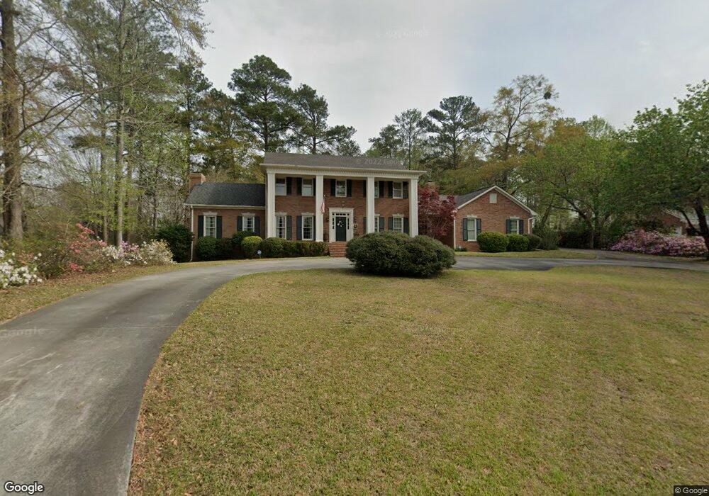
1123 Saint Andrews Dr Macon, GA 31210
Estimated Value: $665,000 - $748,000
4
Beds
4
Baths
3,717
Sq Ft
$187/Sq Ft
Est. Value
About This Home
This home is located at 1123 Saint Andrews Dr, Macon, GA 31210 and is currently estimated at $696,343, approximately $187 per square foot. 1123 Saint Andrews Dr is a home located in Bibb County with nearby schools including Carter Elementary School, Howard Middle School, and Howard High School.
Ownership History
Date
Name
Owned For
Owner Type
Purchase Details
Closed on
May 18, 2011
Sold by
Sutton Robert C and Sutton Rhonda A
Bought by
Garud Michael and Garud Charlotte
Current Estimated Value
Home Financials for this Owner
Home Financials are based on the most recent Mortgage that was taken out on this home.
Original Mortgage
$317,700
Outstanding Balance
$219,869
Interest Rate
4.79%
Mortgage Type
New Conventional
Estimated Equity
$476,474
Purchase Details
Closed on
May 25, 2006
Sold by
Sutton Robert Carlton and Embry Rhonda A
Bought by
Sutton Robert C
Home Financials for this Owner
Home Financials are based on the most recent Mortgage that was taken out on this home.
Original Mortgage
$332,000
Interest Rate
6.44%
Mortgage Type
New Conventional
Purchase Details
Closed on
Mar 13, 1998
Create a Home Valuation Report for This Property
The Home Valuation Report is an in-depth analysis detailing your home's value as well as a comparison with similar homes in the area
Home Values in the Area
Average Home Value in this Area
Purchase History
| Date | Buyer | Sale Price | Title Company |
|---|---|---|---|
| Garud Michael | $353,000 | None Available | |
| Sutton Robert C | -- | None Available | |
| -- | $292,500 | -- |
Source: Public Records
Mortgage History
| Date | Status | Borrower | Loan Amount |
|---|---|---|---|
| Open | Garud Michael | $317,700 | |
| Previous Owner | Sutton Robert C | $332,000 |
Source: Public Records
Tax History Compared to Growth
Tax History
| Year | Tax Paid | Tax Assessment Tax Assessment Total Assessment is a certain percentage of the fair market value that is determined by local assessors to be the total taxable value of land and additions on the property. | Land | Improvement |
|---|---|---|---|---|
| 2025 | $5,355 | $217,918 | $50,400 | $167,518 |
| 2024 | $5,534 | $217,918 | $50,400 | $167,518 |
| 2023 | $5,165 | $203,352 | $50,400 | $152,952 |
| 2022 | $5,991 | $173,051 | $28,800 | $144,251 |
| 2021 | $6,210 | $163,434 | $28,800 | $134,634 |
| 2020 | $5,897 | $151,902 | $24,000 | $127,902 |
| 2019 | $5,457 | $139,401 | $24,000 | $115,401 |
| 2018 | $8,537 | $139,401 | $24,000 | $115,401 |
| 2017 | $5,223 | $139,401 | $24,000 | $115,401 |
| 2016 | $4,823 | $139,401 | $24,000 | $115,401 |
| 2015 | $6,827 | $139,401 | $24,000 | $115,401 |
| 2014 | $6,837 | $139,401 | $24,000 | $115,401 |
Source: Public Records
Map
Nearby Homes
- 1115 Saint Andrews Dr
- 1127 Saint Andrews Dr
- 1124 Saint Andrews Dr
- 1120 Saint Andrews Dr
- 1111 Saint Andrews Dr
- 100 Prestwick Park
- 1128 Saint Andrews Dr
- 102 Troon Way
- 1112 Saint Andrews Dr
- 1112 St Andrews Dr
- 1132 Saint Andrews Dr
- 104 Prestwick Park
- 197 Gleneagles Cir
- 193 Gleneagles Cir
- 103 Troon Way
- 0 Saint Andrews Dr Unit 8094183
- 0 Saint Andrews Dr Unit 8094180
- 0 Saint Andrews Dr Unit 8716811
- 0 Saint Andrews Dr Unit 7225346
- 0 Saint Andrews Dr Unit 7162830