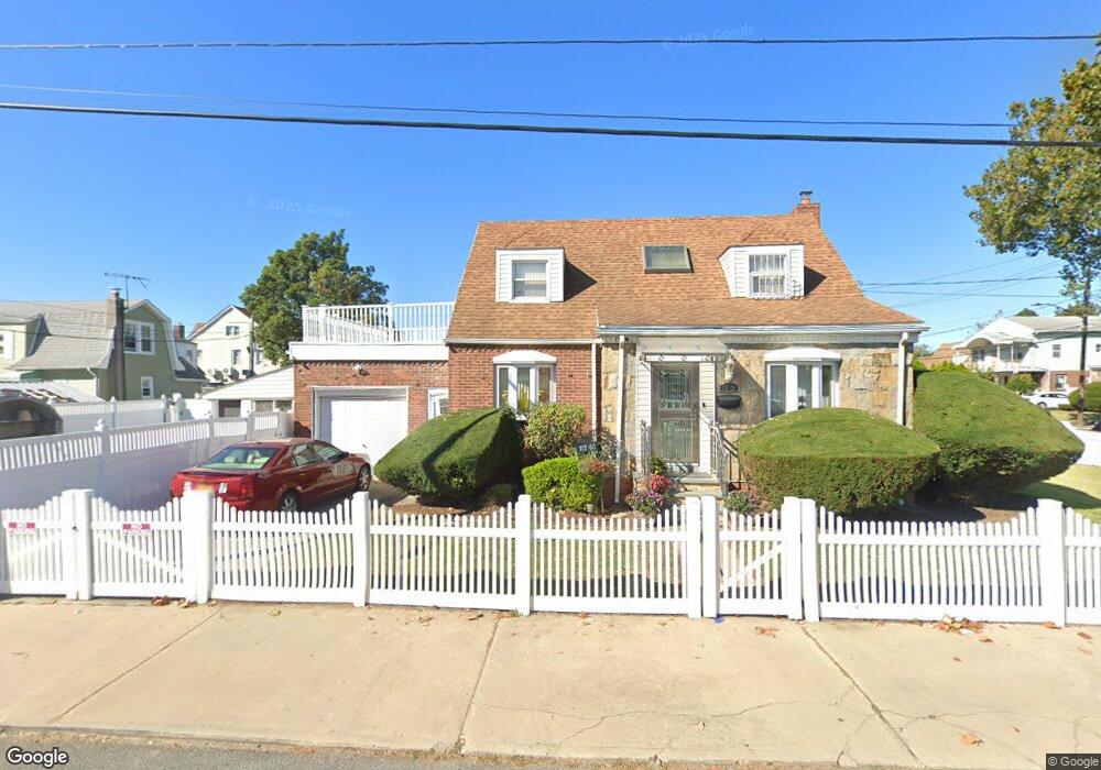
11230 219th St Queens Village, NY 11429
Queens Village NeighborhoodEstimated Value: $625,000 - $701,000
--
Bed
--
Bath
1,124
Sq Ft
$586/Sq Ft
Est. Value
About This Home
This home is located at 11230 219th St, Queens Village, NY 11429 and is currently estimated at $658,747, approximately $586 per square foot. 11230 219th St is a home located in Queens County with nearby schools including P.S./M.S. 147 Ronald Mcnair, I.S. 192 The Linden, and Ss Joachim & Anne School.
Ownership History
Date
Name
Owned For
Owner Type
Purchase Details
Closed on
Aug 8, 2023
Sold by
Dill Linda
Bought by
Linda Dill Irrevocable Trust and Shauwana Dill Darby As Trustee
Current Estimated Value
Purchase Details
Closed on
Jul 14, 2008
Sold by
Dill Freddie
Bought by
Dill Linda
Purchase Details
Closed on
Jul 16, 2003
Sold by
Of The Lwt Of Freddie Dill Sr Freddie and The Lwt Of Freddie Dill Sr Gerald H Gr
Bought by
Dill Freddie
Purchase Details
Closed on
Mar 28, 2000
Sold by
Thomas Rosalind M
Bought by
Dill Freddie
Home Financials for this Owner
Home Financials are based on the most recent Mortgage that was taken out on this home.
Original Mortgage
$170,000
Interest Rate
7.74%
Mortgage Type
Purchase Money Mortgage
Create a Home Valuation Report for This Property
The Home Valuation Report is an in-depth analysis detailing your home's value as well as a comparison with similar homes in the area
Home Values in the Area
Average Home Value in this Area
Purchase History
| Date | Buyer | Sale Price | Title Company |
|---|---|---|---|
| Linda Dill Irrevocable Trust | -- | -- | |
| Linda Dill Irrevocable Trust | -- | -- | |
| Dill Linda | $318,000 | -- | |
| Dill Linda | $318,000 | -- | |
| Dill Freddie | -- | -- | |
| Dill Freddie | -- | -- | |
| Dill Freddie | $195,000 | Commonwealth Land Title Ins | |
| Dill Freddie | $195,000 | Commonwealth Land Title Ins |
Source: Public Records
Mortgage History
| Date | Status | Borrower | Loan Amount |
|---|---|---|---|
| Previous Owner | Dill Freddie | $170,000 |
Source: Public Records
Tax History Compared to Growth
Tax History
| Year | Tax Paid | Tax Assessment Tax Assessment Total Assessment is a certain percentage of the fair market value that is determined by local assessors to be the total taxable value of land and additions on the property. | Land | Improvement |
|---|---|---|---|---|
| 2025 | $5,154 | $31,229 | $9,639 | $21,590 |
| 2024 | $5,258 | $29,462 | $9,806 | $19,656 |
| 2023 | $5,154 | $29,462 | $9,158 | $20,304 |
| 2022 | $5,459 | $38,940 | $13,260 | $25,680 |
| 2021 | $5,509 | $32,880 | $13,260 | $19,620 |
| 2020 | $5,213 | $31,500 | $13,260 | $18,240 |
| 2019 | $4,843 | $30,720 | $13,260 | $17,460 |
| 2018 | $4,707 | $24,552 | $11,073 | $13,479 |
| 2017 | $4,514 | $23,616 | $11,547 | $12,069 |
| 2016 | $4,286 | $23,616 | $11,547 | $12,069 |
| 2015 | $2,467 | $21,687 | $12,036 | $9,651 |
| 2014 | $2,467 | $20,460 | $13,620 | $6,840 |
Source: Public Records
Map
Nearby Homes
- 112-29 219th St
- 21531 Murdock Ave
- 219-47 112th Ave
- 22117 Murdock Ave
- 21438 112th Rd
- 215-28 112th Ave
- 214-38 113th Ave
- 215-11 112th Ave
- 216-23 111th Ave
- 21739 114th Rd
- 217-39 114th Rd
- 214-10 113th Ave
- 21867 110th Ave
- 109-15 221st St
- 22324 Murdock Ave
- 113-66 Springfield Blvd
- 215-16 111th Ave
- 21231 113th Ave
- 114-36 220th St
- 21511 111th Rd
- 21740 112th Rd
- 21849 113th Ave
- 11229 219th St
- 21647 113th Ave
- 21736 112th Rd
- 219-12 112th Rd
- 21839 113th Ave
- 11245 219th St
- 21908 112th Rd
- 218-39 113th Ave
- 21839 113th Ave
- 219-08 112 St
- 112-45 219th St
- 217-41 112th Rd
- 21635 113th Ave
- 11216 219th St
- 21730 112th Rd
- 21730 112th Rd
- 217-30 112th Rd Unit 2
- 217-30 112th Rd