Estimated Value: $313,000 - $398,000
3
Beds
2
Baths
1,517
Sq Ft
$242/Sq Ft
Est. Value
About This Home
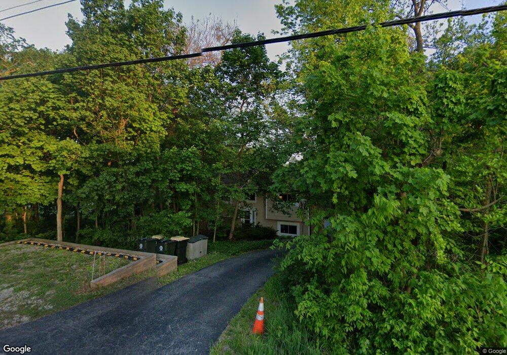
This home is located at 11230 River Rd, Plano, IL 60545 and is currently estimated at $366,868, approximately $241 per square foot. 11230 River Rd is a home located in Kendall County with nearby schools including Yorkville Grade School, Yorkville Intermediate School, and Yorkville Middle School.
Ownership History
Date
Name
Owned For
Owner Type
Purchase Details
Closed on
Feb 2, 2006
Sold by
Kamis Gaylord J and Kamis Diane L
Bought by
Kamis Diane L and Kamis Gaylord J
Current Estimated Value
Purchase Details
Closed on
May 12, 1997
Sold by
Piazza Dorothy N and Piazza James A
Bought by
Kamis Gaylord J and Kamis Diane L
Home Financials for this Owner
Home Financials are based on the most recent Mortgage that was taken out on this home.
Original Mortgage
$115,600
Outstanding Balance
$16,204
Interest Rate
8.27%
Estimated Equity
$350,664
Purchase Details
Closed on
Jan 1, 1989
Create a Home Valuation Report for This Property
The Home Valuation Report is an in-depth analysis detailing your home's value as well as a comparison with similar homes in the area
Home Values in the Area
Average Home Value in this Area
Purchase History
| Date | Buyer | Sale Price | Title Company |
|---|---|---|---|
| Kamis Diane L | -- | None Available | |
| Kamis Gaylord J | $144,600 | -- | |
| -- | $133,000 | -- |
Source: Public Records
Mortgage History
| Date | Status | Borrower | Loan Amount |
|---|---|---|---|
| Open | Kamis Gaylord J | $115,600 |
Source: Public Records
Tax History
| Year | Tax Paid | Tax Assessment Tax Assessment Total Assessment is a certain percentage of the fair market value that is determined by local assessors to be the total taxable value of land and additions on the property. | Land | Improvement |
|---|---|---|---|---|
| 2024 | $7,041 | $104,088 | $16,644 | $87,444 |
| 2023 | $6,395 | $93,127 | $14,891 | $78,236 |
| 2022 | $6,395 | $84,546 | $13,519 | $71,027 |
| 2021 | $6,173 | $80,526 | $13,519 | $67,007 |
| 2020 | $6,132 | $79,263 | $13,519 | $65,744 |
| 2019 | $5,982 | $76,221 | $13,000 | $63,221 |
| 2018 | $5,765 | $71,959 | $16,000 | $55,959 |
| 2017 | $5,713 | $69,294 | $16,000 | $53,294 |
| 2016 | $5,707 | $67,244 | $18,327 | $48,917 |
| 2015 | $5,292 | $60,766 | $16,628 | $44,138 |
| 2014 | -- | $59,480 | $16,628 | $42,852 |
| 2013 | -- | $59,480 | $16,628 | $42,852 |
Source: Public Records
Map
Nearby Homes
- 207 Windham Cir
- 232 Windham Cir
- 1023 S Carly Cir
- W Fox Rd
- 1037 N Carly Cir
- 906 N Carly Cir
- 882 N Carly Cir
- 1408 Chestnut Ln
- 3 Poplar Rd
- 1506 Cottonwood Trail
- 15 E Cedar Ct Unit 3
- 1517 Stoneridge Ct Unit 3
- 202 Morgan St
- Lot 11 Ashley Ln
- 220 Georgeanna St
- 903 S Main St
- 223 Pleasure Dr
- 1202 Gillespie Ln
- 1200 Gillespie Ln
- 1247 Gillespie Ln
- 11218 River Rd
- 11209 River Rd
- 11206 River Rd
- 11136 River Rd
- 11327 River Rd
- 11110 River Rd
- 11090 River Rd
- 11070 River Rd
- 10940 River Rd
- 11050 River Rd Unit B
- 11050 River Rd Unit A
- 11050 River Rd
- 11453 River Rd
- 11028 River Rd
- 11428 River St
- 11428 River Rd
- 11010 River Rd
- 249 Windham Cir
- 255 Windham Cir
- 237 Windham Cir
Your Personal Tour Guide
Ask me questions while you tour the home.