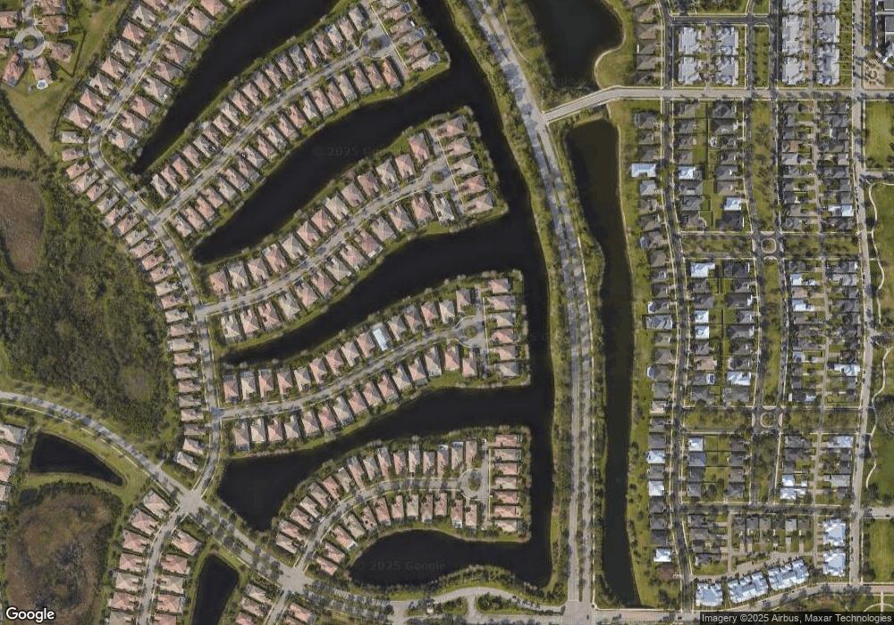
11236 SW Olmstead Dr Port Saint Lucie, FL 34987
Tradition NeighborhoodEstimated Value: $476,318 - $577,000
4
Beds
3
Baths
2,487
Sq Ft
$213/Sq Ft
Est. Value
About This Home
This home is located at 11236 SW Olmstead Dr, Port Saint Lucie, FL 34987 and is currently estimated at $529,830, approximately $213 per square foot. 11236 SW Olmstead Dr is a home located in St. Lucie County with nearby schools including Oak Hammock K-8 School, Windmill Point Elementary School, and St. Lucie West Centennial High School.
Ownership History
Date
Name
Owned For
Owner Type
Purchase Details
Closed on
Apr 28, 2009
Sold by
Bilsbury Andrew and Bilsbury Dina
Bought by
Berco Neil and Berco Anne M Rosen
Current Estimated Value
Home Financials for this Owner
Home Financials are based on the most recent Mortgage that was taken out on this home.
Original Mortgage
$180,000
Outstanding Balance
$113,789
Interest Rate
4.86%
Mortgage Type
Purchase Money Mortgage
Estimated Equity
$416,041
Purchase Details
Closed on
Mar 14, 2006
Sold by
Divosta Homes Lp
Bought by
Bilsbury Andrew and Bilsbury Dina
Home Financials for this Owner
Home Financials are based on the most recent Mortgage that was taken out on this home.
Original Mortgage
$20,000
Interest Rate
6.19%
Mortgage Type
Credit Line Revolving
Create a Home Valuation Report for This Property
The Home Valuation Report is an in-depth analysis detailing your home's value as well as a comparison with similar homes in the area
Home Values in the Area
Average Home Value in this Area
Purchase History
| Date | Buyer | Sale Price | Title Company |
|---|---|---|---|
| Berco Neil | $225,000 | United Title Affiliates Inc | |
| Bilsbury Andrew | $438,500 | American Title Of The Palm B |
Source: Public Records
Mortgage History
| Date | Status | Borrower | Loan Amount |
|---|---|---|---|
| Open | Berco Neil | $180,000 | |
| Previous Owner | Bilsbury Andrew | $20,000 | |
| Previous Owner | Bilsbury Andrew | $318,500 |
Source: Public Records
Tax History Compared to Growth
Tax History
| Year | Tax Paid | Tax Assessment Tax Assessment Total Assessment is a certain percentage of the fair market value that is determined by local assessors to be the total taxable value of land and additions on the property. | Land | Improvement |
|---|---|---|---|---|
| 2024 | $6,124 | $245,746 | -- | -- |
| 2023 | $6,124 | $238,589 | $0 | $0 |
| 2022 | $5,938 | $231,640 | $0 | $0 |
| 2021 | $5,752 | $224,894 | $0 | $0 |
| 2020 | $5,792 | $221,789 | $0 | $0 |
| 2019 | $5,752 | $216,803 | $0 | $0 |
| 2018 | $5,528 | $212,761 | $0 | $0 |
| 2017 | $5,467 | $264,000 | $50,000 | $214,000 |
| 2016 | $5,404 | $246,400 | $46,000 | $200,400 |
| 2015 | $5,457 | $224,500 | $36,000 | $188,500 |
| 2014 | $5,210 | $201,072 | $0 | $0 |
Source: Public Records
Map
Nearby Homes
- 11361 SW Pembroke Dr
- 11379 SW Olmstead Dr
- 11221 SW Northland Dr
- 11595 SW Rockingham Dr
- 11564 SW Rockingham Dr
- 10755 SW Waterway Ln
- 10610 SW Westlawn Blvd
- 10581 SW Stratton Dr
- 10475 SW Westlawn Blvd
- 10780 SW Dardanelle Dr
- 10403 SW Waterway Ln
- 10838 SW Meeting St
- 10420 SW Waterway Ln
- 10499 SW West Park Ave
- 10439 SW West Park Ave
- 10744 SW Elsinore Dr
- 10907 SW Dardanelle Dr
- 10811 SW Elsinore Dr
- 10560 SW Stephanie Way Unit 1102
- 10560 SW Stephanie Way Unit 1207
- 11246 SW Olmstead Dr
- 11206 SW Olmstead Dr
- 11266 SW Olmstead Dr
- 11176 SW Olmstead Dr
- 11286 SW Olmstead Dr
- 11146 SW Olmstead Dr
- 11237 SW Olmstead Dr
- 11118 SW Olmstead Dr
- 11267 SW Olmstead Dr
- 11207 SW Olmstead Dr
- 11117 SW Olmstead Dr
- 11306 SW Olmstead Dr
- 11287 SW Olmstead Dr
- 11147 SW Olmstead Dr
- 11177 SW Olmstead Dr
- 11307 SW Olmstead Dr
- 11324 SW Olmstead Dr
- 11261 SW Pembroke Dr
- 11273 SW Pembroke Dr
- 11291 SW Pembroke Dr
