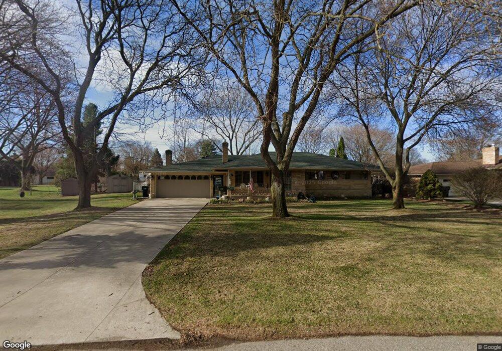
11238 Wilseck Ct Sterling Heights, MI 48314
Estimated Value: $297,000 - $337,000
--
Bed
2
Baths
1,828
Sq Ft
$177/Sq Ft
Est. Value
About This Home
This home is located at 11238 Wilseck Ct, Sterling Heights, MI 48314 and is currently estimated at $323,525, approximately $176 per square foot. 11238 Wilseck Ct is a home located in Macomb County with nearby schools including Dresden Elementary School, Bemis Junior High School, and Henry Ford II High School.
Ownership History
Date
Name
Owned For
Owner Type
Purchase Details
Closed on
Sep 20, 2004
Sold by
Chapaton Thomas J and Olsen Natalie A
Bought by
Jones Larry P and Jones Rosa
Current Estimated Value
Home Financials for this Owner
Home Financials are based on the most recent Mortgage that was taken out on this home.
Original Mortgage
$50,000
Outstanding Balance
$24,854
Interest Rate
5.93%
Mortgage Type
Purchase Money Mortgage
Estimated Equity
$298,671
Purchase Details
Closed on
Dec 20, 1995
Sold by
Bell E
Bought by
Chapaton T
Create a Home Valuation Report for This Property
The Home Valuation Report is an in-depth analysis detailing your home's value as well as a comparison with similar homes in the area
Home Values in the Area
Average Home Value in this Area
Purchase History
| Date | Buyer | Sale Price | Title Company |
|---|---|---|---|
| Jones Larry P | $212,500 | Title One Inc | |
| Chapaton T | $135,000 | -- |
Source: Public Records
Mortgage History
| Date | Status | Borrower | Loan Amount |
|---|---|---|---|
| Open | Jones Larry P | $50,000 |
Source: Public Records
Tax History Compared to Growth
Tax History
| Year | Tax Paid | Tax Assessment Tax Assessment Total Assessment is a certain percentage of the fair market value that is determined by local assessors to be the total taxable value of land and additions on the property. | Land | Improvement |
|---|---|---|---|---|
| 2025 | $3,070 | $159,000 | $0 | $0 |
| 2024 | $2,807 | $148,400 | $0 | $0 |
| 2023 | $2,650 | $131,600 | $0 | $0 |
| 2022 | $2,762 | $120,600 | $0 | $0 |
| 2021 | $2,705 | $111,000 | $0 | $0 |
| 2020 | $2,413 | $107,500 | $0 | $0 |
| 2019 | $2,472 | $95,300 | $0 | $0 |
| 2018 | $2,502 | $88,900 | $0 | $0 |
| 2017 | $2,389 | $84,400 | $18,500 | $65,900 |
| 2016 | $2,308 | $84,400 | $0 | $0 |
| 2015 | -- | $76,800 | $0 | $0 |
| 2014 | -- | $63,500 | $0 | $0 |
Source: Public Records
Map
Nearby Homes
- 44395 Patricia Dr Unit 90
- 44312 Patricia Dr Unit 2
- 44361 Mathison Dr
- 11214 Canal Rd
- 45089 Klingkammer St Unit 10
- 8958 Shannon Dr
- 45210 Keding St Unit 101
- 45200 Keding St Unit 101
- 45449 Sterritt St
- 8628 Strom Dr
- 45467 Sterritt St
- 8235 Mackay Ct
- 11827 Shetland Ct
- 8245 Canal Rd
- 11503 Silver Dr
- 12115 Canal Rd
- 8238 Clinton River Rd
- 11156 Diamond Dr
- 45547 Kensington St
- 11423 Delvin Dr
- 11220 Wilseck Ct
- 44645 Sterritt St
- 44625 Sterritt St
- 11205 Alice Ct
- 44701 Sterritt St
- 11192 Wilseck Ct
- 44595 Sterritt St
- 44737 Sterritt St
- 11199 Alice Ct
- 11217 Wilseck Ct
- 44563 Sterritt St
- 11217 Alice Ct
- 11178 Wilseck Ct
- 11203 Wilseck Ct
- 11193 Alice Ct
- 44755 Sterritt St
- 44650 Sterritt St
- 44678 Sterritt St
- 11189 Wilseck Ct
- 44624 Sterritt St