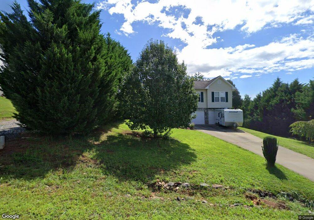
1124 Allman Ridge Rd Morganton, NC 28655
Estimated Value: $267,000 - $289,000
3
Beds
2
Baths
1,471
Sq Ft
$189/Sq Ft
Est. Value
About This Home
This home is located at 1124 Allman Ridge Rd, Morganton, NC 28655 and is currently estimated at $277,635, approximately $188 per square foot. 1124 Allman Ridge Rd is a home located in Burke County with nearby schools including Oak Hill Elementary School, Table Rock Middle School, and Freedom High School.
Ownership History
Date
Name
Owned For
Owner Type
Purchase Details
Closed on
Oct 20, 2016
Sold by
Wood Rebecca Saulman and Wood Justin
Bought by
Howard John M and Howard Anne C
Current Estimated Value
Purchase Details
Closed on
Feb 22, 2007
Sold by
Beu Griffin Really & Auction Inc
Bought by
Saulman Rebecca I
Home Financials for this Owner
Home Financials are based on the most recent Mortgage that was taken out on this home.
Original Mortgage
$113,500
Interest Rate
6.17%
Mortgage Type
New Conventional
Create a Home Valuation Report for This Property
The Home Valuation Report is an in-depth analysis detailing your home's value as well as a comparison with similar homes in the area
Home Values in the Area
Average Home Value in this Area
Purchase History
| Date | Buyer | Sale Price | Title Company |
|---|---|---|---|
| Howard John M | $136,500 | Attorney | |
| Saulman Rebecca I | $111,000 | None Available |
Source: Public Records
Mortgage History
| Date | Status | Borrower | Loan Amount |
|---|---|---|---|
| Previous Owner | Saulman Rebecca I | $113,500 |
Source: Public Records
Tax History
| Year | Tax Paid | Tax Assessment Tax Assessment Total Assessment is a certain percentage of the fair market value that is determined by local assessors to be the total taxable value of land and additions on the property. | Land | Improvement |
|---|---|---|---|---|
| 2025 | $1,355 | $198,885 | $13,968 | $184,917 |
| 2024 | $1,361 | $198,885 | $13,968 | $184,917 |
| 2023 | $1,361 | $198,885 | $13,968 | $184,917 |
| 2022 | $1,152 | $136,276 | $13,302 | $122,974 |
| 2021 | $1,146 | $136,276 | $13,302 | $122,974 |
| 2020 | $1,142 | $136,276 | $13,302 | $122,974 |
| 2019 | $1,017 | $120,396 | $13,302 | $107,094 |
| 2018 | $958 | $112,880 | $13,302 | $99,578 |
| 2017 | $956 | $112,880 | $13,302 | $99,578 |
| 2016 | $934 | $112,880 | $13,302 | $99,578 |
| 2015 | $931 | $112,880 | $13,302 | $99,578 |
| 2014 | $930 | $112,880 | $13,302 | $99,578 |
| 2013 | $918 | $112,880 | $13,302 | $99,578 |
Source: Public Records
Map
Nearby Homes
- 2556 Nc 126
- 3666 Grandview Dr
- 3680 Grandview Dr
- 4333 Kirby Dr Unit 10,14,4
- 3375 Nc 126
- 4407 Georgia Pines Rd
- 1060 Hawksbill Dr
- 2482 Paddock Cir
- 1057 Hawksbill Dr
- 0 Boyd Moore Ave Unit CAR3848175
- 2086 Paddock Cir
- 2151 River Bend Ln
- 4617 Harbor View Terrace
- 1499 Brentwood Place
- 1504 Brentwood Place
- 4634 Harbor View Terrace
- 3026 Coventry Dr
- 2040 River Bend Ln
- 1629 Nc 126
- 1227 River Club Dr
- 1132 Allman Ridge Rd
- 1116 Allman Ridge Rd
- 1129 Allman Ridge Rd
- 1137 Allman Ridge Rd
- 1121 Allman Ridge Rd
- 1102 Allman Ridge Rd
- 1115 Allman Ridge Rd
- 1094 Allman Ridge Rd
- 1103 Allman Ridge Rd
- 1097 Allman Ridge Rd
- 1272 Star Ln
- 1175 Allman Ridge Rd
- 1260 Star Ln
- 1248 Star Ln Unit 8
- 1283 Star Ln
- 1236 Star Ln
- 1271 Star Ln
- 1259 Star Ln
- 2519 Nc 126
- 1247 Star Ln
Your Personal Tour Guide
Ask me questions while you tour the home.