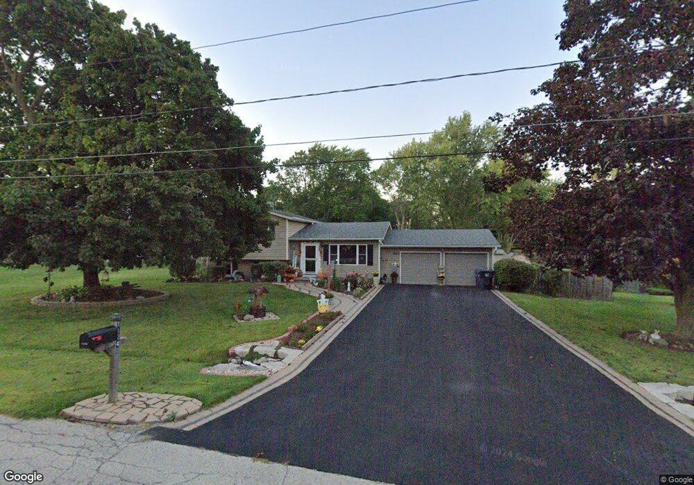
11240 W Leland Ave Beach Park, IL 60099
Estimated Value: $268,000 - $299,214
3
Beds
2
Baths
1,504
Sq Ft
$191/Sq Ft
Est. Value
About This Home
This home is located at 11240 W Leland Ave, Beach Park, IL 60099 and is currently estimated at $286,554, approximately $190 per square foot. 11240 W Leland Ave is a home located in Lake County with nearby schools including Oak Crest School, Beach Park Middle School, and Zion-Benton Township High School.
Ownership History
Date
Name
Owned For
Owner Type
Purchase Details
Closed on
Feb 22, 1999
Sold by
Bord Kevin W and Bord Julia M
Bought by
Bord Julie M
Current Estimated Value
Home Financials for this Owner
Home Financials are based on the most recent Mortgage that was taken out on this home.
Original Mortgage
$106,000
Outstanding Balance
$25,413
Interest Rate
6.89%
Estimated Equity
$261,141
Purchase Details
Closed on
Sep 24, 1993
Sold by
Kaylor Seth and Will Of Florence Betty Rohrbec
Bought by
Bord Kevin W and Bord Julia M
Home Financials for this Owner
Home Financials are based on the most recent Mortgage that was taken out on this home.
Original Mortgage
$105,600
Interest Rate
7.22%
Create a Home Valuation Report for This Property
The Home Valuation Report is an in-depth analysis detailing your home's value as well as a comparison with similar homes in the area
Home Values in the Area
Average Home Value in this Area
Purchase History
| Date | Buyer | Sale Price | Title Company |
|---|---|---|---|
| Bord Julie M | -- | Stewart Title | |
| Bord Kevin W | $88,000 | -- |
Source: Public Records
Mortgage History
| Date | Status | Borrower | Loan Amount |
|---|---|---|---|
| Open | Bord Julie M | $106,000 | |
| Closed | Bord Kevin W | $105,600 |
Source: Public Records
Tax History Compared to Growth
Tax History
| Year | Tax Paid | Tax Assessment Tax Assessment Total Assessment is a certain percentage of the fair market value that is determined by local assessors to be the total taxable value of land and additions on the property. | Land | Improvement |
|---|---|---|---|---|
| 2024 | $6,881 | $82,716 | $14,105 | $68,611 |
| 2023 | $6,634 | $72,537 | $13,616 | $58,921 |
| 2022 | $6,634 | $67,359 | $13,268 | $54,091 |
| 2021 | $6,047 | $58,770 | $12,931 | $45,839 |
| 2020 | $5,917 | $56,084 | $12,340 | $43,744 |
| 2019 | $5,889 | $53,211 | $11,708 | $41,503 |
| 2018 | $6,021 | $52,635 | $14,157 | $38,478 |
| 2017 | $5,965 | $49,516 | $13,318 | $36,198 |
| 2016 | $5,798 | $47,140 | $12,679 | $34,461 |
| 2015 | $5,603 | $43,232 | $11,628 | $31,604 |
| 2014 | $5,031 | $41,894 | $9,770 | $32,124 |
| 2012 | $5,094 | $43,536 | $10,153 | $33,383 |
Source: Public Records
Map
Nearby Homes
- 11345 W Carnahan Ave
- 11382 W Leland Ave
- 38683 N Lewis Ave
- 1121 Otto Graham Ln
- 11342-11346 W Wadsworth Rd
- 38571 N Cedar Ave
- 3931 Bertrand Ln
- 1730 W Beach Rd
- 1667 W Beach Rd Unit 1667
- 1677 W Beach Rd Unit 1677
- 10765 W Liberty Ave
- 38176 N De Woody Rd
- 2614 33rd St
- 38362 N Manor Ave
- 3225 Gilead Ave
- 3411 N Lewis Ave
- 3224 Gilboa Ave
- 3221 Gideon Ave
- 37966 N Cornell Rd
- 10295 W Crissy Ave
- 11262 W Leland Ave
- 38780 Linden Ave
- 11261 W Leland Ave
- 11194 W Leland Ave
- 38781 Linden Ave
- 38781 N Linden Ave
- 11304 W Leland Ave
- 38764 Linden Ave
- 11303 W Leland Ave
- 38765 Linden Ave
- 38780 N Pine Ave
- 11328 W Leland Ave
- 11162 W Leland Ave
- 11239 W Carnahan Ave
- 38738 Linden Ave
- 11221 W Carnahan Ave
- 38888 N Pine Ave
- 38737 Linden Ave
- 11283 W Carnahan Ave
- 11346 W Leland Ave