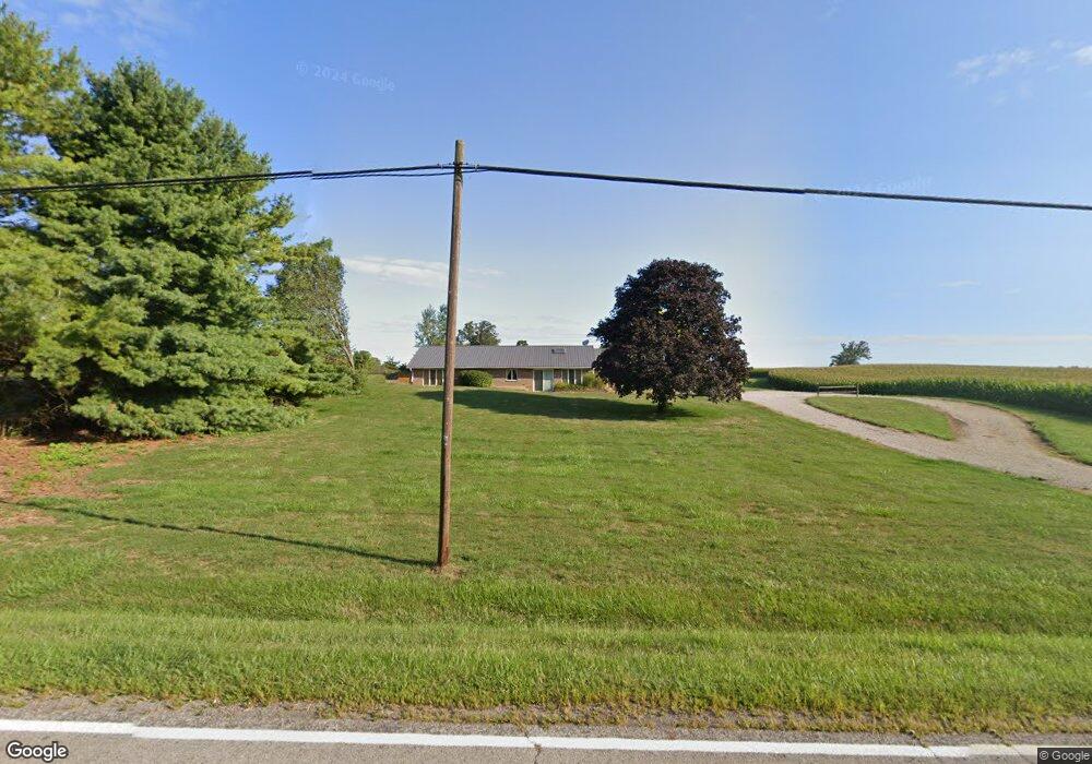
11244 Cemetery Rd Mount Sterling, OH 43143
Estimated Value: $322,467 - $334,000
3
Beds
2
Baths
1,620
Sq Ft
$203/Sq Ft
Est. Value
About This Home
This home is located at 11244 Cemetery Rd, Mount Sterling, OH 43143 and is currently estimated at $329,617, approximately $203 per square foot. 11244 Cemetery Rd is a home located in Madison County with nearby schools including Madison-Plains Elementary School, Madison-Plains Intermediate School, and Madison-Plains Junior High School.
Ownership History
Date
Name
Owned For
Owner Type
Purchase Details
Closed on
Aug 4, 2017
Sold by
Harden Mark A
Bought by
Harden Mark Andrew and Harden Mark Andrew
Current Estimated Value
Create a Home Valuation Report for This Property
The Home Valuation Report is an in-depth analysis detailing your home's value as well as a comparison with similar homes in the area
Home Values in the Area
Average Home Value in this Area
Purchase History
| Date | Buyer | Sale Price | Title Company |
|---|---|---|---|
| Harden Mark Andrew | -- | None Available |
Source: Public Records
Tax History Compared to Growth
Tax History
| Year | Tax Paid | Tax Assessment Tax Assessment Total Assessment is a certain percentage of the fair market value that is determined by local assessors to be the total taxable value of land and additions on the property. | Land | Improvement |
|---|---|---|---|---|
| 2024 | $2,803 | $81,170 | $15,950 | $65,220 |
| 2023 | $2,803 | $81,170 | $15,950 | $65,220 |
| 2022 | $2,192 | $59,770 | $11,750 | $48,020 |
| 2021 | $2,135 | $59,770 | $11,750 | $48,020 |
| 2020 | $2,139 | $59,770 | $11,750 | $48,020 |
| 2019 | $1,766 | $50,700 | $12,170 | $38,530 |
| 2018 | $1,766 | $50,700 | $12,170 | $38,530 |
| 2017 | $1,730 | $50,700 | $12,170 | $38,530 |
| 2016 | $1,450 | $44,090 | $12,170 | $31,920 |
| 2015 | $1,396 | $44,090 | $12,170 | $31,920 |
| 2014 | $1,396 | $44,090 | $12,170 | $31,920 |
| 2013 | -- | $44,620 | $10,140 | $34,480 |
Source: Public Records
Map
Nearby Homes
- 60 N London St
- 67 W Columbus St
- 110 Mountview Ct
- 230 W Columbus St
- 500 Wingate Place N
- 10741 2nd St
- 16095 State Route 207
- 16185 State Route 207
- 15561 Blain Rd
- 12265 Woods Opossum Run
- 10495 Anderson Antioch Rd
- 0 Renick Rd
- 8713 State Route 207
- 14008 1st St
- 10586 Baldwin Rd
- 16270 Cook Yankeetown Rd NE
- 13810 Yankeetown Chenoweth Rd
- 19763 Clarks Run Rd
- 11444 Ballah Rd
- 12764 Cleo Rd
- 11214 Cemetery Rd
- 11184 Cemetery Rd
- 11184 McClimansville Cemetry Rd
- 11184 Cemetery Rd
- 11154 Cemetery Rd
- 11144 Cemetery Rd
- 11124 Cemetery Rd
- 11010 Cemetery Rd
- 14303 Woods Opossum Run Rd
- 11522 Cemetery Rd
- 14625 East St
- 14625 East St
- 11522 McClimansville Cemetery Rd
- 14661 East St
- 11560 Cemetery Rd
- 11560 McClimansville Cemetery Rd
- 14675 East St
- 10915 Cemetery Rd
- 14660 East St
- 11583 Cemetery Rd