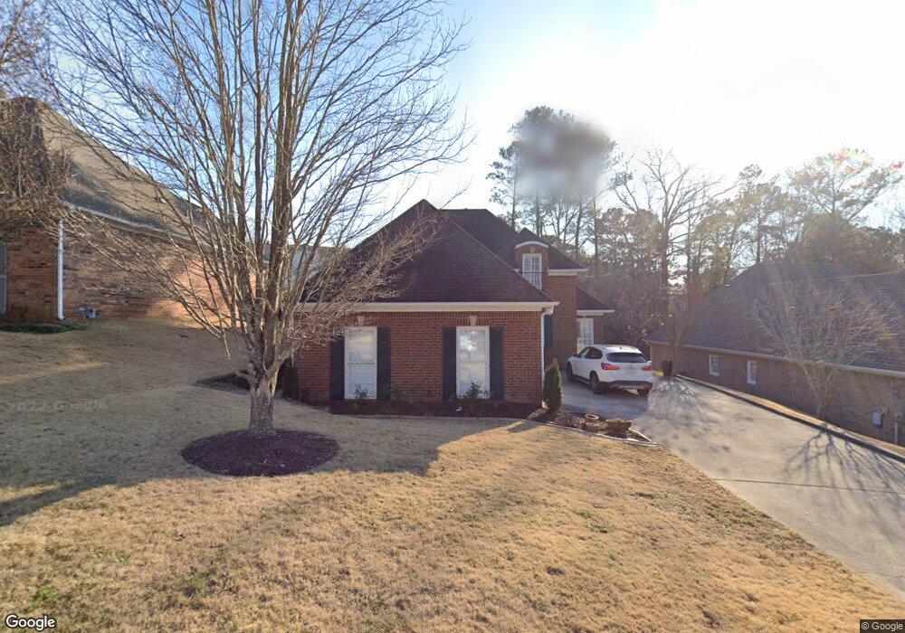
1125 Ashbury Square Birmingham, AL 35216
Estimated Value: $329,000 - $390,480
3
Beds
3
Baths
2,319
Sq Ft
$157/Sq Ft
Est. Value
About This Home
This home is located at 1125 Ashbury Square, Birmingham, AL 35216 and is currently estimated at $364,870, approximately $157 per square foot. 1125 Ashbury Square is a home located in Jefferson County with nearby schools including Green Valley Elementary School, Ira F. Simmons Middle School, and Hoover High School.
Ownership History
Date
Name
Owned For
Owner Type
Purchase Details
Closed on
Nov 22, 2016
Sold by
Mikos Jeannine M
Bought by
Brown Leslie Carol and Brown Janet E
Current Estimated Value
Home Financials for this Owner
Home Financials are based on the most recent Mortgage that was taken out on this home.
Original Mortgage
$100,000
Outstanding Balance
$80,409
Interest Rate
3.47%
Mortgage Type
New Conventional
Estimated Equity
$284,461
Purchase Details
Closed on
Aug 12, 1999
Sold by
J Harris Development Corp
Bought by
Mikos Edward Frank and Mikos Jeannine M
Create a Home Valuation Report for This Property
The Home Valuation Report is an in-depth analysis detailing your home's value as well as a comparison with similar homes in the area
Home Values in the Area
Average Home Value in this Area
Purchase History
| Date | Buyer | Sale Price | Title Company |
|---|---|---|---|
| Brown Leslie Carol | $230,000 | -- | |
| Mikos Edward Frank | $219,900 | Cahaba Title Inc |
Source: Public Records
Mortgage History
| Date | Status | Borrower | Loan Amount |
|---|---|---|---|
| Open | Brown Leslie Carol | $100,000 |
Source: Public Records
Tax History Compared to Growth
Tax History
| Year | Tax Paid | Tax Assessment Tax Assessment Total Assessment is a certain percentage of the fair market value that is determined by local assessors to be the total taxable value of land and additions on the property. | Land | Improvement |
|---|---|---|---|---|
| 2024 | $2,276 | $36,020 | -- | -- |
| 2022 | $2,402 | $33,820 | $3,900 | $29,920 |
| 2021 | $1,996 | $28,210 | $3,900 | $24,310 |
| 2020 | $1,869 | $26,480 | $3,900 | $22,580 |
| 2019 | $1,669 | $23,720 | $0 | $0 |
| 2018 | $1,669 | $23,720 | $0 | $0 |
| 2017 | $1,440 | $22,200 | $0 | $0 |
| 2016 | $1,432 | $22,080 | $0 | $0 |
| 2015 | $1,432 | $23,100 | $0 | $0 |
| 2014 | $1,315 | $25,000 | $0 | $0 |
| 2013 | $1,315 | $25,000 | $0 | $0 |
Source: Public Records
Map
Nearby Homes
- 1104 Ashbury Square
- 3408 Tal Heim Cir
- 2221 Rocky Ridge Rd
- 3408 Tal Meadow Dr
- 2201 Myrtlewood Dr
- 3294 Warringwood Dr Unit B
- 3173 Boxwood Dr
- 152 Wisteria Dr Unit 11
- 3437 Ridgecrest Dr
- 3403 Cedar Crest Cir
- 3416 Cedar Crest Cir
- 3432 Cedar Crest Cir
- 2837 Georgetown Dr Unit F
- 3101 Lorna Rd Unit 1615
- 3101 Lorna Rd Unit 1815
- 3101 Lorna Rd Unit 1626
- 3420 Primm Ln Unit 1
- 3282 Shallowford Cir
- 3298 Shallowford Cir
- 2300 Derby Dr
- 1121 Ashbury Square
- 1129 Ashbury Square
- 1117 Ashbury Square
- 2140 Lynngate Dr
- 1126 Ashbury Square
- 2144 Lynngate Dr
- 120 Ridge Park Dr
- 1113 Ashbury Square
- 2136 Lynngate Dr
- 1116 Ashbury Square
- 1135 Ashbury Square
- 1130 Ashbury Square
- 118 Ridge Park Dr
- 1112 Ashbury Square
- 1134 Ashbury Square
- 1109 Ashbury Square
- 116 Ridge Park Dr
- 114 Ridge Park Dr
- 2148 Lynngate Dr
- 1108 Ashbury Square