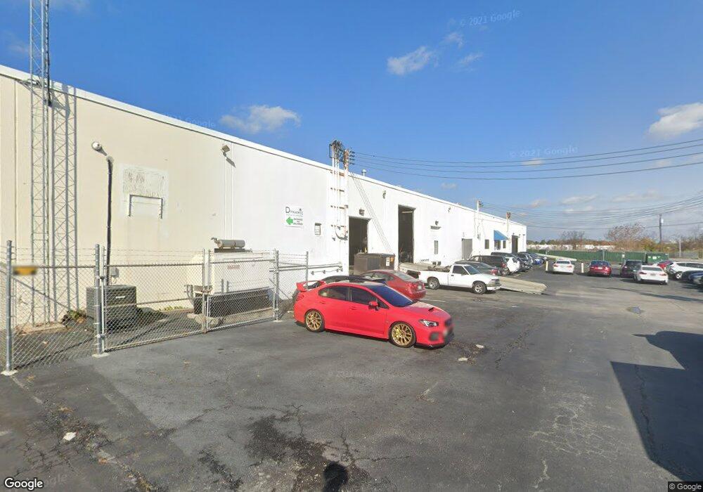
1125 Desoto Rd Baltimore, MD 21223
Estimated Value: $2,616,077
--
Bed
--
Bath
27,310
Sq Ft
$96/Sq Ft
Est. Value
About This Home
This home is located at 1125 Desoto Rd, Baltimore, MD 21223 and is currently estimated at $2,616,077, approximately $95 per square foot. 1125 Desoto Rd is a home located in Baltimore City with nearby schools including Violetville Elementary/Middle School, Booker T. Washington Middle School, and Edmondson Westside High School.
Ownership History
Date
Name
Owned For
Owner Type
Purchase Details
Closed on
Nov 5, 2007
Sold by
Born Industries
Bought by
1125 Desoto Road Llc
Current Estimated Value
Home Financials for this Owner
Home Financials are based on the most recent Mortgage that was taken out on this home.
Original Mortgage
$1,050,000
Outstanding Balance
$665,372
Interest Rate
6.41%
Mortgage Type
Purchase Money Mortgage
Estimated Equity
$1,950,705
Purchase Details
Closed on
May 27, 2005
Sold by
Born Industries Llc
Bought by
Born Industries International and Llc.
Create a Home Valuation Report for This Property
The Home Valuation Report is an in-depth analysis detailing your home's value as well as a comparison with similar homes in the area
Home Values in the Area
Average Home Value in this Area
Purchase History
| Date | Buyer | Sale Price | Title Company |
|---|---|---|---|
| 1125 Desoto Road Llc | $1,389,324 | -- | |
| Born Industries International | -- | -- |
Source: Public Records
Mortgage History
| Date | Status | Borrower | Loan Amount |
|---|---|---|---|
| Open | 1125 Desoto Road Llc | $1,050,000 |
Source: Public Records
Tax History Compared to Growth
Tax History
| Year | Tax Paid | Tax Assessment Tax Assessment Total Assessment is a certain percentage of the fair market value that is determined by local assessors to be the total taxable value of land and additions on the property. | Land | Improvement |
|---|---|---|---|---|
| 2025 | $35,530 | $1,528,500 | -- | -- |
| 2024 | $35,530 | $1,512,700 | $0 | $0 |
| 2023 | $35,159 | $1,496,900 | $320,500 | $1,176,400 |
| 2022 | $34,887 | $1,478,267 | $0 | $0 |
| 2021 | $34,447 | $1,459,633 | $0 | $0 |
| 2020 | $34,008 | $1,441,000 | $320,500 | $1,120,500 |
| 2019 | $33,557 | $1,428,700 | $0 | $0 |
| 2018 | $33,427 | $1,416,400 | $0 | $0 |
| 2017 | $33,137 | $1,404,100 | $0 | $0 |
| 2016 | $30,328 | $1,368,900 | $0 | $0 |
| 2015 | $30,328 | $1,333,700 | $0 | $0 |
| 2014 | $30,328 | $1,298,500 | $0 | $0 |
Source: Public Records
Map
Nearby Homes
- 1052 Parksley Ave
- 3133 Wilkens Ave
- 1710 Wilmington Ave
- 2737 Wilkens Ave
- 2733 Wilkens Ave
- 1710 Wickes Ave
- 1707 Harman Ave
- 2711 Wilkens Ave
- 1637 Spence St
- 1703 - 1707 1/2 Spence St
- 1803 Casadel Ave
- 2305 Herkimer St
- 3214 Clarinda Ave
- 1715 Spence St
- 537 S Longwood St
- 2659 Wilkens Ave
- 2698 Saint Benedict St
- 2644 Wilkens Ave
- 2633 Wilkens Ave
- 2642 Wilkens Ave
- 1201 Desoto Rd
- 1101 Desoto Rd
- 1120 Whistler Ave
- 3001 Cowan Ave
- 1215 Desoto Rd
- 1100 Whistler Ave
- 1053 Desoto Rd
- 1091 Wilmington Ave
- 1051 Desoto Rd
- 1089 Wilmington Ave
- 1038 Wilmington Ave
- 1049 Desoto Rd
- 1060 Parksley Ave
- 1087 Wilmington Ave
- 1047 Desoto Rd
- 1058 Parksley Ave
- 1085 Wilmington Ave
- 1056 Parksley Ave
- 1045 Desoto Rd
- 1083 Wilmington Ave