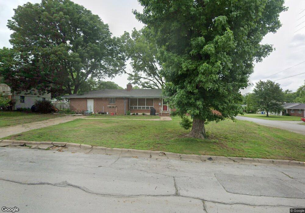
1125 Euclid Blvd Carthage, MO 64836
Estimated Value: $212,000 - $241,000
3
Beds
2
Baths
2,000
Sq Ft
$112/Sq Ft
Est. Value
About This Home
This home is located at 1125 Euclid Blvd, Carthage, MO 64836 and is currently estimated at $224,955, approximately $112 per square foot. 1125 Euclid Blvd is a home located in Jasper County with nearby schools including Carthage High School, St. Ann's Catholic School, and Victory Academy.
Ownership History
Date
Name
Owned For
Owner Type
Purchase Details
Closed on
Feb 13, 2023
Sold by
Sprawls William J and Sprawls Marta
Bought by
Kowacich Eric
Current Estimated Value
Home Financials for this Owner
Home Financials are based on the most recent Mortgage that was taken out on this home.
Original Mortgage
$107,115
Outstanding Balance
$103,503
Interest Rate
6.12%
Mortgage Type
New Conventional
Estimated Equity
$121,452
Purchase Details
Closed on
Mar 17, 2006
Sold by
Sprawls William J
Bought by
Sprawls William J and Johnson Sprawls Martha
Home Financials for this Owner
Home Financials are based on the most recent Mortgage that was taken out on this home.
Original Mortgage
$11,200
Interest Rate
6.33%
Mortgage Type
Credit Line Revolving
Purchase Details
Closed on
May 13, 2005
Sold by
Sherrel John A and Sherrel Marjorie D
Bought by
Sprawls William J
Home Financials for this Owner
Home Financials are based on the most recent Mortgage that was taken out on this home.
Original Mortgage
$94,418
Interest Rate
6.03%
Mortgage Type
FHA
Create a Home Valuation Report for This Property
The Home Valuation Report is an in-depth analysis detailing your home's value as well as a comparison with similar homes in the area
Home Values in the Area
Average Home Value in this Area
Purchase History
| Date | Buyer | Sale Price | Title Company |
|---|---|---|---|
| Kowacich Eric | -- | -- | |
| Sprawls William J | -- | None Available | |
| Sprawls William J | -- | -- |
Source: Public Records
Mortgage History
| Date | Status | Borrower | Loan Amount |
|---|---|---|---|
| Open | Kowacich Eric | $107,115 | |
| Previous Owner | Sprawls William J | $11,200 | |
| Previous Owner | Sprawls William J | $94,418 |
Source: Public Records
Tax History Compared to Growth
Tax History
| Year | Tax Paid | Tax Assessment Tax Assessment Total Assessment is a certain percentage of the fair market value that is determined by local assessors to be the total taxable value of land and additions on the property. | Land | Improvement |
|---|---|---|---|---|
| 2025 | $1,124 | $24,420 | $4,040 | $20,380 |
| 2024 | $1,124 | $21,840 | $4,040 | $17,800 |
| 2023 | $1,124 | $21,840 | $4,040 | $17,800 |
| 2022 | $1,098 | $21,400 | $4,040 | $17,360 |
| 2021 | $1,086 | $21,400 | $4,040 | $17,360 |
| 2020 | $1,054 | $19,910 | $4,040 | $15,870 |
| 2019 | $1,056 | $19,910 | $4,040 | $15,870 |
| 2018 | $1,014 | $19,160 | $0 | $0 |
| 2017 | $1,016 | $19,160 | $0 | $0 |
| 2016 | $992 | $18,760 | $0 | $0 |
| 2015 | $917 | $18,760 | $0 | $0 |
| 2014 | $917 | $18,760 | $0 | $0 |
Source: Public Records
Map
Nearby Homes
- 1131 Belle Air Place
- 1647 Glenwood Place
- xxxx Lilac Ln
- 1012 Euclid Blvd
- 839 Euclid Blvd
- 1106 Southern Hills
- 1743 S River St
- 824 Euclid Blvd
- 1328 Sunrise Dr
- 1814 Buena Vista Ave
- 1242 Sheila Ann Dr
- 1244 Glenwood Place
- 1230 Sheila Ann Dr
- 1005 E 13th St
- 702 E Centennial Ave
- 1448 Quail Place
- 1922 Southwood Ln
- 1910 Wynwood Dr
- 2032 Alison St
- 2141 Carrie St
- 1117 Euclid Blvd
- 1621 Pearl St
- 1207 Euclid Blvd
- 1111 Euclid Blvd
- 1615 Pearl St
- 1124 Euclid Blvd
- 1620 Pearl St
- 1120 Euclid Blvd
- 1646 Pearl St
- 1618 Lilac Ln
- 1612 Pearl St
- 1105 Euclid Blvd
- 1110 Euclid Blvd
- 1614 Lilac Ln
- 1605 Pearl St
- 1219 Euclid Blvd
- 1625 Glenwood Place
- 1608 Lilac Ln
- 1141 Belle Air Place
- 1100 Euclid Blvd