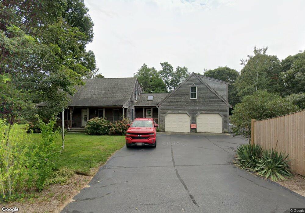
1125 Governor Prence Rd Eastham, MA 02642
Estimated Value: $724,000 - $933,000
3
Beds
2
Baths
1,835
Sq Ft
$471/Sq Ft
Est. Value
About This Home
This home is located at 1125 Governor Prence Rd, Eastham, MA 02642 and is currently estimated at $863,375, approximately $470 per square foot. 1125 Governor Prence Rd is a home located in Barnstable County with nearby schools including Eastham Elementary School, Nauset Regional Middle School, and Nauset Regional High School.
Ownership History
Date
Name
Owned For
Owner Type
Purchase Details
Closed on
May 2, 2002
Sold by
Taylor Candace C and Rufleth Candace C
Bought by
Largey Ernest J
Current Estimated Value
Create a Home Valuation Report for This Property
The Home Valuation Report is an in-depth analysis detailing your home's value as well as a comparison with similar homes in the area
Home Values in the Area
Average Home Value in this Area
Purchase History
We collect this data history from publicly available records. To have your information removed, we recommend requesting removal directly through your county’s website.
| Date | Buyer | Sale Price | Title Company |
|---|---|---|---|
| Largey Ernest J | $155,000 | -- |
Source: Public Records
Mortgage History
We collect this data history from publicly available records. To have your information removed, we recommend requesting removal directly through your county’s website.
| Date | Status | Borrower | Loan Amount |
|---|---|---|---|
| Open | Largey Ernest J | $110,000 | |
| Open | Largey Ernest J | $225,000 | |
| Closed | Largey Ernest J | $301,000 | |
| Closed | Largey Ernest J | $300,700 |
Source: Public Records
Tax History
| Year | Tax Paid | Tax Assessment Tax Assessment Total Assessment is a certain percentage of the fair market value that is determined by local assessors to be the total taxable value of land and additions on the property. | Land | Improvement |
|---|---|---|---|---|
| 2025 | $6,871 | $891,200 | $274,600 | $616,600 |
| 2024 | $6,067 | $865,500 | $266,500 | $599,000 |
| 2023 | $5,445 | $752,100 | $222,100 | $530,000 |
| 2022 | $4,985 | $581,000 | $198,300 | $382,700 |
| 2021 | $4,896 | $533,300 | $180,300 | $353,000 |
| 2020 | $4,493 | $515,200 | $184,000 | $331,200 |
| 2019 | $4,160 | $504,200 | $178,600 | $325,600 |
| 2018 | $3,999 | $478,900 | $173,400 | $305,500 |
| 2017 | $3,710 | $469,600 | $170,000 | $299,600 |
| 2016 | $3,620 | $486,500 | $188,900 | $297,600 |
| 2015 | $3,392 | $477,700 | $185,200 | $292,500 |
Source: Public Records
Map
Nearby Homes
- 10 Cartway N
- 40 Uncle Nate's Way
- 40 Bayview Rd
- 655 Herring Brook Rd
- 385 Bridge Rd
- 785 State Hwy Unit 9
- 704 State Hwy
- 1061 State Hwy Unit 4
- 1061 State Hwy Unit 1061
- 20 Priscilla Cir
- 480 Dyer Prince Rd
- 339 Dyer Prince Rd
- 20 Stone Ct
- 20 Kittiwake Ln
- 12 Settlers Trace
- 25 Twin Rocks Dr
- 181 Rock Harbor Rd
- 1975 State Hwy Unit 1
- 1975 State Hwy Unit 9
- 60 Smith Heights Way
- 1105 Governor Prence Rd
- 35 Kerry Ln
- 1020 Bridge Rd
- 1050 Bridge Rd
- 40 Kerry Ln
- 20 Blue Bill Ln
- 25 Kerry Ln
- 1055 Bridge Rd
- 1085 Governor Prence Rd
- 1000 Bridge Rd
- 30 Kerry Ln
- 1100 Bridge Rd
- 10 Blue Bill Ln
- 1075 Bridge Rd
- 15 Kerry Ln
- 75 Ireland Way
- 250 Widgeon Dr
- 35 Governor Bradford Rd
- 1080 Governor Prence Rd
- 20 Kerry Ln
Your Personal Tour Guide
Ask me questions while you tour the home.