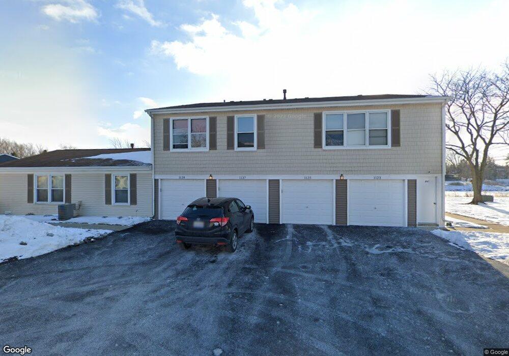
1125 Hampton Harbor Unit 8803 Schaumburg, IL 60193
South Schaumburg NeighborhoodEstimated Value: $245,654 - $261,000
2
Beds
--
Bath
1,000
Sq Ft
$254/Sq Ft
Est. Value
About This Home
This home is located at 1125 Hampton Harbor Unit 8803, Schaumburg, IL 60193 and is currently estimated at $253,914, approximately $253 per square foot. 1125 Hampton Harbor Unit 8803 is a home located in Cook County with nearby schools including Michael Collins Elementary School, Robert Frost Junior High School, and J B Conant High School.
Ownership History
Date
Name
Owned For
Owner Type
Purchase Details
Closed on
Mar 22, 2024
Sold by
Glatt Dale
Bought by
Dale Glatt Trust and Glatt
Current Estimated Value
Purchase Details
Closed on
Jul 23, 2004
Sold by
Hampson Norman D and Hampson Judith A
Bought by
Glatt Dale F
Home Financials for this Owner
Home Financials are based on the most recent Mortgage that was taken out on this home.
Original Mortgage
$120,000
Interest Rate
6.35%
Mortgage Type
New Conventional
Create a Home Valuation Report for This Property
The Home Valuation Report is an in-depth analysis detailing your home's value as well as a comparison with similar homes in the area
Home Values in the Area
Average Home Value in this Area
Purchase History
| Date | Buyer | Sale Price | Title Company |
|---|---|---|---|
| Dale Glatt Trust | -- | None Listed On Document | |
| Glatt Dale F | $150,000 | Atgf Inc |
Source: Public Records
Mortgage History
| Date | Status | Borrower | Loan Amount |
|---|---|---|---|
| Previous Owner | Glatt Dale F | $120,000 | |
| Closed | Glatt Dale F | $15,000 |
Source: Public Records
Tax History Compared to Growth
Tax History
| Year | Tax Paid | Tax Assessment Tax Assessment Total Assessment is a certain percentage of the fair market value that is determined by local assessors to be the total taxable value of land and additions on the property. | Land | Improvement |
|---|---|---|---|---|
| 2024 | $3,438 | $15,590 | $646 | $14,944 |
| 2023 | $3,306 | $15,590 | $646 | $14,944 |
| 2022 | $3,306 | $15,590 | $646 | $14,944 |
| 2021 | $3,196 | $13,874 | $352 | $13,522 |
| 2020 | $3,209 | $13,874 | $352 | $13,522 |
| 2019 | $3,213 | $15,416 | $352 | $15,064 |
| 2018 | $2,253 | $10,944 | $293 | $10,651 |
| 2017 | $2,236 | $10,944 | $293 | $10,651 |
| 2016 | $2,333 | $10,944 | $293 | $10,651 |
| 2015 | $2,010 | $9,341 | $264 | $9,077 |
| 2014 | $2,004 | $9,341 | $264 | $9,077 |
| 2013 | $1,935 | $9,341 | $264 | $9,077 |
Source: Public Records
Map
Nearby Homes
- 1100 Boston Harbor Unit 7004
- 421 E Wise Rd
- 426 E Niagara Ave
- 620 S Point Dr
- 718 N Point Dr
- 826 Thornton Ct Unit 2AL
- 833 Thornton Ct Unit 2B
- 916 Manchester Cir Unit 91A
- 1910 Baltimore Dr
- 205 Nantucket Harbor Unit 104
- 126 Manchester Ct Unit 61B
- 382 Newberry Dr
- 124 E Monterey Ave
- 722 Merlin Dr Unit 16
- 1810 Hawk Ln
- 36 Shore Dr
- 1771 Vermont Dr
- 630 Cross Creek Dr W Unit BB2
- 263 Doral Ct Unit 1
- 966 Cumberland Ct Unit B2
- 1123 Hampton Harbor Unit 8804
- 1127 Hampton Harbor Unit 8802
- 1129 Hampton Harbor Unit 8801
- 1129 Hampton Harbor Unit 1034
- 1121 Hampton Harbor Unit 8703
- 1121 Hampton Harbor Unit 87
- 1135 Hampton Harbor Unit 8902
- 1133 Hampton Harbor Unit 8903
- 1131 Hampton Harbor Unit 8904
- 1115 Hampton Harbor Unit 8704
- 1119 Hampton Harbor Unit 8702
- 1115 Hampton Harbor
- 1119 Hampton Harbor Unit 87
- 1111 Hampton Harbor Unit 9002
- 1117 Hampton Harbor Unit 8701
- 1109 Hampton Harbor Unit 9003
- 1107 Hampton Harbor Unit 9004
- 1109 Hampton Harbor Unit 1109
- 1107 Hampton Harbor Unit 9004
- 1113 Hampton Harbor Unit 9001