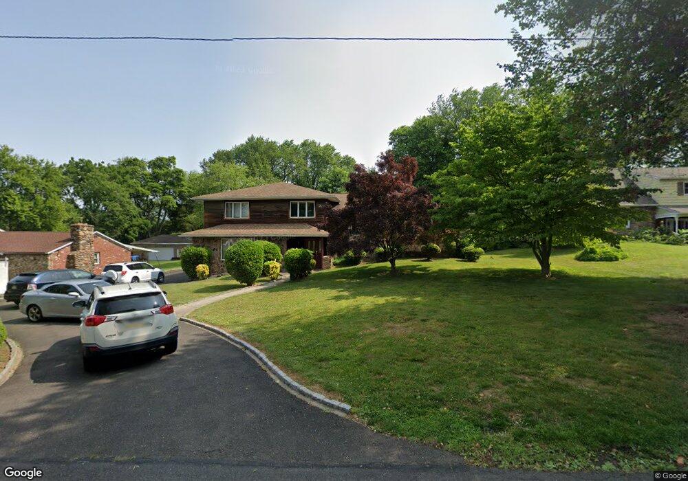
1125 Hawthorne Rd Bensalem, PA 19020
Estimated Value: $613,000 - $666,060
3
Beds
3
Baths
2,218
Sq Ft
$289/Sq Ft
Est. Value
About This Home
This home is located at 1125 Hawthorne Rd, Bensalem, PA 19020 and is currently estimated at $642,015, approximately $289 per square foot. 1125 Hawthorne Rd is a home located in Bucks County with nearby schools including School Lane Charter School, St. Ephrem School, and De La Salle Vocational School.
Ownership History
Date
Name
Owned For
Owner Type
Purchase Details
Closed on
Aug 31, 2001
Sold by
Pollich Francis
Bought by
Boyle John and Boyle Mary
Current Estimated Value
Home Financials for this Owner
Home Financials are based on the most recent Mortgage that was taken out on this home.
Original Mortgage
$236,000
Outstanding Balance
$92,429
Interest Rate
7.05%
Estimated Equity
$549,586
Create a Home Valuation Report for This Property
The Home Valuation Report is an in-depth analysis detailing your home's value as well as a comparison with similar homes in the area
Home Values in the Area
Average Home Value in this Area
Purchase History
| Date | Buyer | Sale Price | Title Company |
|---|---|---|---|
| Boyle John | $295,000 | -- |
Source: Public Records
Mortgage History
| Date | Status | Borrower | Loan Amount |
|---|---|---|---|
| Open | Boyle John | $236,000 |
Source: Public Records
Tax History Compared to Growth
Tax History
| Year | Tax Paid | Tax Assessment Tax Assessment Total Assessment is a certain percentage of the fair market value that is determined by local assessors to be the total taxable value of land and additions on the property. | Land | Improvement |
|---|---|---|---|---|
| 2025 | $10,304 | $47,200 | $3,320 | $43,880 |
| 2024 | $10,304 | $47,200 | $3,320 | $43,880 |
| 2023 | $10,013 | $47,200 | $3,320 | $43,880 |
| 2022 | $9,955 | $47,200 | $3,320 | $43,880 |
| 2021 | $9,955 | $47,200 | $3,320 | $43,880 |
| 2020 | $9,855 | $47,200 | $3,320 | $43,880 |
| 2019 | $9,635 | $47,200 | $3,320 | $43,880 |
| 2018 | $9,411 | $47,200 | $3,320 | $43,880 |
| 2017 | $9,352 | $47,200 | $3,320 | $43,880 |
| 2016 | $9,352 | $47,200 | $3,320 | $43,880 |
| 2015 | -- | $47,200 | $3,320 | $43,880 |
| 2014 | -- | $47,200 | $3,320 | $43,880 |
Source: Public Records
Map
Nearby Homes
- 1100 Wayland Ave
- 4783 Meeting Rd
- 953 Farley Rd
- 938 Ashton Rd
- 446 N Mount Vernon Cir Unit 446
- 435 N Mount Vernon Cir Unit 435
- 419 Rutgers Ct
- 393 Rutgers Ct Unit 393
- 389 Rutgers Ct Unit 389
- 580 S Mount Vernon Cir
- 5110 Bay Rd
- 5107 Leeward Rd
- 1440 Atterbury Way
- 5102 Lighthouse Ln
- 5217 Bay Rd
- 801 Cliff Rd
- 4744 Dunston Rd
- L:15 Dunston Rd
- 1881 Byberry Rd
- 3300 Newportville Rd
- 1113 Hawthorne Rd
- 1137 Hawthorne Rd
- 1132 Wayland Ave
- 1105 Hawthorne Rd
- 1155 Hawthorne Rd
- 1150 Wayland Ave
- 1124 Hawthorne Rd
- 1138 Hawthorne Rd
- 1114 Wayland Ave
- 1106 Hawthorne Rd
- 1063 Hawthorne Rd
- 1169 Hawthorne Rd
- 1152 Hawthorne Rd
- 1166 Wayland Ave
- 1074 Hawthorne Rd
- 1156 Hawthorne Rd
- 1062 Hawthorne Rd
- 1182 Wayland Ave
- 1051 Hawthorne Rd
- 1052 Wayland Ave