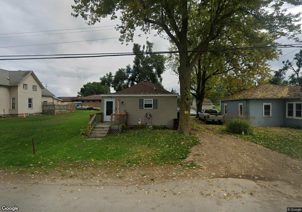
1125 Knapp Ave Jackson, MI 49203
Estimated Value: $101,623 - $121,000
3
Beds
1
Bath
966
Sq Ft
$112/Sq Ft
Est. Value
About This Home
This home is located at 1125 Knapp Ave, Jackson, MI 49203 and is currently estimated at $107,906, approximately $111 per square foot. 1125 Knapp Ave is a home located in Jackson County with nearby schools including Middle School at Parkside, Jackson High School, and St. Mary Star of the Sea School.
Ownership History
Date
Name
Owned For
Owner Type
Purchase Details
Closed on
Dec 10, 2003
Sold by
Poole Steven D and Poole Jane
Bought by
Poole Michael and Poole Christina
Current Estimated Value
Home Financials for this Owner
Home Financials are based on the most recent Mortgage that was taken out on this home.
Original Mortgage
$66,750
Outstanding Balance
$39,192
Interest Rate
9.9%
Mortgage Type
Purchase Money Mortgage
Estimated Equity
$68,714
Purchase Details
Closed on
Dec 12, 1997
Sold by
Poole Steven and Poole Thomas
Bought by
Poole Michael and Poole Christina
Create a Home Valuation Report for This Property
The Home Valuation Report is an in-depth analysis detailing your home's value as well as a comparison with similar homes in the area
Home Values in the Area
Average Home Value in this Area
Purchase History
| Date | Buyer | Sale Price | Title Company |
|---|---|---|---|
| Poole Michael | $38,000 | -- | |
| Poole Michael | $38,000 | -- |
Source: Public Records
Mortgage History
| Date | Status | Borrower | Loan Amount |
|---|---|---|---|
| Open | Poole Michael | $66,750 |
Source: Public Records
Tax History Compared to Growth
Tax History
| Year | Tax Paid | Tax Assessment Tax Assessment Total Assessment is a certain percentage of the fair market value that is determined by local assessors to be the total taxable value of land and additions on the property. | Land | Improvement |
|---|---|---|---|---|
| 2025 | $1,355 | $39,500 | $0 | $0 |
| 2024 | $687 | $34,400 | $0 | $0 |
| 2023 | $662 | $31,900 | $0 | $0 |
| 2022 | $1,307 | $25,000 | $0 | $0 |
| 2021 | $994 | $29,000 | $0 | $0 |
| 2020 | $983 | $29,700 | $0 | $0 |
| 2019 | $973 | $27,700 | $0 | $0 |
| 2018 | $940 | $25,000 | $0 | $0 |
| 2017 | $761 | $25,300 | $0 | $0 |
| 2016 | $506 | $25,200 | $25,200 | $0 |
| 2015 | $733 | $24,500 | $24,500 | $0 |
| 2014 | $733 | $24,500 | $24,500 | $0 |
| 2013 | -- | $24,500 | $24,500 | $0 |
Source: Public Records
Map
Nearby Homes
- 2718 Page Ave
- 1139 S Dettman Rd
- 2505 Page Ave
- 0 Page Ave Unit 25019979
- 698 S Dettman Rd
- Vl Watts St
- 539 S Dettman Rd
- O Research Dr
- 939 S Gorham St
- 2016 Pringle Ave
- 324 Amos St
- 606 S Gorham St
- 509 S Gorham St
- Unit 55 Sanctuary Dr
- Unit 50 Sanctuary Dr
- Unit 48,49 Sanctuary Dr
- Unit 53 Sanctuary Dr
- Unit 53, 5 Sanctuary Dr
- vl Seymour Rd
- Unit 48 Sanctuary Dr