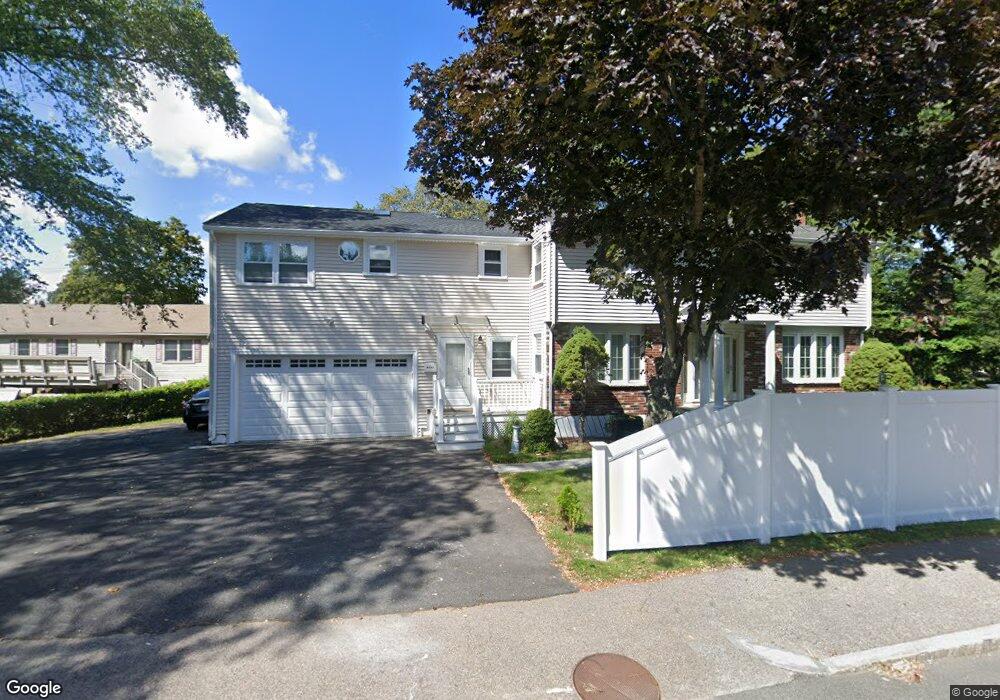
1125 Liberty St Braintree, MA 02184
South Braintree NeighborhoodEstimated Value: $840,000 - $1,113,000
4
Beds
2
Baths
2,400
Sq Ft
$386/Sq Ft
Est. Value
About This Home
This home is located at 1125 Liberty St, Braintree, MA 02184 and is currently estimated at $925,664, approximately $385 per square foot. 1125 Liberty St is a home located in Norfolk County with nearby schools including Braintree High School, First Baptist Christian School, and Thayer Academy.
Ownership History
Date
Name
Owned For
Owner Type
Purchase Details
Closed on
Jun 3, 2024
Sold by
Kwong Sandy M
Bought by
Kwong Sandy M
Current Estimated Value
Home Financials for this Owner
Home Financials are based on the most recent Mortgage that was taken out on this home.
Original Mortgage
$300,000
Outstanding Balance
$296,428
Interest Rate
7.38%
Mortgage Type
Adjustable Rate Mortgage/ARM
Estimated Equity
$629,236
Purchase Details
Closed on
Jul 9, 1999
Sold by
Kaczan Josephine M and Kaczan Joann M
Bought by
Lan Xin L
Home Financials for this Owner
Home Financials are based on the most recent Mortgage that was taken out on this home.
Original Mortgage
$163,000
Interest Rate
7.19%
Mortgage Type
Purchase Money Mortgage
Create a Home Valuation Report for This Property
The Home Valuation Report is an in-depth analysis detailing your home's value as well as a comparison with similar homes in the area
Home Values in the Area
Average Home Value in this Area
Purchase History
| Date | Buyer | Sale Price | Title Company |
|---|---|---|---|
| Kwong Sandy M | -- | None Available | |
| Kwong Sandy M | -- | None Available | |
| Lan Xin L | $231,000 | -- |
Source: Public Records
Mortgage History
| Date | Status | Borrower | Loan Amount |
|---|---|---|---|
| Open | Kwong Sandy M | $300,000 | |
| Closed | Kwong Sandy M | $300,000 | |
| Previous Owner | Lan Xin L | $200,000 | |
| Previous Owner | Lan Xin L | $163,000 |
Source: Public Records
Tax History Compared to Growth
Tax History
| Year | Tax Paid | Tax Assessment Tax Assessment Total Assessment is a certain percentage of the fair market value that is determined by local assessors to be the total taxable value of land and additions on the property. | Land | Improvement |
|---|---|---|---|---|
| 2025 | $7,679 | $769,400 | $405,600 | $363,800 |
| 2024 | $6,657 | $702,200 | $381,100 | $321,100 |
| 2023 | $6,327 | $648,300 | $344,200 | $304,100 |
| 2022 | $6,206 | $623,700 | $319,600 | $304,100 |
| 2021 | $5,792 | $582,100 | $295,000 | $287,100 |
| 2020 | $5,497 | $557,500 | $270,400 | $287,100 |
| 2019 | $5,322 | $527,500 | $270,400 | $257,100 |
| 2018 | $5,067 | $480,700 | $245,800 | $234,900 |
| 2017 | $4,796 | $446,600 | $221,300 | $225,300 |
| 2016 | $4,491 | $409,000 | $196,700 | $212,300 |
| 2015 | $4,316 | $389,900 | $185,600 | $204,300 |
| 2014 | $4,190 | $366,900 | $177,000 | $189,900 |
Source: Public Records
Map
Nearby Homes
- 117 Amherst Rd
- 45 Forest St
- 70 Christina Dr
- 115 Richard Rd
- 293 Alida Rd
- 57 Daniel Rd
- 894 Liberty St Unit 2
- 432 Grove St
- 116 Cardinal Ct
- 278 Allerton Commons Ln
- 426 John Mahar Hwy Unit 311
- 422 John Mahar Hwy Unit 108
- 422 John Mahar Hwy Unit 305
- 420 John Mahar Hwy Unit 202
- 56 Plain St
- 428 John Mahar Hwy Unit 301
- 30 Bradford Commons Ln
- 15 Highland Ave
- 206 Allerton Commons Ln Unit 206
- 7 Drake St