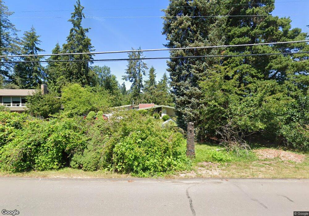
1125 Marylhurst Dr West Linn, OR 97068
Marylhurst NeighborhoodEstimated Value: $823,000 - $945,000
4
Beds
3
Baths
3,183
Sq Ft
$276/Sq Ft
Est. Value
About This Home
This home is located at 1125 Marylhurst Dr, West Linn, OR 97068 and is currently estimated at $879,916, approximately $276 per square foot. 1125 Marylhurst Dr is a home located in Clackamas County with nearby schools including Stafford Primary School, West Linn High School, and Harmony Academy.
Ownership History
Date
Name
Owned For
Owner Type
Purchase Details
Closed on
Mar 13, 1998
Sold by
Blanding Mary Elizabeth and Blanding Paul James
Bought by
Oakes Anthony D and Oakes Karie A
Current Estimated Value
Home Financials for this Owner
Home Financials are based on the most recent Mortgage that was taken out on this home.
Original Mortgage
$140,000
Outstanding Balance
$25,026
Interest Rate
7.11%
Estimated Equity
$854,890
Purchase Details
Closed on
Feb 7, 1997
Sold by
Blanding Molly and Blanding Mary Jean
Bought by
Blanding Mary Elizabeth and Blanding Paul James
Create a Home Valuation Report for This Property
The Home Valuation Report is an in-depth analysis detailing your home's value as well as a comparison with similar homes in the area
Home Values in the Area
Average Home Value in this Area
Purchase History
| Date | Buyer | Sale Price | Title Company |
|---|---|---|---|
| Oakes Anthony D | $230,000 | First American Title Ins Co | |
| Blanding Mary Elizabeth | -- | -- |
Source: Public Records
Mortgage History
| Date | Status | Borrower | Loan Amount |
|---|---|---|---|
| Open | Oakes Anthony D | $140,000 |
Source: Public Records
Tax History Compared to Growth
Tax History
| Year | Tax Paid | Tax Assessment Tax Assessment Total Assessment is a certain percentage of the fair market value that is determined by local assessors to be the total taxable value of land and additions on the property. | Land | Improvement |
|---|---|---|---|---|
| 2025 | $8,521 | $442,162 | -- | -- |
| 2024 | $8,202 | $429,284 | -- | -- |
| 2023 | $8,202 | $416,781 | $0 | $0 |
| 2022 | $7,742 | $404,642 | $0 | $0 |
| 2021 | $7,306 | $392,857 | $0 | $0 |
| 2020 | $7,233 | $381,415 | $0 | $0 |
| 2019 | $6,938 | $370,306 | $0 | $0 |
| 2018 | $6,585 | $359,520 | $0 | $0 |
| 2017 | $6,244 | $349,049 | $0 | $0 |
| 2016 | $5,980 | $338,883 | $0 | $0 |
| 2015 | $5,662 | $329,013 | $0 | $0 |
| 2014 | $5,347 | $319,430 | $0 | $0 |
Source: Public Records
Map
Nearby Homes
- 1611 Arran Ct
- 1397 Skye Pkwy
- 1321 Troon Dr
- 2167 Marylwood Ct
- 19640 Kapteyns St
- 1384 Celtic Ct
- 2041 Marylhurst Dr
- 19661 Sun Cir
- 1354 Skye Pkwy
- 655 Rosemont Rd
- 1777 Skyland Dr
- 2455 College Hill Place
- 2005 Carriage Way
- 17833 Marylcreek Dr
- 18300 S Whitten Ln
- 17514 Brookhurst Dr
- 451 S Wilda Rd
- 800 Rosemont Rd
- 17900 Crestline Dr
- 17634 Brookhurst Dr
- 1105 Marylhurst Dr
- 1177 Marylhurst Dr
- 1334 Stonehaven Dr
- 1055 Marylhurst Dr
- 1330 Stonehaven Dr
- 1223 Marylhurst Dr
- 1144 Marylhurst Dr
- 1332 Stonehaven Dr
- 1328 Stonehaven Dr
- 1212 Marylhurst Dr
- 1336 Stonehaven Dr
- 1751 Hillcrest Dr
- 1222 Marylhurst Dr
- 1326 Stonehaven Dr
- 1710 Hillcrest Dr Unit 1
- 1710 Hillcrest Dr
- 1333 Stonehaven Dr
- 1003 Marylhurst Dr
- 1338 Stonehaven Dr
- 1323 Stonehaven Dr